Montbrison State Forest

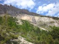
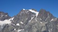
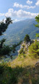
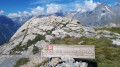
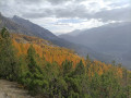
A very beautiful walk along the valley side and then beneath a huge glacial cirque. Magnificent views over the valley and the Écrins peaks opposite. A quiet, idyllic area with few visitors. A steady but sustained climb.

Details

n°36957453
Creation:
Last update:
Last review:
  • Walking
    Activity: Walking
  • ↔
    Distance: 8.58 mi
  • ◔
    Average duration: 7h 10 
  • ▲
    Difficulty: Difficult

  • ⚐
    Back to start: Yes
  • ↗
    Ascent: + 3,684 ft
  • ↘
    Descent: - 3,681 ft

  • ▲
    Highest point: 7,700 ft
  • ▼
    Lowest point: 3,980 ft

Photos

Description of the walk

Park in the car park at the Pelvoux–Les Eyssars municipal swimming pool.

(S/E) Turn right and follow the River Gyr as closely as possible on the right bank, heading downstream. You’ll come to a stone bridge.

(1) Cross it to the left, continue straight ahead, and cross the D994E with care. Immediately afterwards, cross the Julianne torrent and head for the junction with the Route de la Gaillarde.

(2) Turn left here and continue along the path that follows on from it. You’ll reach a crossroads of footpaths with a small rest area.

(3) Continue straight ahead up the stony path on the right bank of the stream, following the signposts towards Coul d’Amont. Ford the stream, then take the zigzagging path straight ahead (on the right bank), which climbs steadily above the stream. You will reach the hamlet of Coul d’Aval.

(4) Stay on the path opposite, following the yellow markings to reach, after another climb, the hamlet of Coul d’Amont.

(5) Carry on; be careful here as the yellow markings end, but the path is obvious. After heading due north, you’ll reach the Ravin des Traversières.

(6) Caution: the stream crossing is tricky. In the summer of 2023, a rockslide blocked the path; do not descend into the hollow but instead climb over the rockslide, keeping roughly level with it. Continue on to reach a crossroads of paths.

(7) Continue gently uphill to the right; a very faint arrow marked on a rock points towards Condamine. Carry on and, after a few hairpin bends, you’ll reach the edge of the forest. Enjoy the beautiful view from here.

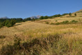
(8) Continue the climb, skirting the Ravin de Clot Lajas, then, after a few hairpin bends, reach the junction with the path leading to the Col de Vallouise in a large alpine meadow. This is the highest point of the walk.

(9) Turn left, following the sign for Cabane de Chouvet and the orange-and-green Green Circles. After a series of hairpin bends, enter the forest. Continue the descent until you reach the junction leading to the Cabane de Chouvet, between plots numbered 17 and 18.

(10) Carry on straight ahead, cross the Ravin de la Baumasse, turn left, and reach another junction which also leads to the Cabane de Chouvet.

(11) Turn right and continue along the winding path to reach the junction at the Ravin de Mardanel.

(12) Turn left and follow the yellow markings to reach a dirt track. Take this track to reach the hamlet of Combe.

(13) Take the road on the right, called Chemin de la Condamine, but leave it quickly to turn left onto an inconspicuous path: please note that it does not appear on the IGN map. Descend via a wooden staircase and then follow the green and white markings. You will reach the junction with the Route de l’Eychauda.

(14) Take this road, then cut across it to avoid the hairpin bends. Continue on to reach the D994E at the ‘Les Fangeas’ bus stop.

(15) Turn right onto it with great care, then turn left off it to return to the car park at the Pelvoux swimming pool (S/E).

Waypoints

  1. S/E : mi 0 - alt. 4,045 ft - Municipal swimming pool car park. Walk alongside the - Gyr (cours d'eau) - Affluent de la Gyronde
  2. 1 : mi 0.57 - alt. 3,980 ft - Stone bridge
  3. 2 : mi 0.81 - alt. 4,065 ft - Route de la Gaillarde
  4. 3 : mi 1.14 - alt. 4,321 ft - Developed area
  5. 4 : mi 1.76 - alt. 5,115 ft - Coul d’Aval
  6. 5 : mi 2.16 - alt. 5,715 ft - Coul d’Amont
  7. 6 : mi 2.45 - alt. 6,010 ft - Ravin des Traversières
  8. 7 : mi 2.65 - alt. 6,112 ft - Condamine crossroads
  9. 8 : mi 3.35 - alt. 6,696 ft - Edge of the forest
  10. 9 : mi 4.35 - alt. 7,690 ft - Flat section at the highest point
  11. 10 : mi 6.14 - alt. 6,227 ft - Chouvet junction no. 1
  12. 11 : mi 6.84 - alt. 5,574 ft - Chouvet junction no. 2 - Cabane de Chouvet
  13. 12 : mi 7.27 - alt. 5,082 ft - Mardanel Ravine
  14. 13 : mi 7.71 - alt. 4,816 ft - Combe
  15. 14 : mi 7.92 - alt. 4,534 ft - Eychauda Path
  16. 15 : mi 8.37 - alt. 4,052 ft - D994E Les Fangeas
  17. S/E : mi 8.58 - alt. 4,045 ft - Municipal swimming pool car park

Notes

The route may be easier the other way round: a slightly less steep climb through deciduous woodland.
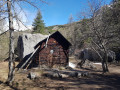
(10), (11): alternative route via the Cabane de Chouvet, slightly steeper. ONF hut, drinking fountain, camping possible. We’re told this is an interesting alternative route.

Worth a visit

(S/E) Swimming pool: closes at 6 pm. Mini-market open daily 7 am–8 pm. Hotels and restaurants in the village of Pelvoux. All shops in Vallouise.

(9) Alternative route: it is possible to make a round trip to the Col de Vallouise by adding 260 m of elevation gain.

Reviews and comments

5 / 5
Based on 1 review

Reliability of the description
5 / 5
Ease of following the route
5 / 5
Route interest
5 / 5
Daoud Kewit
Daoud Kewit

Overall rating : 5 / 5

Date of your route : Oct 28, 2024
Reliability of the description : ★★★★★ Very good
Ease of following the route : ★★★★★ Very good
Route interest : ★★★★★ Very good
Very busy route : No

Walk completed on 28/10/2024. The directions are clear and there’s little risk of getting lost.
Please note: from the start to point 2, the path along the river to the Chorges bridge has been closed for several weeks and will likely remain so for several months. We had to turn back and go round the other side of the river.
You should therefore plan to walk along the road through the village to get directly to point 2. It’s less pleasant, but there’s no alternative until further notice.

Machine-translated

Other walks in the area

For more walks, use our search engine .

The GPS track and description are the property of this route's author. Please do not copy them without permission.