The Chouvet Hut

This forest shelter, which is always open, provides a pleasant stop for walkers wishing to climb to La Condamine without having to travel by car and then on foot. Stopping here saves them two hours on the journey to the summit.

Details

n°12855691
Creation:
Last update:
Last review:
  • Walking
    Activity: Walking
  • ↔
    Distance: 3.84 mi
  • ◔
    Average duration: 2h 55 
  • ▲
    Difficulty: Moderate

  • ⚐
    Back to start: Yes
  • ↗
    Ascent: + 1,325 ft
  • ↘
    Descent: - 1,309 ft

  • ▲
    Highest point: 6,224 ft
  • ▼
    Lowest point: 5,082 ft

Description of the walk

In Pelvoux, coming from Vallouise, turn right onto the road signposted ‘L’Eychauda’. Continue up this road and park at the hairpin bend at the junction withthe GR®54. Parking spaces are available at both hairpin bends.

(S/E) Stay on the road as it climbs if the car park is the one shown on the map. You will then reach another hairpin bend which also has parking spaces.

(1) Leave the road and turn right onto the correct path, marked with white and yellow markings on a stone. Proceed first along a level stretch, then slightly downhill, crossing the Ravin de la Baumasse and then the Ravin de Mardanel.

(2) Here, begin an easy climb to reach a junction marked by a sign.

(3) Pass the signpost for the Chouvet Hut on your right and turn left towards La Condamine through the forest. Continue along this very pleasant path and cross the Ravin de la Baumasse once more to reach another crossroads.

(4) Turn right downhill and, after a few hairpin bends, reach the Cabane de Chouvet.

(5) Continue downhill to quickly reach the junction from the outward journey.

(3) Head straight ahead and follow the path back in the opposite direction to the outward journey to return to the car park at the hairpin bend (S/E) or (1) whichever one you chose on the outward journey.

Waypoints

  1. S/E : mi 0 - alt. 5,108 ft - Car park at the hairpin bend
  2. 1 : mi 0.19 - alt. 5,210 ft - Crossroads: road and footpath
  3. 2 : mi 0.8 - alt. 5,089 ft - Mardanel Ravine
  4. 3 : mi 1.25 - alt. 5,564 ft - Chouvet-Condamine junction
  5. 4 : mi 1.95 - alt. 6,224 ft - Codamine-Chouvet junction
  6. 5 : mi 2.36 - alt. 5,771 ft - Cabane de Chouvet
  7. S/E : mi 3.84 - alt. 5,115 ft - Car park at the hairpin bend

Notes

(5) Water point and shelter at the Cabane Chouvet

Worth a visit

(2) A lovely view of the slopes at the Pelvoux ski resort, which do not detract from the landscape in the slightest.
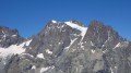
(2) There’s also a lovely view of the summit of Pelvoux.

Always be cautious and plan ahead when you're outdoors. Visorando and the author of this route cannot be held responsible for any accidents occurring on this route.

The GR® and PR® markings are the intellectual property of the Fédération Française de Randonnée Pédestre.

Reviews and comments

4.3 / 5
Based on 2 reviews

Reliability of the description
4.5 / 5
Ease of following the route
4.5 / 5
Route interest
4 / 5
papangue2
papangue2

Overall rating : 4.7 / 5

Date of your route : Jul 10, 2023
Reliability of the description : ★★★★★ Very good
Ease of following the route : ★★★★★ Very good
Route interest : ★★★★☆ Good
Very busy route : No

True to its description, this partly shaded route has a lovely surprise in store for my cabin… and it’s a great starting point for the ascent of His Majesty Montbrison: you save an hour’s climb and there’s water!

Machine-translated

Bussotti
Bussotti

Overall rating : 4 / 5

Date of your route : Mar 15, 2022
Reliability of the description : ★★★★☆ Good
Ease of following the route : ★★★★☆ Good
Route interest : ★★★★☆ Good
Very busy route : No

A lovely walk best done in March at the latest; a gradual climb with snow and a few patches of ice.
A lovely little hut, with a table and benches for lunch. We’ll do this again in the summer.

Machine-translated

Other walks in the area

For more walks, use our search engine .

The GPS track and description are the property of this route's author. Please do not copy them without permission.