Lacs de la Tempête and Col de la Louze from Bénétant

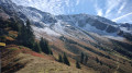
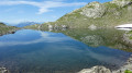
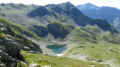
The Lacs de la Tempête in the Beaufortain form a plateau away from busy roads. Most visitors are content to visit Lac Supérieur, which can be reached from Saint-Guérin. This more challenging route starts from the hamlet of Bénétant (Cevins) and climbs along a steep path that requires care, running alongside numerous waterfalls. It takes you around all the Lacs de la Tempête and continues on to the Col de la Louze for views of the massif’s peaks and Mont Blanc.

Details

n°2223954
Creation:
Last update:
Last review:
  • Walking
    Activity: Walking
  • ↔
    Distance: 7.03 mi
  • ◔
    Average duration: 6h 00 
  • ▲
    Difficulty: Difficult

  • ⚐
    Back to start: Yes
  • ↗
    Ascent: + 3,215 ft
  • ↘
    Descent: - 3,196 ft

  • ▲
    Highest point: 7,110 ft
  • ▼
    Lowest point: 4,242 ft

Photos

Description of the walk

From the N90 in the Tarentaise Valley, turn off at Cevins, head up towards the church and take the long, narrow road that ends at Bénétant. To avoid causing a hindrance in the hamlet, 200 metres before reaching it, turn right onto the stony Route des Ardoisières and park in the large open space before a ford.

(S/E) Follow the Route des Ardoisières for 500 metres. Just before the ford across the Torrent de Bénétant, the path leading up to the Waterfall du Dard and the Lacs de la Tempête starts on the right.

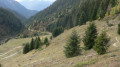
(1) Follow this steep path, which winds its way through the forest in numerous hairpin bends, climbs above rocky slabs via sections fitted with handrails, and crosses to run alongside several waterfalls, including the Cascade du Dard. Finally, as the forest thins out and after passing a water source, you’ll emerge onto the grassy ridge of the Chalet du Dard (ruins on the right).

(2) Climb straight up the valley, following the left bank of the torrent, until you reach a ridge overlooking an area of peat bogs, with the Chalet de Chizeraz on the opposite bank.

(3) Cross a torrent to descend towards the ruins of Chizeraz and climb up, skirting the ridge to the right that closes off the valley, to discover the Lac Vert nestled in its natural setting. Then, via a climb along the hillside, reach the hilltop overlooking the outlet of the lakes.

(4) Go round the two lakes, which follow one after the other to the south, and climb up a small ridge holding back the upper lake.

(5) The main path runs along the right bank of the lake, then climbs to the left to reach a high point on the ridge enclosing the lake, at the break in the slope towards Nâves (Grande Maison).

(6) Walk level across the mountainside beneath the Grand Mont to reach the grassy pass of the Col de la Louze.

(7) Return via the same path.

(6) Descend alongside the lakes via the ascent path or one of the many possible alternative routes.

(4) Downstream from the main lakes, head left to climb a little way up a side valley and visit the Lacs des Besaces.

(8) Return to the main path.

(4) Continue the descent towards Chizeraz.

(3) Pass the Chalet du Dard.

(2) Carefully begin the descent through the forest back to the Route des Ardoisières.

(1) Return to the starting point on the Route des Ardoisières (S/E).

Waypoints

  1. S/E : mi 0 - alt. 4,242 ft - Route des Ardoisières
  2. 1 : mi 0.3 - alt. 4,386 ft - Start of the Dard trail
  3. 2 : mi 0.99 - alt. 5,577 ft - Chalet du Dard - Nant du Dard (cours d'eau) - Affluent de l'Arrondine
  4. 3 : mi 1.65 - alt. 6,440 ft - Chizeraz
  5. 4 : mi 2.31 - alt. 6,837 ft - Downstream end of the main routes - Lacs de la Tempète
  6. 5 : mi 2.73 - alt. 6,998 ft - Downstream end of the Upper Lake
  7. 6 : mi 3.01 - alt. 7,073 ft - High bridge at the junction with the Louze
  8. 7 : mi 3.48 - alt. 6,952 ft - Col de la Louze
  9. 8 : mi 4.7 - alt. 6,939 ft - Lac des Besaces
  10. S/E : mi 7.03 - alt. 4,242 ft - Route des Ardoisières

Notes

Water is plentiful throughout the route, in the form of torrents, waterfalls and lakes, though there is no guarantee that it is safe to drink.

The climb through the forest is very steep. The path is well marked and winds in numerous hairpin bends to make the most of the few gentle sections on an otherwise very steep slope. Several sections are fitted with steps and, in particular, handrails. However, it is not particularly technical or exposed (due to the presence of trees and vegetation), but there are frequent exposed sections, which require caution, especially on the descent.
This path should be avoided in snowy or rainy conditions.

Once out of the forest, there are several possible paths offering varied routes around the lakes. Be careful, however, with the path descending along the right bank: to take it, you must be sure to cross the stream again further downstream, i.e. once the snowmelt has finished.
The presence of numerous snowfields until July (on the left bank near the lakes) does not prevent progress, as the slopes crossed at this altitude are gentle.

Possible alternative descent route: if you are reluctant to descend the path between (2) and (1), it is possible, from the Chalet du Dard, to take a detour via Le Priolet for a descent reputed to be less steep, joining the Route des Ardoisières further down. However, this involves a climb of over 200 metres in elevation.

Worth a visit

Three points of interest on this route:
- the water: the Cascade du Dard is signposted, but in fact, on the ascent, there are waterfalls everywhere, particularly in spring,
- the lakes: each has its own charm, from the Lac Vert, nestled amongst the rocks, to the Lac Supérieur – the largest, which remains snow-covered until July – via the Lacs des Besaces (a frog spawning ground),
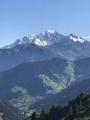
- the views: the ascent is steep and offers views only to the rear and of a few peaks in the Bauges (Sambuy, Dent de Cons), but the traverse to the Col de la Louze opens up the views: towards the peaks of the Beaufortain and the Mont Blanc massif on one side, and towards Peclet-Poset, then the Cheval Noir and the Perron des Encombres on the other.

Reviews and comments

4.7 / 5
Based on 1 review

Reliability of the description
5 / 5
Ease of following the route
4 / 5
Route interest
5 / 5
ycol
ycol

Overall rating : 4.7 / 5

Date of your route : Oct 31, 2022
Reliability of the description : ★★★★★ Very good
Ease of following the route : ★★★★☆ Good
Route interest : ★★★★★ Very good
Very busy route : No

Please take care: sections may be tricky in wet conditions

Machine-translated

Other walks in the area

For more walks, use our search engine .

The GPS track and description are the property of this route's author. Please do not copy them without permission.