


Starts and finishes at the La Ravoire car park above La Bâthie (73)
The second stage is a bit long, with several very steep descents.
Circuit and summit of the Grand Mont starting from La Ravoire


In two stages with an overnight stay at the Apage mountain hut in Arêches
Details
Creation:
Last update:
Last review:
-
 Activity: Walking
 -
 Distance: 13.24 mi
 -
 Average duration: 2 days
 -
 Difficulty: Difficult
 -
-
 Back to start: Yes
 -
 Ascent: + 5,860 ft
 -
 Descent: - 5,843 ft
 -
-
 Highest point: 8,809 ft
 -
 Lowest point: 4,396 ft
-
 Country:
France
Country:
France
-
 Areas: Alps, Beaufortain
 -
 City:
La Bâthie (73540)
City:
La Bâthie (73540) -
 Start/End: N 45.64769° / E 6.50276°
 -


 Hour-by-hour weather
Photos
Stages of the route
This route needs several days, find the details below:
Notes
Reviews and comments
3.3 / 5
Based on 3 reviews
Reliability of the description
3 / 5
3 / 5
Ease of following the route
3.7 / 5
3.7 / 5
Route interest
3.3 / 5
3.3 / 5
ChZambaux
Bénétant’s decision to set off was a good idea! It’s true that the return journey to La Ravoire is a bit of a slog when all you’re dreaming of is giving your legs a rest after a 1,700-metre descent...
Machine-translated

LeFourInsa25
Overall rating : 4 / 5
Date of your route : Oct 07, 2023
Reliability of the description : ★★★★☆ Good
Ease of following the route : ★★★★☆ Good
Route interest : ★★★★☆ Good
Very busy route : No
A brilliant two-day hike, ideal for a weekend.
As we wanted to camp near the Alpage refuge, we decided to set off from the hamlet of Bénétant instead, to balance out the distances and walking times.
It turned out to be a good compromise.
On the first day, despite the rain, we were still able to enjoy the peaceful paths, completely devoid of any sign of human presence, all the way to the Refuge des Arolles, from where a few ski lifts somewhat mar the landscape.
The second day was splendid, culminating in the descent to the magnificent Tempête lakes.
Although the route isn’t technically challenging, you mustn’t be afraid of heights, and good-quality footwear is essential due to the very long descent, much of which is over unstable scree.
The distance was underestimated according to my GPS.
I highly recommend it.
Machine-translated
Mbar2
@ChZambaux
Hello, I’m sorry if my comment ‘hurt’ your pride.
But I still think that a mountain scarred by ski runs and ski lifts, with antennas and solar panels at its summit, is rather unremarkable and remains an “unnatural” site.
And whilst I do think it’s interesting for hikers to compare peaks and routes, personally I like to wander around lovely spots (Pierra Menta, Pecloz, Grand Charnier… to name just the most recent ones I’ve explored).
So, everyone is free to give their opinion on this site – that’s great!
Machine-translated
ChZambaux
I’m sorry to hear you were disappointed with this walk! You are absolutely right to comment on the suitability of the suggested route and to highlight its shortcomings.
However, I do not understand – and certainly do not agree with – the idea of passing judgement on a natural site, and frankly, no, the Grand Mont is by no means ‘run-of-the-mill’! It is one of the main peaks of the Beaufortain massif and is particularly dear to local residents.
I don’t think it’s particularly relevant to compare the peaks with one another, as each has its own unique characteristics, and the undeniable appeal of Mont Thabor in no way detracts from that of a mountain range which isn’t even in the vicinity…
No hard feelings!
Machine-translated
Mbar2
Overall rating : 2.3 / 5
Date of your route : Aug 12, 2023
Reliability of the description : ★★☆☆☆ Disappointing
Ease of following the route : ★★★☆☆ Average
Route interest : ★★☆☆☆ Disappointing
Very busy route : No
A two-day self-guided hike.
Day 1: From the end of the tarmac road towards La Ravoire to the Col de la Forclaz (5 hours 40 minutes’ walk)
It is possible to camp just before the Col de la Forclaz (you may be able to find water from the stream by descending 100 metres to Lac Cornu) , or even after the Col de Louze heading towards the Grd Mont before reaching the scree slope (but be aware that the last water source is at the Alpage de Rognoux refuge or on the return journey via Lac Cornu).
It’s worth noting that the ‘shortcut’ indicated by the GPX track at Tête Rouge is, in my opinion, of no interest. It’s better to follow the Tour du Beaufortain route up to the 2,037-metre point (top of the chairlift) and then head to the Alpage de Rognoux refuge via the track.
Day 2: Col de la Forclaz – Grand Mont summit – return via Col de la Louze – Lacs de la Tempête – Chalet du Dard – return to car (8-hour walk)
The summit of the Grand Mont is rather unremarkable but offers a fine view of Mont Blanc
On the way back, to pass by the lakes, we chose to return to point 3 and go via the Col de la Louze. The descent alongside the first Tempête Lakes is very pleasant (it’s actually the highlight of the hike).
The section between the Chalets du Dard and the waterfall isn’t technically difficult for experienced walkers, even with a 13kg rucksack. You just need to be careful and not be afraid of heights. However, it’s a long slog! It feels like it never ends.
And the bad news is that once you reach the ford, it’s still nearly two hours along a forest track to get back to the car!!
So, in conclusion, it’s a hike with little real charm (apart from the first lakes of La Tempête), with a long road journey to get there and a very long, uninspiring walk back to the car.
Personally, it’s a far cry from my favourite hikes (such as the three-day Thabor trek).
Machine-translated
ChZambaux
Hello
Apologies for the lack of detail regarding the descent down the Dard waterfall. It’s a route I’ve been using for a very long time, so I’m not sufficiently aware of just how daunting it can be – and, above all, of the fact that it can be rather slippery in wet conditions, which are indeed quite common.
I should have mapped out the alternative route via Le Priolet, as the start point near the Dard chalets isn’t easy to find. It’s described in more detail in another walk I’ve written about, which involves the ascent via the waterfall and the return via Le Priolet...
I’ll amend my guide based on your comments.
Kind regards
Machine-translated
seb76
Overall rating : 3.7 / 5
Date of your route : Jul 19, 2021
Reliability of the description : ★★★☆☆ Average
Ease of following the route : ★★★★☆ Good
Route interest : ★★★★☆ Good
Very busy route : No
Hello,
I’ve just returned from a weekend’s hiking with a friend around the Grand Mont, having followed your guide and the few directions provided (which were a bit too sparse for our liking, see below)
Stunning scenery, trails and a wonderfully varied landscape, with Mont Blanc visible for much of the circular route… and what can I say about the fantastic panorama from the summit of the Grand Mont, where we were lucky enough to have a very clear horizon
I’d recommend setting off fairly early from the Refuge de l’Alpage (around 8 am is actually plenty) to make the most of the clear weather before the clouds roll in and gather over Mont Blanc; the route from the chalet to the summit is quite long, so allow about three hours at a brisk pace
However – and here we’d like to raise a small yellow flag regarding the return route you suggest along the Bénétant torrent and the Dard waterfall
In fact, this is a rather vertiginous and dangerous section in places, which, in our view, you do not highlight sufficiently in your guidebook
Admittedly, the route is equipped with cables, but certain sections prove to be genuinely difficult, especially when they’re wet – as was the case this weekend and, from what we’ve heard from a few locals, seems to be the case quite regularly
There is indeed an alternative route which significantly lengthens the walk (as we can see on the IGN map), but unfortunately we couldn’t find it near the Dard chalets (the signposts were hard to spot)
We therefore suggest that you highlight the difficulty and relative danger of the section along the Bénétant/Dard waterfall to warn your regular hikers
In any case, I have very fond memories of this walk and remain a big fan of the walks you feature on your website
and I am, of course, happy to discuss the matter with you and/or provide any further details you may need to enhance your route description
A loyal mountain enthusiast!
Machine-translated
Other walks in the area
La Ravoire – Arêches Alpine Refuge
 Visorando Member
 5.05 mi
+2,425 ft
-961 ft
4h 25
5.05 mi
+2,425 ft
-961 ft
4h 25
 Moderate
 Departure from La Bâthie (Savoie)
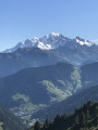
First (easy) stage of a two-day tour of the Grand Mont.
A well-marked path forming part of the Tour du Beaufortain.
Magnificent views of Mont Blanc from the Col de la Bâthie
Former Cevins Slate Quarry
 4.63 mi
+1,542 ft
-1,542 ft
3h 30
Moderate
Departure from La Bâthie (Savoie)
4.63 mi
+1,542 ft
-1,542 ft
3h 30
Moderate
Departure from La Bâthie (Savoie)
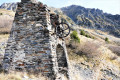
A walk that will take you past the remains of the slate quarries operated from the 16th century until the mid-20th century, offering lovely views from its balcony path over the Bellachat mountain pastures and the Col de La Bâthie. Best enjoyed from 10 June until the first snow
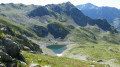
Ridges of the Grande Journée starting from La Ravoire
 6.75 mi
+3,189 ft
-3,173 ft
5h 55
Difficult
Departure from La Bâthie (Savoie)
6.75 mi
+3,189 ft
-3,173 ft
5h 55
Difficult
Departure from La Bâthie (Savoie)
A beautiful circular walk that takes you through the Bellachat mountain pastures, where Beaufort cheese is made, past the Croix de la Dormiaz and along the summit ridge with breathtaking views over the Albertville basin, before reaching the summit of the Grande Journée and its stunning 360° panorama. Return via Lac Sans Fond and the Lavouet Lakes.
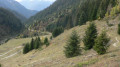
Pointe de Lavouet circular walk
 5.99 mi
+2,923 ft
-2,917 ft
5h 20
Difficult
Departure from La Bâthie (Savoie)
5.99 mi
+2,923 ft
-2,917 ft
5h 20
Difficult
Departure from La Bâthie (Savoie)
Ascent of Pointe de Lavouet, a less well-known peak than Pointe de la Grande Journée, offering views of Mont Blanc, Pierra Menta and the Col de la Bâthie. A beautiful, little-used circular route passing by the lovely Lac sans Fond and returning via the mountain pastures and the Col de la Bâthie. Best undertaken from June to October to avoid snow-covered sections that obscure the path and can be dangerous.
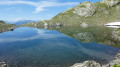
The Pointe de la Grande Journée via the ridges, starting from the Belachat mountain pasture
 5.35 mi
+2,303 ft
-2,283 ft
4h 30
Difficult
Departure from La Bâthie (Savoie)
5.35 mi
+2,303 ft
-2,283 ft
4h 30
Difficult
Departure from La Bâthie (Savoie)
A beautiful circular hike that starts at the Bellachat mountain pastures with Beaufort cheese making, passing by the Croix de la Dormiaz and a path along the summit ridge with breathtaking views of the Albertville basin. Then head to the Pointe de la Grande Journée for stunning 360° views.
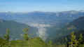
Dormiaz Ridge Route
 5.19 mi
+2,224 ft
-2,224 ft
4h 20
Moderate
Departure from La Bâthie (Savoie)
5.19 mi
+2,224 ft
-2,224 ft
4h 20
Moderate
Departure from La Bâthie (Savoie)
A lovely, unspoilt route that climbs via the Trimpaz Forest track to join an old path where you make your way through rhododendrons and blueberries to reach the Dormiaz ridge.
Breathtaking views over the Albertville basin, the Roche Pourrie, the Aulp de Tours, the Grande Journée and the Bellachat mountain pastures.
Lac des Cornaches circular route via the Col de la Tourche Vernay
 6.18 mi
+3,097 ft
-3,097 ft
5h 30
Difficult
Departure from Cevins (Savoie)
6.18 mi
+3,097 ft
-3,097 ft
5h 30
Difficult
Departure from Cevins (Savoie)
Looking for space and solitude? This walk is for you.
A path that’s shaded in the morning – ideal in hot weather – will take you to Lac des Cornaches via the Col de la Tourche Vernay, with a balcony-style walkway offering views of the Bellachat mountain pastures, the Albertville valley and the Grand Mont.
For more walks, use our search engine .
The GPS track and description are the property of this route's author. Please do not copy them without permission.

