The Grand Tour des Cornaches or the Gran Tor d’lé Kornache

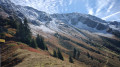
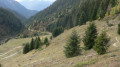
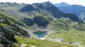
A challenging route due to its length and elevation gain, off the beaten track, featuring a balcony path overlooking the Tarentaise Valley and the villages of Tours-en-Savoie, La Bâthie, Cevins, Rognaix and Saint-Paul-sur-Isère, with breathtaking views of the Combe de Savoie.

Details

n°3117595
Creation:
Last update:
Last review:
  • Walking
    Activity: Walking
  • ↔
    Distance: 9.89 mi
  • ◔
    Average duration: 9h 50 
  • ▲
    Difficulty: Difficult

  • ⚐
    Back to start: Yes
  • ↗
    Ascent: + 6,037 ft
  • ↘
    Descent: - 6,017 ft

  • ▲
    Highest point: 8,219 ft
  • ▼
    Lowest point: 4,150 ft

Photos

Description of the walk

Head to Cevins and take the road near the church that climbs up to Bénétant. Near Bénétant, take the track signposted ‘Lacs des Tempêtes’ and park near the wooden sign pointing towards Le Priolet.

(S/E) Head up the Priolet path; this steady, sustained climb starts facing due south. A series of tight hairpin bends leads to the Priolet crossroads, marked by a signpost.

(1) Turn right and shortly afterwards you’ll reach the Col de la Tourche Vernay.

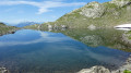
(2) Continue left onto the clearly visible balcony path, leaving the path on the right that descends directly to Lac des Cornaches. Begin a gentle descent; then, after a bend, turn right at the junction to reach Lac des Cornaches.

(3) Return quickly to the previous junction and take the path opposite. Enter a wooded section and continue along this path, passing beneath La Tournette.

(4) Take care here. Continue to the right along a tricky path; remain vigilant as some exposed sections may cause vertigo for those prone to it. Pass by the source of the Ruisseau de la Gruvaz and reach the junction at the Col des Évettes.

(5) Cross the stream and climb up the path on the left to reach the Col des Évettes

(6) Continue to the left; the path is not clearly marked. Stay in the valley and follow the clearly visible cairns to reach the start of the ridges. Take care here too, as the slope is quite steep; reach the base of the western ridge of the Pointe de Bizard.

(7) Turn right onto this ridge to reach the summit of the Grande Pointe de Bizard, the highest point of the walk.

(8) Continue along the northern ridge.

(9) Keep to the left, head downhill and, via a series of small plateaus, reach a rock face.

(10) Head down to the right across the mountain pasture to get closer to the stream, then follow it along its left bank to the junction at the Chalet de Chizeraz.

(11) Take the path opposite to reach the Chalet de Chizeraz.

(12) Return to the previous junction via the same route.

(11) Turn right and walk along the right bank of the Torrent de Bénétant, then cross it and head away from its left bank. Reach the ruins of the Chalets du Dard at the crossroads.

(13) Turn left to join the Chemin du Priolet, which starts at the foot of the vertical rock face. Continue along an uphill path until you reach the original junction at the Chemin du Priolet.

(1) Turn right and follow the same route as on the way there to reach the car park on Route de Bénétant (S/E).

Waypoints

  1. S/E : mi 0 - alt. 4,154 ft - Car park signposted ‘Route de Bénétant’
  2. 1 : mi 1.08 - alt. 6,204 ft - Junction of the circular loop at Priolet
  3. 2 : mi 1.29 - alt. 6,427 ft - Col de Tourche Vernay (1928m)
  4. 3 : mi 2.39 - alt. 5,850 ft - Lac des Cornaches
  5. 4 : mi 3.52 - alt. 6,949 ft - La Tournette
  6. 5 : mi 4.03 - alt. 6,827 ft - Junction for the Col des Evettes
  7. 6 : mi 4.29 - alt. 7,241 ft - Col des Evettes (2207m)
  8. 7 : mi 4.93 - alt. 8,025 ft - Start of the ridge
  9. 8 : mi 5.43 - alt. 8,219 ft - Grande Pointe de Bizard (2507 m)
  10. 9 : mi 5.73 - alt. 8,159 ft - At the foot of the Pointe de Comborsier
  11. 10 : mi 6.31 - alt. 7,635 ft - Summit
  12. 11 : mi 7.05 - alt. 6,440 ft - Chalet crossroads
  13. 12 : mi 7.14 - alt. 6,486 ft - Chizéraz chalet
  14. 13 : mi 7.93 - alt. 5,574 ft - The ruined Chalets du Dard - Nant du Dard (cours d'eau) - Affluent de l'Arrondine
  15. S/E : mi 9.89 - alt. 4,150 ft - Car park signposted ‘Route de Bénétant’

Notes

(3) Mountain hut open.
Between (4) and (5) This wild area is home to chamois, which you may spot.
(11) Open mountain hut and water point.

Worth a visit

The Croix de Sécheron.
Lac Vert on the Chizeraz Plateau.

Reviews and comments

4.7 / 5
Based on 1 review

Reliability of the description
4 / 5
Ease of following the route
5 / 5
Route interest
5 / 5
gérard bruet
gérard bruet

Overall rating : 4.7 / 5

Date of your route : Jun 17, 2023
Reliability of the description : ★★★★☆ Good
Ease of following the route : ★★★★★ Very good
Route interest : ★★★★★ Very good
Very busy route : No

I did the walk on 17 June 2023 – a superb view, though there was still snow on the Comborsiè descent; we took that route and went to see the Seven Lakes – absolutely stunning 😻. For the return journey, we chose the descent via the Dard waterfall; the path has handrails and is quite steep. A superb walk, completed in 8 hours including breaks.

Machine-translated

Other walks in the area

For more walks, use our search engine .

The GPS track and description are the property of this route's author. Please do not copy them without permission.