The Chardonnet and Aiguillette Passes Route

Route around the Aiguillette du Lauzet.

Details

74403
Creation:
Last update:
Last review:
  • Walking
    Activity: Walking
  • ↔
    Distance: 6.06 mi
  • ◔
    Average duration: 5h 45 
  • ▲
    Difficulty: Difficult

  • ⚐
    Back to start: Yes
  • ↗
    Ascent: + 3,409 ft
  • ↘
    Descent: - 3,399 ft

  • ▲
    Highest point: 8,871 ft
  • ▼
    Lowest point: 5,564 ft

Photos

Description of the walk

Park in one of the car parks at Pont de l’Alpe; for this walk, use the large car park on the left-hand side of the road as you come from Briançon.
(S/E) Walk up the road to the bridge and immediately turn right onto the wide track that runs along the left bank of the stream.
Cut across the bend in the track by taking the well-marked path which rejoins the wide track further up.
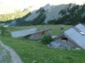
Stay on this track until you reach the chalets at Alpe du Lauzet.

(1) Then, as you leave the chalets, take the path (signposted ‘Grand Lac’).
Reach the Clot des Vaches after a steep climb.

(2) Turn right onto theGR®57and stay on it, following theGR® markings (red and white) to the Col du Chardonnet Sud.

(3) Then turn right onto the correct path (cairn) which climbs to a small, unnamed peak (altitude 2,713 m). Begin the descent towards the Col de l’Aiguillette, which remains visible.

(4) Turn onto the path which, running close to the cliff, leads to the plateau at the foot of the Croix de l’Aiguillette.

(5) Begin the descent along the well-defined but unmarked path to reach the Chemin du Roy.

(6) Turn right onto it and, after 100 metres, turn left onto the path which winds its way through the mountain pastures several times before finally rejoining the track you took on the way up, then the Pont de l’Alpe and the car park (S/E).

Waypoints

  1. S/E : mi 0 - alt. 5,564 ft - Pont de l’Alpe.
  2. 1 : mi 0.95 - alt. 6,388 ft - The Lauzet Alpine Pasture.
  3. 2 : mi 1.61 - alt. 7,247 ft - GR57
  4. 3 : mi 2.49 - alt. 8,652 ft - Col du Chardonnet
  5. 4 : mi 3.18 - alt. 8,304 ft - Col de l'Aiguillette
  6. 5 : mi 3.34 - alt. 8,406 ft - Croix de l’Aiguillette crossroads
  7. 6 : mi 4.62 - alt. 6,818 ft - GR50–PR junction, returning to Pont de l’Alpe.
  8. S/E : mi 6.06 - alt. 5,571 ft - Pont de l’Alpe

Notes

No water along the route except at the start (a fountain behind the fire hydrant).
There are a few shelters at the Col du Chardonnet, but they are very basic – they are bivouac-style shelters (a small stone wall no more than 50 cm high).
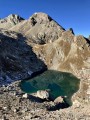
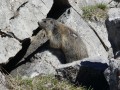
There are plenty of animals in this area today, for example:
- around thirty chamois were practising mountaineering on the Aiguillette ridges, and the whole family was there: the mums, the young ones, the yearlings,
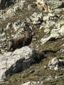
- about ten ibex were lounging on the banks of the Aiguillette; from a distance, only their horns were visible, but what horns they were,
- a dozen vultures were waiting for a carcass,
- a flock of sheep was penned in,
- two Patou dogs were barking at the walkers passing close to the park.
Dozens of walkers were out and about.

This route passes through a protected area, which may be subject to special regulations:

Worth a visit

La Grave and the Meije cable car.
The Col du Galibier and the monument dedicated to Henri Desgranges, founder of the Tour de France cycle race.
The Col du Lautaret and the Alpine Garden.

Always be cautious and plan ahead when you're outdoors. Visorando and the author of this route cannot be held responsible for any accidents occurring on this route.

The GR® and PR® markings are the intellectual property of the Fédération Française de Randonnée Pédestre.

Reviews and comments

4.9 / 5
Based on 3 reviews

Reliability of the description
5 / 5
Ease of following the route
4.7 / 5
Route interest
5 / 5
JJS1951
JJS1951

Overall rating : 4.7 / 5

Date of your route : Jul 20, 2026
Reliability of the description : ★★★★★ Very good
Ease of following the route : ★★★★☆ Good
Route interest : ★★★★★ Very good
Very busy route : No

A lovely route that we’d already done in the opposite direction; it’s better the way described here.
We chose to take the final section from 8 to 1 via the black dotted line; I highly recommend it – it’s a more pleasant path with no one about, a descent without stones, 500 metres longer, but very good indeed.

Machine-translated

adubout
adubout

Overall rating : 5 / 5

Date of your route : Aug 14, 2018
Reliability of the description : ★★★★★ Very good
Ease of following the route : ★★★★★ Very good
Route interest : ★★★★★ Very good

A lovely hike – we spotted ibex and marmots along the way.
It’s a bit more challenging and interesting than just the Aiguillette circuit, which is the route most people take.

Machine-translated

AUDUC
AUDUC

Overall rating : 5 / 5

Date of your route : Jul 09, 2015
Reliability of the description : ★★★★★ Very good
Ease of following the route : ★★★★★ Very good
Route interest : ★★★★★ Very good

A lovely walk – we didn’t see any ibex or chamois. It was already warm by the time we passed beneath the Aiguillette pass.

Machine-translated

Other walks in the area

For more walks, use our search engine .

The GPS track and description are the property of this route's author. Please do not copy them without permission.