Country:
 City:
City:


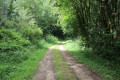
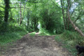
Cemetery car park – Route D 737.
(S/E) Cross the D737 with great care and head left towards the roundabout along the grass verge. Go round the roundabout on the right, cross the Route de Melle (D737) and then follow the Route de Lezay (D45) for about a hundred metres. Cross the D45 and take the Chemin de Bourdenloeil opposite, which immediately turns right (south-east). Follow the path to a T-junction.
(1) Then take the path on the right. Cross the D45 with care and continue straight ahead along the path known as the ‘Chemin du Noyer au Berger’. Go straight on, ignoring a turn-off to the right and then one to the left.
(2) At the next junction, turn slightly to the right. Cross the D737 with care and you’ll soon reach a T-junction. Turn right and enter La Villedé. On the left, you’ll see a Protestant family cemetery surrounded by greenery.
(3) Turn left onto Allée des Charmilles. At the T-junction, turn left onto a well-maintained track. Continue straight ahead (south) at the following junctions. At the junction near an electricity pylon, carefully cross a small road and continue straight ahead onto a track that runs a short distance alongside the D 737.
(4) At the next junction, turn right. At the Fork in the road that appears shortly afterwards, turn right again.
(5) At the junction, turn right (north) and you’ll come to a crossroads.
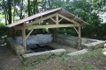
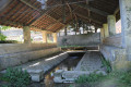
(6) Follow the Grand Rue du Vivier to the right. After about a hundred metres, turn left into Rue du Lavoir (note a spring and a washhouse on the left). At the end, turn left into Rue de la Planche to return to the crossroads.
(6) Take the Grand Rue de Vivier to the right (west). As you leave the hamlet, you’ll see a family cemetery on the left-hand side. The road bends to the right; ignore a turn-off on the left.
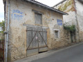
(7) At the place known as La Maison Neuve (a beautiful old property on the right), continue straight ahead along the road leading towards Gripoteau. Ignore a road on the left, go downhill, cross the Ruisseau de Chambrille and head up the hillside opposite.
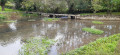
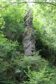
(8) At the junction, turn right onto a path that descends towards the stream. Just before this, at a Fork in the road (elevation 148), take the left-hand path. Turn right immediately and head slightly downhill to the Ruisseau de Chambrille. Keep the stream on your right for a long stretch and descend the valley. After the Vallée des Grenats joins from the right, you’ll see an upright granite boulder on the left: the Dame de Chambrille.
(9) At the end of the valley, turn right and cross the Ruisseau de Chambrille. Climb slightly and, at thefirst junction, go straight on.
(10) Atthe second junction, turn left onto a grassy path. At the end, turn left and, shortly afterwards, turn right. Ignore a path branching off to the left and join the D 737 opposite the cemetery. Cross the road with care and you’ll find the car park on your left (S/E).

 Visorando Member

 Easy
Easy