Circular route from the Moulin de Grand Vault to the Gasse aux Grolles

A pleasant walk east of La Mothe-Saint-Héray to the vicinity of Bougon. Starting by following the Sèvre Niortaise for a while, the route climbs onto a plateau, winding its way through a rather idyllic valley. The route continues across the plateau, offering a route through the lowlands with varied landscapes.

Details

3203379
Creation:
Last update:
Last review:
  • Walking
    Activity: Walking
  • ↔
    Distance: 7.81 mi
  • ◔
    Average duration: 3h 50 
  • ▲
    Difficulty: Moderate

  • ⚐
    Back to start: Yes
  • ↗
    Ascent: + 256 ft
  • ↘
    Descent: - 256 ft

  • ▲
    Highest point: 420 ft
  • ▼
    Lowest point: 243 ft

Photos

Description of the walk

The car park is located on Place Clémenceau in the centre of La Mothe-Saint-Héray

(S/E) Leave the car park via Rue du Rempart in the south-east corner of the square. Continue along Allée du Parc. Pass the primary and secondary schools on your right and the sports facilities on your left; then, just as the street takes a sharp bend, carry straight on along a path running parallel to the Route d’Exoudun (D307) on your right, about ten metres away. The path leads to Allée de Paris.

(1) Turn right onto Allée du Parc and, at the nearby junction with the Route d’Exoudun (D307), take the flat Chemin des Vignes opposite, after carefully crossing the junction. The path approaches the Sèvre Niortaise and runs alongside it.

At the Grand Ratier on the right (private property on the banks of the Sèvre Niortaise), the road gives way to a path. Carry on straight ahead until you reach a ruin. Take the track on the left to climb straight up the hillside and join a gently sloping track which leads out onto the Route d’Exoudun (D307) on the right, at a junction with a small road and a track, in the bend of the road just before the Moulin de Grand Vault.

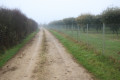
(2) Cross the road carefully (poor visibility) and continue along the white track to the right of the small road. Follow this track as it climbs up the Garenne de la Coudraie valley. Continue until it joins a small road running south-west to north-east. Follow this road to the left for about twenty metres.
At this point, you can take a detour on the route to see the magnificent Dolmen de la Pierre Levée (about three hundred metres away, following the road northwards). Along the road there are some fine dry-stone walls.

(3) Turn right onto a track which, further on, bends to the right and joins a crossroads of four tracks after passing through the Chiron Boireau area.

(4) Turn left onto a path that climbs gently towards the D56. Cross it carefully and continue straight ahead along a small, almost flat road heading towards La Roche and Bougon. Carry on straight until you reach the final junction with a path, about a hundred metres before the first houses in La Roche.

(5) Turn left onto the track heading west, which passes south of La Roche and then La Groie. At the next T-junction, turn right onto the track leading down to the road serving the hamlet of La Groie. Turn left and follow the road for about a hundred metres to reach the junction with the road known as Rue du Bénitier de Bougon.

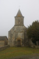
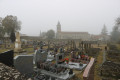
(6) Turn right and follow Rue du Bénitier with care until you turn left onto Rue des Sablières. Shortly afterwards, you’ll pass the village cemetery on your right. Further on, you’ll see the Church of Saint-Pierre de Bougon on your right. Continue straight on until you reach the Route de Salles.
When you reach it, turn left and walk carefully along the Route de Salles (no pavement) until you reach the next junction on the left.

(7) Turn left and take the farm track opposite, at the farm’s dead-end on the left. The farm track, after a right-angled bend to the right, heads westwards, climbing up to a small plateau where the remains of a small copse can be seen in the Sablières area, on your left. The track soon descends through the Petit Cerisier area, passes a crossroads and eventually joins the D56.

(8) Follow the D56 carefully to the right. Cross the Justices junction with the D5 – which runs from La Mothe-Saint-Héray to Pamproux – with great care. Opposite, take the farm track heading towards the Gasse aux Grolles in a north-westerly direction. Continue straight on to the Gasse aux Grolles, taking care when crossing the D5E

(9) After walking alongside the Gasse aux Grolles on your left (farm), turn onto the first path on the left. Just before this, you’ll see a plot planted with truffle oaks on your right. The path is initially flat, running along the edge of a sort of plateau; after a right-angled bend to the right, it descends the hillside and joins the Chemin de Broute Lumas.

(10) Turn left to follow the tarmac road, preferably on the right-hand side, where there is a verge of varying width running alongside the houses on your right. Continue to the junction with the D737.

(11) Turn left immediately at this somewhat complicated junction to stay on the pavement alongside the houses and take Rue du Maréchal Foch. Follow it to the junction with Route du Pont l’Abbé on the right and Route de Pamproux (D5) on the left. Cross the junction carefully and walk past the town hall, heading to the left to reach Place Clémenceau (S/E).

Waypoints

  1. S/E : mi 0 - alt. 249 ft - Car park at Place Clémenceau
  2. 1 : mi 0.46 - alt. 325 ft - Crossroads – Allée de Paris - Orangerie de la Mothe Saint Héray
  3. 2 : mi 1.15 - alt. 292 ft - Junction of the footpath and the D307 road north of the mill - Sèvre Niortaise (fleuve)
  4. 3 : mi 2.15 - alt. 354 ft - Path on the right - Dolmen de la Pierre Levée (Bougon)
  5. 4 : mi 2.59 - alt. 377 ft - Crossroads
  6. 5 : mi 3.3 - alt. 400 ft - Crossroads – crossroads
  7. 6 : mi 4.06 - alt. 364 ft - Junction of Route de La Groie and Rue du Bénitier
  8. 7 : mi 4.34 - alt. 331 ft - Junction of Route de Salles and the road on the left
  9. 8 : mi 5.45 - alt. 417 ft - Junction of the footpath and the D56 road near Les Justices
  10. 9 : mi 6.75 - alt. 358 ft - Junction with a path on the left
  11. 10 : mi 7.13 - alt. 302 ft - Chemin de Broute Lumas
  12. 11 : mi 7.51 - alt. 243 ft - Junction of Chemin de Broute Lumas and the D737
  13. S/E : mi 7.81 - alt. 249 ft - Car park at Place Clémenceau

Notes

This walk across varied terrain requires suitable footwear.

This walk is not signposted. Consequently, it is advisable to follow the directions in the description and on the map, whilst keeping a close eye on the landscape. The waypoints (with their GPS coordinates and the distance from the starting point) serve as aids for walkers exploring the route for the first time.

Alternative route 1:
(3) At the mouth of the Vallon de la Garenne de la Coudraie, turn left onto the small road running south-west to north-east and continue straight ahead with caution towards the Carrefour des Sept Chemins. As you climb, admire the magnificent dry-stone walls on your left – a remarkable achievement by our ancestors. After about 300 metres, on the right-hand side, stop to see the large Dolmen de la Pierre Levée.
At the Carrefour des Sept Chemins, turn right and follow the D56 with great care until you reach the first farm track on the left (almost at the bottom of a small valley). Turn left onto the track and follow it to rejoin the original route at the area known as “Le Moulin à Vent”.

Alternative Route 2:
After the Carrefour des Justices (just past the ‘8 ’), turn off onto the first farm track on the left, about 400 metres from the crossroads (altitude 118 metres). Follow this track, which leads straight back to La Mothe-Saint-Héray. The track runs past the fire station on the left-hand side, then passes through a housing estate. Turn right to go round the water tower and head down towards the village via Rue du Barrabas. This leads to Place Clémenceau, where the car park is located.

If you follow either of the two alternative routes, the route is shortened to 9.7 km.

Walk completed by the author on 16 January 2022.

Worth a visit

La Mothe-Saint-Héray
La Mothe-Saint-Héray, a charming little village in southern Deux-Sèvres
In the beginning there was… a lake! At the bottom of the Sèvre Niortaise riverbed, Lake Vauclair occupied the site of the present-day village. This lake gradually disappeared by the 5th century.

The town arose from the merger of two settlements in the early 15th century: La Mothe, the younger of the two – a medieval motte built to defend against the Normans, who had advanced as far as Melle – and Saint-Héray (formerly ‘Sensiac’), dating back to the 6th-century settlement of farming families around Arédius, after whom the village was named. He was the grand-nephew of Clovis, who had acquired a country house there.

Monuments:
The Orangery
Built in 1634, with its two pavilions, by Nicolas Tillon, Richelieu’s master mason, this monument to Mothais history remains the sole remnant of the mighty medieval castle.
It was modernised in the 17th century by the Baudan Parabère family.
The fortress was transformed into an opulent residence. Within its walls, many illustrious figures stayed for a time.
The citadel, purchased in 1840 by a private individual, met a sad fate as it was sold off stone by stone in 1842. The Orangery nearly suffered the same fate. Saved from demolition at the last minute, the local council secured ‘historic monument’ status for the building in 1925. Three years later, the orangery became the property of the local council. From then on, it underwent restoration.
In 1997, an ambitious restoration project was launched, restoring the complex to its former splendour, which visitors can now admire.
Set amidst its French-style gardens and canal, the orangery seems to be nestled in a lush green setting where walkers can let themselves be carried away by the scent of the orange and lemon trees scattered across the esplanade.
Now converted into an exhibition space, the gallery comes alive from spring to autumn with cultural events.

The church:
Two villages, one church.
Originally, there were two villages: Sansiac, with the Church of Saint-Héray or Yrieix, and, later, La Mothe, centred around a castle, with the Church of Saint-Flavien. New settlements – Villeneuve and the La Robinière district – brought them together. The two villages merged on 9 August 1404. The name La Mothe-Saint-Heray (or Heraye, or even Sainte-Heraye) is already attested in the 13th and 14th centuries.
‘Heray’ is derived from the Latin ‘Aredius’, which also gave rise to ‘Yrieix’ in Limousin. Yrieix was a holy monk from Limousin who was also a friend of Saint Radegonde (6th century).
In the final decade of the 15th century, a new church was built on a new site, sheltered from the floods of the River Sèvre. The Church of Saint-Flavien ceased to exist. The Impasse de la Vieille Église preserves the memory of the first Church of Saint-Héray.
The construction of the new church, commissioned in 1490 by Jacques de Beaumont, Lord of Bressuire, was completed after his death around 1498 by his son-in-law, André de Vivonne. The keystones of the ribbed vaults are adorned with the coats of arms of the lords of La Mothe-Saint-Héray; Jacques de Beaumont’s coat of arms appears on the keystone of the eastern bay above the high altar.
Set alight by the Protestants, the church was restored around 1582. Transformed during the Revolution into a Temple of Reason, it was thus spared.
It was built over an intermittent spring.

The Dovecote of the Benedictine Convent
It belonged to ‘La Salle’, the largest farm in the village under the Ancien Régime, towards which its gate faces.
The dovecote was reserved for the lord high justice (a feudal right); it served two purposes:
- rearing squabs for meat,
- the production of pigeon droppings, used as fertiliser.
These large populations of pigeons devoured the peasants’ crops, and the peasants were unable to destroy them for fear of heavy fines. This is why it was one of the demands of the 1789 Revolution, when this privilege was abolished.
It has 750 nesting boxes, corresponding to the number of arpents – a unit of area that varied according to region and, above all, the nature of the land, as it represented the area that a team of draught animals could plough in a day. The external stone parapet (rambière) prevents pests (such as rodents) from climbing up.
Owned by the local council since 2013, its restoration earned it an honourable mention from the Society for the Protection of Landscapes and Aesthetics in France in 2015 and a departmental award, ‘Les Rubans du Patrimoine’, in 2016.
Source: the municipality’s official website

The Dolmen of La Pierre Levée
Listed as a Historic Monument in 1875 (by list). It is situated below the Carrefour des 7 Chemins in the municipality of Bougon.
Historic Monuments website (Monumentum).

The Pierre Levée area
The Regional Conservatory of Natural Areas has been working to preserve the Pierre-Levée site since 2001, in partnership with local stakeholders, as part of the compensatory measures following a land-use development project carried out in the late 1990s. Under a 99-year long-term lease, it manages around ten hectares belonging to the municipalities of Bougon and Exoudun.
Source: CREN website

Reviews and comments

4.1 / 5
Based on 3 reviews

Reliability of the description
4.3 / 5
Ease of following the route
4.3 / 5
Route interest
3.7 / 5
lemarcheur65
lemarcheur65 ★

Hello MARTDomi
The author of this walk has been notified.

Machine-translated

MARTDomi
MARTDomi

Overall rating : 3.7 / 5

Date of your route : Jul 03, 2024
Reliability of the description : ★★★★☆ Good
Ease of following the route : ★★★★☆ Good
Route interest : ★★★☆☆ Average
Very busy route : No

A pleasant circular loop

Please note: In Bougon, the farm’s cul-de-sac is clearly signposted as private property under CCTV surveillance, and today the road to Salles is strictly closed off, EVEN TO PEDESTRIANS.
We therefore had to go round Bougon

Machine-translated

GILMIC79
GILMIC79

Overall rating : 4.7 / 5

Date of your route : Mar 07, 2023
Reliability of the description : ★★★★★ Very good
Ease of following the route : ★★★★★ Very good
Route interest : ★★★★☆ Good
Very busy route : No

A very easy walk, on flat, clear ground

Machine-translated

philouis
philouis

Thank you. We’ve been there too. But it might put some people off.

Machine-translated

pgetrochon
pgetrochon

I’ve done this walk twice – the first time with my dog, and the second time with a group of about fifteen walkers. There are no signs indicating that it’s private property. Nobody said anything to us. Of course, we just passed through, as it’s more pleasant to take the Impasse de la Ferme. However, if the problem were to persist, you simply need to head a short way north to the Route de Salles by going straight on past the church. Once there, turn left onto the Route de Salles until the next junction, then turn left again to rejoin the route.
This suggested route helps to minimise the distance travelled on tarmac roads.
Enjoy your walks

Machine-translated

philouis
philouis

Overall rating : 4 / 5

Date of your route : Mar 28, 2022
Reliability of the description : ★★★★☆ Good
Ease of following the route : ★★★★☆ Good
Route interest : ★★★★☆ Good
Very busy route : No

A lovely walk, very interesting at the start, though a bit flat towards the end.
We covered 14 km as we went all the way to the dolmen, and in Bougon, we went via Les Groies then past the temple to rejoin the route. At the Impasse de la Ferme, there’s a fallen tree trunk lying across the path, which doesn’t exactly encourage you to carry on and gives the impression you’re trespassing on private property.

Machine-translated

Other walks in the area

For more walks, use our search engine .

The GPS track and description are the property of this route's author. Please do not copy them without permission.