Around the Sèvre Niortaise between La Mothe-Saint-Héray and Bagnault

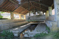
In this hedgerow-dotted countryside, at the heart of Protestant country, where water and stone alternate, the paths wind through contrasting landscapes steeped in history. This walk will allow you to discover wash-house fountains, a ‘donkey bridge’ (stone bridge), a dolmen and numerous examples of traditional built heritage, including farmhouses and the Château d’Exoudun.

Details

1377443
Creation:
Last update:
Last review:
  • Walking
    Activity: Walking
  • ↔
    Distance: 7.03 mi
  • ◔
    Average duration: 3h 25 
  • ▲
    Difficulty: Moderate

  • ⚐
    Back to start: Yes
  • ↗
    Ascent: + 167 ft
  • ↘
    Descent: - 164 ft

  • ▲
    Highest point: 394 ft
  • ▼
    Lowest point: 272 ft
  • ⚐ Country: France
  • ⚐ City: Exoudun (79800)
  • ⚑
    Start/End: N 46.344045° / W 0.080415°
  • ❏
    IGN map(s): Ref. 1628SB
  • Hour-by-hour weather

Photos

Description of the walk

The car park is on Rue du Stade, alongside the Sèvre Niortaise (the town hall is nearby on the other side of the street).

(S/E) Take the footbridge over the Sèvre Niortaise to enter the adjacent park. Cut diagonally across the park to reach Impasse de Crémille at the corner of the house bordering it. Note that at the end of this cul-de-sac is an old mill on the Sèvre Niortaise. Follow this short cul-de-sac westwards to the junction.

(1) Turn left onto a street, the Chemin de la Peyratte, which climbs steeply and becomes a footpath shortly after the last house. The Chemin de la Peyratte overlooks the Sèvre Niortaise.

(2) Turn left onto the first track, which continues to run alongside the Sèvre Niortaise. Carry on until you reach a small road, which you’ll come to just after passing a cemetery on your left. Turn left, walk for about a hundred metres, then take the track on the left leading to the Fontaine de Thuet.

Retrace your steps back to the path running alongside the cemetery. Cross the small road carefully and continue along the path opposite.

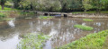
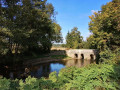
(3) At the next crossroads, carry on straight ahead, staying on the path on the left. After a bend to the right, the path descends and crosses the Sèvre Niortaise via a stone bridge known as the Pont aux Ânes.
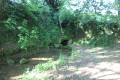
Immediately after the stone bridge, turn left onto a small sunken path leading to the Fontaine de la Patinière. From there, a narrow lane opens out onto the Route de Chenay (D 307), which leads into Bagnault (Rue de la Pigeonnerie). Note that a few dozen metres further down, on the left, you can see the Saugé manor. Take Rue de la Pigeonnerie towards the village centre.

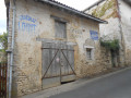
(4) At the first junction where four streets meet, turn left into the Tue de la Rochelle. Here you’ll see the Hôtel de la Rochelle. Turn right into Rue des Templiers, which takes the walker past the Templar Commandery. From the junction of these two streets, you can see the mullioned windows at the rear of the Hôtel Saint-Jacques. At the Commandery, turn left onto Rue de la Pigeonnerie, whose bridge spans the seasonal stream known as the Accourants.

From this bridge, you can see, on the right, the Logis de Bagnault – also known as the Logis de Chamberland – the former residence of the Commander. You need to walk a short way along the bed of the Accourants to see the south façade of the house with its mullioned windows, then turn into Rue du Minage to see the other façade and the small pedestrian gate. Return to the junction and turn right into Rue de la Gare, which climbs steeply. Pass the junction with Rue de l’Équerre on your left and continue to the next junction.

(5) Turn left onto a farm track (before the last block of houses). At the next junction of tracks, carry on straight ahead and follow this track straight on until you reach a small road. Turn left.

(6) Almost immediately afterwards, turn right onto a track. Carry on straight ahead until you reach a farm track. Turn right.

(7) Immediately afterwards, turn left onto a track heading north-west. Continue until you reach a small road. Turn right and follow the road carefully uphill for about 300 metres to see, on your right, the Sept Chemins dolmen, dating from around 5,500 years ago, which is the most prominent feature of the Bougon necropolis.
Return along the small road and go about ten metres past the point where you joined the road earlier.

(8) Turn right onto the path heading west, just after a hedge; the path is flat at first, then descends gently into a narrow valley at a place called La Garenne de Coudraie. Continue along the path until you reach a road.

(9) When you reach the D 307, turn left and follow it with great care. Pass above the Moulin de Grand Vault.

(10) At the next junction, turn right onto the small road leading downhill. Shortly afterwards, turn right towards Le Prieuré. Immediately after this, the road crosses the Sèvre Niortaise via a small bridge. Walk through the hamlet of Le Prieuré.

At the next T-junction, turn right onto the small, steeply ascending road. It winds round a dry-stone wall enclosing a large estate. At the top of the climb, turn left onto a path that continues to run alongside the dry-stone wall.

(11) At the next crossroads, take the path on the left. Continue until you reach a small road. Turn right and, about sixty metres further on, turn left onto a path. Shortly afterwards, at the next crossroads, take the path on the left and continue along the edge overlooking the Sèvre Niortaise.

(12) Just as the path turns into a road, turn left onto the Chemin de l’Houmeau towards the hamlet of La Planche. On reaching La Planche, turn right onto Rue des Coteaux, which climbs initially before descending slightly. After passing a building on the left, take the narrow alleyway on the left which soon joins a small path, the Impasse de la Planche. Turn left again to reach the bubbling fountain (a large basin under a canopy and a small basin with a water level gauge next to it).

Turn round and continue along Impasse de la Planche.

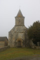
(1) At the crossroads, turn left into Rue du Pont. Cross the Sèvre Niortaise and carefully cross Rue du Stade to continue along Rue du Pont. At the end of this street, turn left into Rue de la Vieille Pierre, then immediately right into Rue du Coq. As you round the next bend, you’ll see the beautiful Boissec manor house, one of Exoudun’s former seigneuries, and a little further on, Saint-Edouard Church.
Continue along Rue des Treilles, which follows on from Rue du Coq. It leads into Rue des Granges, skirting around Exoudun Castle.

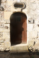
As you walk down Rue des Granges, you’ll enjoy a lovely view of Exoudun Castle. Turn left into a small street which offers a lovely view of Saint-Édouard Church (seen from below). After a right-angle bend, the street joins Rue de la Vieille Pierre; head up this street to the left towards the town hall. There are some beautiful house doors here. Continue along Grande Rue towards the town hall.

At the corner by the town hall, walk up the Route de Loubigné on the left for about a hundred metres and you’ll see a dolmen on the right. At the same point, on the other side of the road, you’ll see the north façade of the Logis de Boissec, which you caught a glimpse of on Rue du Coq. In line with the driveway, to the right of the main building, note a beautiful dovecote roofed with slate tiles. Head back down the street towards the town hall.

Carry on straight ahead at the corner by the town hall, cross Rue du Stade with care and head back to the car park (after Rue du Coq) (S/E).

Waypoints

  1. S/E : mi 0 - alt. 299 ft - Long-stay car park at the Stadium (opposite the Town Hall) - Sèvre Niortaise (fleuve)
  2. 1 : mi 0.07 - alt. 295 ft - Crossroads at the bottom of Rue de la Pommeraie
  3. 2 : mi 0.26 - alt. 302 ft - Junction of farm tracks
  4. 3 : mi 1.09 - alt. 341 ft - Junction of farm tracks
  5. 4 : mi 1.32 - alt. 344 ft - Junction of the D307 road and Rue de la Rochelle
  6. 5 : mi 1.7 - alt. 341 ft - Junction of Rue de la Gare and the farm track
  7. 6 : mi 2.41 - alt. 381 ft - Junction of road and farm track
  8. 7 : mi 2.83 - alt. 377 ft - Junction of farm tracks
  9. 8 : mi 3.63 - alt. 351 ft - Junction of road and farm track
  10. 9 : mi 4.61 - alt. 282 ft - Junction of road and farm track
  11. 10 : mi 4.87 - alt. 312 ft - Crossroads near Le Grand Ratier
  12. 11 : mi 5.42 - alt. 367 ft - Junction of farm tracks
  13. 12 : mi 6.11 - alt. 374 ft - T-junction of farm tracks
  14. S/E : mi 7.03 - alt. 299 ft - Long-stay car park at the Stadium (opposite the Town Hall)

Notes

The car park is on Rue du Stade, alongside the Sèvre Niortaise (the town hall is nearby on the other side of the street). Please ensure you leave the bus stop space clear.

This walk takes place over varied terrain, so suitable footwear is essential.

Most of this walk is signposted in yellow. The rest of the route is unmarked. Consequently, it is advisable to follow the directions in the description and on the map, whilst paying close attention to the landscape. The waypoints, with their GPS coordinates and the distance from the starting point, serve as aids for walkers exploring the route for the first time.
This walk is loosely based on the route published by the Deux-Sèvres Tourist Office: ‘The old towns of Exoudun and Bagnault, from fortified strongholds to Renaissance residences’

Hike completed by the author on 7 September 2018

Worth a visit

Exoudun
Exoudun is a small French village situated in the Deux-Sèvres department and the Poitou-Charentes region. Its inhabitants are known as Exoudunois and Exoudunoises.
The commune covers an area of 26 km² and had a population of 592 according to the latest census in 2007. With a population density of 22.8 inhabitants per km², Exoudun has seen a 4.4 per cent decline in its population compared with 1999.
Surrounded by the communes of Chenay, La Mothe-Saint-Héray and Sepvret, Exoudun is situated 31 km north-east of Niort, the largest town in the area.
Situated at an altitude of 92 metres, the River Sevre Niortaise is the main watercourse flowing through the commune of Exoudun.
Source: http://www.poitoucharentes.visite.org/ website (excerpts)

Places and monuments
- Former feudal castle known as the ‘Tour Rasée’;
- Protestant church built in 1855
- The source of the Sèvre Niortaise, known as the Fontaine-Bouillante: the Fontaine Bouillonnante takes its name from the bubbling waters that feed it. These waters, which resurface from the Dive basin, then flow into the nearby Sèvre Niortaise.
It is said that in the 4th century, Saint Martin used these waters to baptise new converts.
For many years, a local custom saw young women from Exoudun come here to throw two pins into the water… If they fell in the shape of a cross, it was a sign of a future marriage.
Source: Wikipedia (excerpts)

Bagnault
Like its administrative centre, Exoudun, Bagnault is a town of character and a major centre of Protestantism in the Poitou region
The village of Bagnault is situated to the east of the market town of Exoudun, at the confluence of the Accourants and Sèvre Niortaise valleys, at the foot of the Saint-Sauvant plateau, occupying part of its base and the riverside escarpments. Almost submerged in winter by water from its fountains and numerous seasonal springs, in summer it rests beneath the cool, delightful shade of its poplars, ash trees and fruit trees.
As one walks through this humble hamlet, one is struck by the fact that it possesses all the hallmarks of a small town: neatly aligned houses, streets whose names date back several centuries, local place-names recalling some local event or a long-vanished ancient monument, tall and spacious houses with openings adorned with delicate carvings, grand gateways, wide chimneys, gables bearing coats of arms, old shops with broad stone sills—in short, an ensemble that evokes a wealth and prosperity dating back a very long time.
Apart from the houses lining the main streets, others are set back, out of the way, in a garden or an enclosed courtyard, where their white façades stand out strikingly against the backdrop of greenery that frames them. All are occupied by farmers; the local industries, which once employed many craftsmen, no longer exist.
It is one of the few villages which, along with Melle and Chizé, has retained its medieval character and the appearance of centuries past right up to the present day.
Extract from a very interesting account of Bagnault by F. Dubreuil (1935):

Numerous photos of this charming town, a major centre of the Knights Templar, can be found on André BIANCO’s page: Photos

Reviews and comments

4.2 / 5
Based on 3 reviews

Reliability of the description
4 / 5
Ease of following the route
4 / 5
Route interest
4.7 / 5
philouis
philouis

Overall rating : 4 / 5

Date of your route : May 30, 2022
Reliability of the description : ★★★★☆ Good
Ease of following the route : ★★★★☆ Good
Route interest : ★★★★☆ Good
Very busy route : No

A lovely route along the Sèvre, with just the bare minimum of tarmac. The villages of Exoudun and Bagnault would have been worth a bit more of a look around.

Machine-translated

Sneg
Sneg

Overall rating : 5 / 5

Date of your route : Aug 29, 2020
Reliability of the description : ★★★★★ Very good
Ease of following the route : ★★★★★ Very good
Route interest : ★★★★★ Very good
Very busy route : No

We followed the route to the letter. No problems at all – it was perfect. Beautiful houses, lovely wash houses, charming façades, but also, unfortunately, a lot of buildings in ruins. And some old adverts – very old ones!

Machine-translated

danmic
danmic

Hello,
It all seemed clear when we were planning the route, so we set off with the standard printed map. The path opposite must have been too obvious… and as for the dead end, we didn’t spot the public section. In any case, it was a pleasant walk – we’ve been on worse ones. Thank you for planning it.
Taking a screenshot is a good idea that I’ll bear in mind, because I usually always check the IGN map before setting off (the contour lines are easier to read on screen and there’s no route marked out, so you can see things better).
My next phone might let me upload a route description!
Kind regards
D Peltier

Machine-translated

pgetrochon
pgetrochon

Hello,

Thank you for your comment.
Your comments call for some clarification:

Point 4: Rue de la Rochelle – a bread oven and a fountain are not mentioned in the description, but there is no Hôtel de la Rochelle. If you head down the Accourants stream bed, you won’t come across the south side of the house, but a shed instead...

The Hôtel de la Rochelle is a historic building now owned by a private individual, which gave its name to the street. It is not specifically signposted, but the street’s historic built heritage includes it.
The unmarked fountain is off the route and, as the route has already taken us past several others, I did not wish to include it in my walking plan. However, a clearly visible sign marks it at the right-angled bend in Rue de la Rochelle.
As for the bread oven, it was an oversight (even though some others have even more character). It is used every year for the village festival.

Point 7: “Immediately after, turn left” onto a north-west-bound path – we couldn’t see any path – so we turned right to join the small road and then left to go and see the dolmen. There were temporary fences for the cows during haymaking, which may explain the lack of access. The map was a great help to us at that point.

At point (7) there is a crossroads, but the path on the route isn’t directly opposite; it’s slightly offset to the right (when looking as you approach the crossroads, i.e. before reaching it). This is what you can see when zooming in on the map and on the ground. To be honest, I wanted to mention this, hence the “just after” and “turn right”.
The path does indeed exist as I described it. However, if you didn’t notice the slight misalignment of the paths, you must not have taken the right one. The mention of the north-westerly direction was intended to reassure you and confirm your choice, to ensure you didn’t set off down the wrong path.

Point 12: very confusing. We did manage to reach the hamlet known as La Planche, but the cul-de-sac has apparently been ‘privatised’ for several years now, and it’s impossible to use it or even walk to the end of it; we were stopped halfway by a rather unfriendly owner of a holiday home who told us our map must be 20 years out of date! We returned via the uphill street and walked to the bubbling fountain through the narrow alleyway, then made our way straight back to the car park.

On reaching the hamlet of La Planche, the route cannot naturally continue as the path has been sold to a private individual who has made it private.
So, when you reach the houses at La Planche, towards the bottom of the downhill road, you must turn right onto Rue des Coteaux, which climbs steeply. At the top of Rue des Coteaux (which is a public road), the street immediately descends again and you can take the narrow lane on the left, which quickly joins Impasse de la Planche on the non-private section. This takes you directly to the nearby bubbling fountain.
Then simply take Impasse de la Planche (the public section) towards Exoudun and carry on straight ahead WITHOUT going back up Rue des Coteaux. The cul-de-sac leads out near the junction of Rue de Pied des Vignes, Chemin de la Peyratte and Impasse de la Crémille.

The information is reliable, both in the description and on the map, but it’s true that the printed document, due to its size, obscures certain details. It’s sometimes useful to check the route BEFORE the walk by zooming in on the map to better appreciate these kinds of details, which can quickly cause confusion on the ground when you don’t necessarily have the chance to do so.
Personally, for tricky sections, I zoom in on the map and take a screenshot to supplement the route details provided by VIsorando; that way, I avoid any unpleasant surprises.

Happy hiking!

Machine-translated

danmic
danmic

Overall rating : 3.7 / 5

Date of your route : Jun 02, 2019
Reliability of the description : ★★★☆☆ Average
Ease of following the route : ★★★☆☆ Average
Route interest : ★★★★★ Very good

Hello,
Point 4: Rue de la Rochelle – a bread oven and a fountain, not mentioned in the description, but no Hôtel de la Rochelle. Heading into the Accourants stream bed does not lead to the south side of the house, but to a shed...
Point 7: “Immediately after, turn left” onto a north-west-facing track – we couldn’t see any track – so we turned right to join the small road, then left to go and see the dolmen. There were temporary fences for the cows during haymaking, which may explain the lack of access. The map was a great help to us at that point.
Point 12: very confusing. We did manage to reach the hamlet known as La Planche, but the cul-de-sac has apparently been ‘privatised’ for several years now, and it’s impossible to use it or even walk to the end; we were stopped halfway by a rather unfriendly owner of a second home who told us our map must be 20 years out of date! We returned via the uphill street and made our way to the bubbling fountain through the narrow alley, then headed straight back to the car park.
It was very hot (33°), so the shaded sections were much appreciated.

Machine-translated

Other walks in the area

For more walks, use our search engine .

The GPS track and description are the property of this route's author. Please do not copy them without permission.