From La Croisée de Furigny to the rivers of Salles

A pleasant and original walk around Salles. After passing through the countryside north of the village, this route allows you to explore the banks of the Pamproux along a very natural path via good grassy tracks not shown on the map. This route offers an insight into interesting built and natural heritage (wash houses, springs, old buildings, etc.).

Details

3193254
Creation:
Last update:
Last review:
  • Walking
    Activity: Walking
  • ↔
    Distance: 7.77 mi
  • ◔
    Average duration: 3h 50 
  • ▲
    Difficulty: Moderate

  • ⚐
    Back to start: Yes
  • ↗
    Ascent: + 322 ft
  • ↘
    Descent: - 328 ft

  • ▲
    Highest point: 476 ft
  • ▼
    Lowest point: 240 ft

Photos

Description of the walk

(S/E) Head north-east to Rue de la Halte. Turn left onto it towards the railway line. The street runs alongside the railway and joins Rue du Temple. Turn left and go under the railway line (Caution: the tunnel is narrow and has only one lane with no pavement!). Proceed to the junction and take the first road on the right.

(1) Turn right onto the road and continue straight on towards the north-east. A little further on, it turns into a track. Continue straight up the hill to the Croisée de Furigny, a T-junction.

(2) Turn left (north). At the fork, take the path on the right (east). There is a lovely view of the countryside to the right. At the junction, turn right and follow the path straight on, lined with fairly tall hedges. The path descends to a junction with a road north-west of Bois Chaton.

(3) Continue along the path opposite, to the left of a mobile phone mast. Before the railway line, the path turns left to run alongside the track. At the bottom of a descent, look out for a narrow pedestrian tunnel on the right: enter this tunnel, which passes under the railway line. On the other side, join a path and follow it to the left (north-east) through a small wood.

(4) Near the railway line, turn right downhill (south). At the junction, continue straight ahead along a dirt track.

(5) At the junction, cross the road carefully and continue straight ahead along the downhill road leading to Pié-Frouin. Cross the hamlet and continue along the path that follows. Cross the Pamproux and climb the hill opposite. At the junction halfway up the slope, turn right. You will come to a small road; follow it carefully to the right.

(6) Before the bridge over the Pamproux, take a path on the left. Before the Moulin du Petit Gourault, turn left and follow the river on your right. Ignore a turn-off on the left (spring on the right) and head towards the Moulin Neuf. Turn left before the first footbridge and reach a second footbridge.

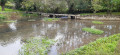
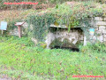
(7) Continue staying on the same bank of the Pamproux and follow its course as closely as possible. Go round the spring known as Fontegrive: you must go round the small stone building to avoid crossing the spring-fed stream via the ford intended for farm tractors (30 cm of water on the day the route was surveyed). Continue along a path that runs alongside a branch of the Bougon, a tributary of the Pamproux. Just before reaching the Riberolles road, you will see a spring on the right-hand side of the path.

(8) Follow the road to the right downhill to quickly cross the Bougon, then climb up the opposite side of the valley. Pass a sewage treatment plant on your left, then go round the hamlet of Pié Bourgueil on the right. The small road joins the D 5E road at a crossroads.

(9) Turn right into the area with a picnic table on the right. Continue along the D 5E road towards the village of Salles. Just before the bridge crossing the Pamproux, go down a wooden staircase on the left. Cross a small wooden bridge heading west to reach a pleasant spot on the banks of the Pamproux with a picnic table. Walk along the river on your right.

(10) In an area of scrub, head back up to the left towards the D5E road. Follow the road carefully to the right. After about 150 m, take the first path on the right (not shown on the map). Return to the banks of the Pamproux and head left. Follow the river to your right as it meanders. You’ll come out onto a small road.

(11) Follow the road to the right and go round the hamlet of Avernant on the left. Follow the railway line on your left. After the level crossing, turn right onto the road known as the Route des Pierrières. Cross the hamlet of Les Pierrières, turning left. Then take the first path on the right.

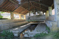
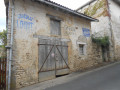
(12) At the start of a right-hand bend, take a grassy path on the left between two hedges (path not shown on the map). Cross a wooden footbridge, turn right with the path and walk down alongside a field. At the bottom corner of the field, go down a wooden staircase. Join a path marked Rue des Lavandières. Head north with the Pamproux stream on your right. On reaching Salles, you will see a remarkable wash house on your right. Turn left, reach Rue Saint Martin and follow it to the left. At the end, turn left onto Rue du Logis. Rue du Logis curves to the right and further on joins Rue Montausier.

(13) Follow Rue Montausier to the right, passing the town hall and the school. Turn left into Rue Rougier. At the end, turn right then left to enter a small housing estate. At the small square, continue straight ahead along a narrow white track. Turn right along this track to return to the car park (S/E).

Waypoints

  1. S/E : mi 0 - alt. 328 ft - Car park at the community hall (near the railway line)
  2. 1 : mi 0.28 - alt. 318 ft - Crossroads after the railway tunnel
  3. 2 : mi 1.38 - alt. 456 ft - Furigny Crossroads
  4. 3 : mi 2.39 - alt. 394 ft - Crossroads (path and road)
  5. 4 : mi 2.84 - alt. 364 ft - Eastern corner of Bois Chaton
  6. 5 : mi 3.26 - alt. 299 ft - Pié-Frouin - Cross the - Pamproux (rivière)
  7. 6 : mi 3.79 - alt. 272 ft - Crossroads before Petit Courault
  8. 7 : mi 4.12 - alt. 253 ft - Le Moulin Neuf
  9. 8 : mi 4.64 - alt. 256 ft - Crossroads (path and road)
  10. 9 : mi 4.98 - alt. 256 ft - Pié Bourgueil
  11. 10 : mi 5.36 - alt. 243 ft - Crossroads east of Chaboureuil
  12. 11 : mi 6.34 - alt. 246 ft - Crossroads (path and road)
  13. 12 : mi 7.13 - alt. 295 ft - Chaboureuil
  14. 13 : mi 7.57 - alt. 305 ft - Junction of Rue du Logis and Rue Montauzier
  15. S/E : mi 7.77 - alt. 328 ft - Car park at the community hall (near the railway line)

Notes

The car park is located at the community hall, near the railway line. A second car park is situated beyond the community hall (see at the far end of the first car park). Another option is near the town hall, on Rue Montausier.

This hike over varied terrain requires suitable footwear.

This walk is only partially marked in yellow. Furthermore, some sections of the route along the River Pamproux are not shown on the map. Consequently, it is advisable to follow the directions in the description and on the map, whilst keeping a close eye on the landscape.

Hike completed by the author on 29 May 2020

Worth a visit

Salles
Several standing stones, notably that of Avernant, as well as Neolithic remains found on the surface, attest to the long history of human occupation in the commune. No remains from the Gallo-Roman period have been found, but the commune was crossed by a Roman road that started in Rom (Lezay canton) and, passing through Bougon, crossed the River Pamproux at Petit-Courault to reach Les Granges de Soudan. In the Middle Ages, the castellany of Salles fell under the jurisdiction of the abbey and later the castellany of St-Maixent; the parish was under the authority of the archpriest of Exoudun. The seigneury of Riberolles, formerly known as ‘villa Ribérola’, belonged to the Maintrolle family in the 11th century. The Gillier family settled in Salles in the mid-14th century and their descendants by marriage remained there until 1868.
Since the opening of the Poitiers-Bordeaux motorway around 1982, Salles, situated 7 km from the Soudan exit, has enjoyed excellent road access. The station on the Poitiers-La Rochelle line was closed in 1988.

The Château de Salles
The Château de Salles is situated in the canton of La Mothe St Héray. The fief and seigneury date back to the early Middle Ages. A Knight of Maintrolles is known to have been Lord of Salles in the 12th century. His successor at Salles appears to have been Viscount Aymeri Bar, who was at Salles at the time of the Hundred Years’ War. In 1489, Salles belonged to the Gillier family, men-at-arms ennobled in 1379. It is to them that we owe the foundations of the castle. This family wielded considerable influence in the region: they owned the Château de La Villedieu. Their coat of arms can thus be found on the castle’s Gothic gate, in the churches of Salles and Saint-Eanne, as well as in the Church of Notre-Dame-la-Grande in Poitiers. The Gillier family merged with the Sainte-Maure-Montausier family. Léon de Sainte-Maure, born of Louise Gillier’s first marriage, married Marguerite de Chateaubriand in 1606. In 1610, their son Charles de Sainte-Maure-Montausier was born. Known in his youth as Charles de Salles, he took the title of Duke of Montausier and married the beautiful Julie d’Angennes, daughter of the Marquise de Rambouillet. It is said that Louis XIV visited Salles twice, in 1675 and 1680, the years in which each of the two plane trees was planted. Marie-Julie de Sainte-Maure married Emmanuel de Crussol, Duke of Uzès and Governor of Saintonge and Angoumois, in 1664. She inherited the estate of Salles and the Château de Pugny. She was therefore Duchess of Uzès and Montausier, Marquise of Rambouillet and Pisani, and Lady of Salles, Pugny, Talmond and other places. One of her sons, François de Crussol, Knight and Count of Montausier, married Charlotte Pasquier de Franclieu in 1705. His other son, Louis-Charles de Crussol, Marquis of Montausier, married Marie-Elisabeth d’Aubusson de La Feuillade in 1737. The coats of arms of both families were depicted on the mantelpiece in the grand salon before the fire in 1875. Louis-Charles was responsible for the 18th-century section of the château. The Aubusson de La Feuillade coat of arms is located in the entrance hall. On 10 July 1750, he welcomed King Louis XV to Salles, who is said to have spent the night at the château. The son of Anne-Marie-André de Crussol died without issue, and the château passed to Antoinette-Catherine Emmanuel de Crussol, who was married to Alexandre Green de Saint-Marsault. Her daughter, after marrying Charles-Léon, Count of Lescours, sold the château in 1873 to Mme Dulas. The château had remained in the same family for four centuries, most often passed down through the female line. Since then, two successive owners have taken over without maintaining the building. Restoration of the roof was essential to halt the damage caused by the storm of 1972. The repairs were carried out in 1974 and 1975, but in October, the 15th-century section of the building burned down during the night. Within ten months, everything was repaired with the help of local craftsmen.

Saint Martin’s Church
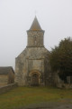
A small Romanesque church listed in the Supplementary Inventory of Historic Monuments,
featuring a beautiful chevet with a colonnaded window.
The apse’s semi-circular end and the 12th-century barrel vault of the choir (listed) feature cross ribs.
To the south, a 15th-century chapel built by the Gillier de Salles family

The Spinning Mill
On the site of the spinning mill, a small mill stood in the 17th century.
Around 1780, the Marquis de Montausier sold his rank of colonel in the Orléans regiment for 60,000 francs and used this sum to build a flour mill, the ‘Manufacture royale des farines’; this mill was intended to ship flour to America. There were only three others as fine as this in the whole of France serving the same purpose. The Revolution of 1789 prevented it from thriving. Around 1820, it was converted into a paper mill, and in 1840, Mr Lescours set up a spinning mill there.
When his son, Junien Charles, Count of Lescours, married Mademoiselle Juliette-Marie-Gabrielle Sauvignan de Baronnière, residing in Orléans, and sold his holdings in Salles in 1873, the property passed into the hands of Mr Cabaille of Saint-Maixent-l’École, who sold it to Mr Tirant in 1875. It belonged to the latter until 1883. During this short period, the machinery was greatly expanded; a 25-horsepower steam engine was installed; wool combing and dyeing were added to the spinning operations; nearly 100 workers were employed there.
Mr Tirant’s bankruptcy led to the spinning mill passing into the hands of Mr Ferdinand Rougier, who retained only the spinning operations; he employed an average of 60 workers, and 10 to 15 tonnes of wool were processed there each year.
Between 1901 and 1902, Mr Rougier had a new spinning mill built and replaced the old steam engine with a new, more advanced and much more powerful one capable of driving all the machinery in both mills; this engine has a power of 60 horsepower; with the turbine, a power of 82 horsepower can be achieved.
The new facility began operating in 1902; at the same time, electric lighting replaced the old oil lighting
In 1912, Mr Rougier sold the spinning mill to Mr Pierre Micheau, son of Mr Léon Micheau, a notary in Pamproux.
In 1923, Mr Micheau sold it again to Mr Celestin Henry Fontanault, who ran it until 1929, when the spinning mill was incorporated as a limited company.
During those few years, Mr Fontanault had looms installed there.
Source: website

Notable figure
Charles de Sainte-Maure (1610–1690), Baron of Montausier, Marquis of Salles, Duke of Montausier, Governor to the Grand Dauphin, Governor of Angoumois, Governor of Normandy. Married to Julie d'Angennes, daughter of Madame de Rambouillet, he married her in 1645 after having courted her for 15 years. They had a daughter, Julie Marie, who married Emmanuel de Crussol d'Uzès, Duke of Uzès and Peer of France. Together with most of the regulars at the Hôtel de Rambouillet, he composed the ‘Guirlande de Julie’, a suite of madrigals in which Julie’s beauty is compared to flowers.
Source: Wikipedia (excerpts)

Reviews and comments

4.9 / 5
Based on 4 reviews

Reliability of the description
5 / 5
Ease of following the route
4.8 / 5
Route interest
5 / 5
bernard francis
bernard francis

Overall rating : 5 / 5

Date of your route : Sep 20, 2021
Reliability of the description : ★★★★★ Very good
Ease of following the route : ★★★★★ Very good
Route interest : ★★★★★ Very good
Very busy route : No

Thank you very much – it was a lovely walk you recommended; we really enjoyed it

Machine-translated

pub44470
pub44470

Overall rating : 5 / 5

Date of your route : Aug 22, 2021
Reliability of the description : ★★★★★ Very good
Ease of following the route : ★★★★★ Very good
Route interest : ★★★★★ Very good
Very busy route : No

Hello, and thank you for this lovely walk.
The description and route were perfect.
This walk along the water’s edge was very pleasant.

Machine-translated

mg79120mg
mg79120mg

Overall rating : 4.7 / 5

Date of your route : Sep 11, 2020
Reliability of the description : ★★★★★ Very good
Ease of following the route : ★★★★☆ Good
Route interest : ★★★★★ Very good
Very busy route : No

Thank you, it really is an excellent route – highly recommended.

Machine-translated

pgetrochon
pgetrochon

Thank you for your message.
Your comment regarding waypoints that may obscure key features on the map is true in a few rather rare cases. Personally, I recommend planning your hike on a computer and zooming in on the map to get a clear view of everything. The route description then helps to clear up any doubts.
Happy hiking

Machine-translated

philouis
philouis

Overall rating : 5 / 5

Date of your route : Aug 16, 2020
Reliability of the description : ★★★★★ Very good
Ease of following the route : ★★★★★ Very good
Route interest : ★★★★★ Very good
Very busy route : No

A SUPERB HIKE, ESPECIALLY WHEN YOU REACH THE SECTION ALONG THE PAMPROUX.
A NOTE THAT DOESN’T NECESSARILY RELATE TO THIS HIKE: ON THE ROUTE MAP, THE WAYPOINTS SOMETIMES TEND TO OVERLAP THE ROUTE, WHICH MAKES IT DIFFICULT TO FOLLOW.
Otherwise, it’s absolutely brilliant.

Machine-translated

Other walks in the area

For more walks, use our search engine .

The GPS track and description are the property of this route's author. Please do not copy them without permission.