The Rocher de Roure, starting from Puy-Saint-André

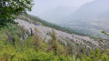
The Rocher de Roure offers a remarkable view of the Durance valley, Briançon and the forts that protect them. This route, which is almost entirely in the shade, is a great option on very hot days.

Details

38844027
Creation:
Last update:
Last review:
  • Walking
    Activity: Walking
  • ↔
    Distance: 5.94 mi
  • ◔
    Average duration: 3h 55 
  • ▲
    Difficulty: Moderate

  • ⚐
    Back to start: Yes
  • ↗
    Ascent: + 1,325 ft
  • ↘
    Descent: - 1,302 ft

  • ▲
    Highest point: 6,033 ft
  • ▼
    Lowest point: 4,849 ft

Description of the walk

Park at Puy-Saint-André – please note there are few spaces available, but a car park is available just before Puy Chalvin.

(S/E) Walk to Puy-Saint-André town hall, head slightly downhill towards Briançon until you find a wide path on your right. Take this path, crossing the Torrent de la Chenal and then the Ravin des Merles. Further on, you’ll come to a crossroads of paths. Turn right and, after a short climb, you’ll reach the forest track that forms part of theGR®50.

(1) Turn left onto this track and, following the white and red markings along a virtually level path, head towards the junction with the Sachas Forest House and Puy Chalvin.

(2) Continue along theGR®, heading down to cross the Torrent de Sachas via a footbridge. Resume the ascent and, via a series of tight hairpin bends, reach the Rocher de Roure signpost. In fact, this signpost marks the vertical drop of the rock face.

(3) Carry on, still on theGR®, with a short descent followed by another climb via tight hairpin bends. After crossing the Torrent de Pra Piouzéou, you’ll reach a crossroads of paths.

(4) Leave theGR® here and continue to the right along the well-marked yellow trail, which runs almost horizontally to the Rocher de Roure junction.

(5) Turn right to reach the summit of the Rocher. Take care here, as this rock faces a large vertical cliff face.

(6) Return to the previous crossroads.

(5) Continue along the path on the right and begin an easy descent through the Bois d’Aval towards Les Combes. You’ll reach a path junction.

(7) Take the path on the right – the descent is steeper – then veer left to reach the footbridge over the Torrent de Sachas. Cross the torrent via the footbridge and then turn right onto the wide forest track. Follow this almost level path to reach the junction at the Ravin de l’Eyrette. Please note: there are no signs indicating the path here, but it is clearly visible to the right of the track.

(8) Turn right onto this very pleasant path and, following a descent that is quite steep in places, reach the Chalet Forestier de Sachas. Continue straight on down the slope to return to the crossroads you passed on the way there.

(2) Turn left onto the forest track and theGR®50, then return to the original junction.

(1) Stay on the track straight ahead to return easily to the Puy-Saint-André car park (S/E).

Waypoints

  1. S/E : mi 0 - alt. 4,948 ft - Puy-Saint-André car park
  2. 1 : mi 0.63 - alt. 4,987 ft - GR50 junction
  3. 2 : mi 1.16 - alt. 5,052 ft - Puy Chalvin junction
  4. 3 : mi 2.09 - alt. 5,702 ft - Rocher de Roure signpost
  5. 4 : mi 2.55 - alt. 5,886 ft - GR junction
  6. 5 : mi 2.83 - alt. 6,014 ft - Rocher de Roure junction
  7. 6 : mi 2.85 - alt. 5,997 ft - Roure Rock
  8. 7 : mi 3.4 - alt. 5,919 ft - Trail junction
  9. 8 : mi 4.47 - alt. 5,640 ft - Eyrette junction
  10. S/E : mi 5.94 - alt. 4,944 ft - Puy-Saint-André car park

Notes

There is no water on this route apart from that in the streams, but this must be treated with Micropure.

This route passes through a protected area, which may be subject to special regulations:

Worth a visit

(2) Sachas hut with a designated campsite. This hut can be booked via this website

Always be cautious and plan ahead when you're outdoors. Visorando and the author of this route cannot be held responsible for any accidents occurring on this route.

The GR® and PR® markings are the intellectual property of the Fédération Française de Randonnée Pédestre.

Reviews and comments

4.5 / 5
Based on 2 reviews

Reliability of the description
5 / 5
Ease of following the route
4.5 / 5
Route interest
4 / 5
Chicots
Chicots

Overall rating : 4.7 / 5

Date of your route : Sep 01, 2025
Reliability of the description : ★★★★★ Very good
Ease of following the route : ★★★★☆ Good
Route interest : ★★★★★ Very good
Very busy route : No

A lovely hike at the start of your stay, on a little-used route. Lots of viewpoints and refreshing little streams

Machine-translated

sben
sben

Overall rating : 4.3 / 5

Date of your route : Aug 05, 2024
Reliability of the description : ★★★★★ Very good
Ease of following the route : ★★★★★ Very good
Route interest : ★★★☆☆ Average
Very busy route : No

A varied walk, with plenty of sections in the shade. There aren’t many views along the route – it was a good warm-up for the walks that followed.
We came across very few people on the route.
Thanks for the route.

Machine-translated

Other walks in the area

For more walks, use our search engine .

The GPS track and description are the property of this route's author. Please do not copy them without permission.