Partias Nature Reserve and Crête de Serre-Chevalier

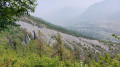
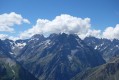
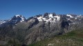
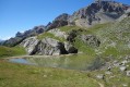
A very pleasant autumn walk through the mountain pastures. Stunning views of the Pelvoux glacier, which contrasts with the ski lift infrastructure in the Serre-Chevalier valley. Walking along the ridges allows you to immerse yourself completely in a site protected for its wildlife, flora and unique geological features.
Please note: this hike is made difficult by very steep, vertiginous and poorly maintained paths, as well as missing signposts; see the notice dated 13/07/2023

Details

807090
Creation:
Last update:
Last review:
  • Walking
    Activity: Walking
  • ↔
    Distance: 8.66 mi
  • ◔
    Average duration: 6h 40 
  • ▲
    Difficulty: Difficult

  • ⚐
    Back to start: Yes
  • ↗
    Ascent: + 3,068 ft
  • ↘
    Descent: - 3,068 ft

  • ▲
    Highest point: 8,711 ft
  • ▼
    Lowest point: 5,643 ft

Description of the walk

From the N94 which bypasses Briançon, turn left at the traffic lights onto the D35 opposite the Peugeot garage. Staying on the D35, continue towards Puy Saint-André / Puy Chalvin (ignoring the D135 which climbs to the right towards Puy Saint-Pierre). On leaving Puy Saint-André, turn right towards Puy Chalvin. Do the same when leaving Puy Chalvin. The tarmac road turns into a dirt track.
Park your car above the Chapelle Saint-Laurent, near an electricity substation, a picnic area and a paragliding launch site.

(S/E) Follow the wide track northwards, passing through the pretty hamlet of Les Combes. 500 metres further on, pass a car park, then continue for the same distance until you reach the gate marking the entrance to the Partias Nature Reserve (information sign).

(1) The walk begins at a traditional fountain, carved out of a tree trunk. Continue along the forest track which climbs to the left until you reach a signpost indicating ‘Lac des Partias’ to the right.

(2) Continue along the stony mountain pasture track.

(3) Junction of paths. From here, you can make a return trip to the lake (to do so, head west, passing a shepherd’s cottage next to a sheepfold, then reach the lake). Return to the junction and continue along the path to the north-west.

(4) Continue north on this path and you’ll soon reach the Ravin du Mélivrin path.

(5) Turn left, following this well-marked path to reach the Col de la Pisse.

(6) At the pass, head up to the right towards the summit of the Eychauda, clearly visible above you. There’s little chance of getting lost, as the path is well marked, even though the climb, which cuts across the contour lines, is steep.

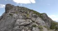
(7) At the summit of the Eychauda, take a moment to admire the view and spot, in the distance to the north-west, a barely visible section of the lake of the same name. When you reach the top of the ski lift, continue to the right towards the Serre-Chevalier ridge. The slope is steep, then levels off into undulating terrain ideal for taking in the views.

(8) Descend carefully towards a valley, leaving the Col de Serre-Chevalier on your left. Join the ascent route at the junction with the Ravin de Mélivrin path.

(5) Continue straight on to return to the previous junction via the route you took on the way up.

(4) Leave the yellow-marked route and follow a mule track on the left, lined with larch trees.
Head towards the gate marking the entrance to the nature reserve.

(1) Follow the route you took on the way out to return to the car park (S/E).
Waypoints

  1. S/E : mi 0 - alt. 5,643 ft - Car park
  2. 1 : mi 1.65 - alt. 6,227 ft - Entrance to the nature reserve (gate)
  3. 2 : mi 1.96 - alt. 6,440 ft - Signpost for Lac des Partias
  4. 3 : mi 2.51 - alt. 6,870 ft - Junction of paths
  5. 4 : mi 2.78 - alt. 7,221 ft - Marked trail
  6. 5 : mi 2.95 - alt. 7,313 ft - Towards the Col de la Pisse
  7. 6 : mi 4.08 - alt. 8,212 ft - Col de la Pisse
  8. 7 : mi 4.31 - alt. 8,711 ft - Summit of the Eychauda
  9. 8 : mi 5.09 - alt. 7,828 ft - Combe
  10. S/E : mi 8.66 - alt. 5,643 ft - Car park

Notes

At the car park: you can continue by car along the road leading up to the hamlet of Les Combes. Personally, I preferred to carry on by mountain bike, as the road becomes rather rough, even though it is a departmental road (D351).
You can top up your water supplies in the hamlet of Les Combes (water not tested) and at the fountain at the entrance to the nature reserve.
Please take care to protect the nature reserve.

This route passes through a protected area, which may be subject to special regulations:

Worth a visit

At the signpost, you can continue along the stone path which goes straight ahead, then veers left towards the Col de la Trancoulette (the climb is steep), and on to the Croix d’Aquila.

Reviews and comments

4.5 / 5
Based on 2 reviews

Reliability of the description
5 / 5
Ease of following the route
3.5 / 5
Route interest
5 / 5
jluca
jluca

Overall rating : 4.7 / 5

Date of your route : Jul 12, 2023
Reliability of the description : ★★★★★ Very good
Ease of following the route : ★★★★☆ Good
Route interest : ★★★★★ Very good
Very busy route : No

From the Col de la Pisse onwards, it was a real slog. The climb up to the Eychauda requires sure-footedness, walking sticks, and not too many people so you don’t end up with stones falling on your head. Magnificent view. The descent on the other side is a real slog, with no path and a steep slope on loose ground. The ridge after that is pleasant, until the final descent to the Col de Serre-Chevalier, which is a real slog again. We couldn’t find the path to reach the start of the Lac des Partias trail and had to make our way down by eye.
Overall, the IGN map is out of date: some paths don’t exist, whilst others do but aren’t marked…
The nature reserve signposts were generally lying on the ground, so they were hard to see and provided little guidance.
I’d suggest classifying this hike as ‘difficult’ due to the steep slopes without a marked path. There’s no point sending inexperienced hikers on such a gruelling trek!
But the views are spectacular and the site is magnificent. Thank you for this route description; we enjoyed it, even if it was a bit of a struggle at times. Note: I’m a hiker, climber, ski tourer, and I spend a lot of time in the mountains.
Kind regards,
JL

Machine-translated

grandin
grandin ★

Right, no problem, thanks

Machine-translated

Chris3084
Chris3084

OK. I’ll do that at the end of August as I’m not at home at the moment.

Machine-translated

grandin
grandin ★

Thank you, Anna

Christian, shall I let you make the change?

Machine-translated

annapontoire
annapontoire

Exactly – a return trip to the lake, then back onto the marked trail indicated by a wooden sign before the hut

We’re currently mapping out the signposted trails using our GPS. I’ll get back to you as soon as I have more information on how to publish or edit these walks in the nature reserve.

Thank you for your cooperation!

Have a good day,

Anna

Machine-translated

grandin
grandin ★

Hello Anna,

For the moment, I think your suggestion of simply doing a return trip to the lake is a very good idea:

Route to (3), then back to the fork in the path before the hut, to head towards (4) and follow the rest of the walk

Is that correct?

As for the other path – the one you’re trying to promote – we can’t include it in this description because a route must be walked in its entirety by the author.

However, if you’d like, you can suggest a walk that takes that route to us yourself...

Have a lovely day, Nathalie

Machine-translated

annapontoire
annapontoire

Hello to you both,

I do, of course, understand the desire to reach the lake (even though it dries up during the two summer months).

There are several options:

- either we could suggest that walkers make a round trip, then rejoin the signposted path towards the Col de la Pisse (before the shepherd’s hut);

- or there is actually a marked trail between the shepherd’s hut below and a small hut further up. However, unfortunately we are currently struggling to make this visible… But we’re working on it! A yellow marker has been painted on a rock to indicate the start of the trail, and a cairn higher up can also help show the route.

As I may have mentioned, the IGN maps (particularly Geoportail) are out of date…

Please don’t hesitate to get in touch if you have any further questions! You can also contact me at my email address: anna.pontoire@lpo.fr

Have a lovely day,

Anna

Machine-translated

grandin
grandin ★

Here is Christian’s (the author’s) reply

If you’d like, I can of course amend the route by removing the section via WPT 3.
But it seems a shame not to go all the way to the shepherd’s hut. Even if the ‘lake’ is a lake in name only, it seems a shame to skip this part of the route. Doesn’t the shepherd himself take this very same path?


I do, however, understand the concern for environmental protection, which is also important to me.


To help move our joint discussion forward and, above all, to bring our views into line, wouldn’t it be another (good?) idea to continue along the path that bypasses my original route to the west – a path which, incidentally, is marked on the IGN map? I’d actually almost taken it. This natural cirque is beautiful.


Thank you for your opinion (or ‘your opinions’, if you’re in touch with Anna again), and I’ll make the necessary changes based on your feedback.


NB: I appreciate this exchange as it seems to me to embody the ‘DNA’ of Visorando in terms of collaboration


I’m sure we’ll be in touch very soon. Christian

If I’ve understood correctly, Christian, you’re suggesting a change to your route between (5) and (6), using the marked path shown on the map, south of the one the current route follows. I’m not sure – though perhaps I’ve misunderstood – but is this part of the route, the circular loop (4,5,6,7,8), being questioned by Anna?

Anna, could you clarify this, please?

Machine-translated

grandin
grandin ★

Thank you for clarifying that.

I’ll get in touch with the author to update the route for this walk as soon as possible.

Have a nice day

Machine-translated

annapontoire
annapontoire

Hello Nathalie,

That’s right! Before the shepherd’s hut, there’s a junction signposted ‘Lac des Partias’ and ‘Col de la Pisse’. So you shouldn’t go all the way to the lake

Indeed, the information on Geoportail (IGN) isn’t up to date… We’ll try to sort that out! There’s no marked path at the far end of the lake, and, as you no doubt know, it’s important to let the flora and fauna thrive undisturbed off the beaten track.

Thank you for this exchange and for your understanding

Kind regards,

Anna

Machine-translated

grandin
grandin ★

annapontoire

The route shown on the map at (3) does indeed follow a path that does not appear on the IGN map. If I understand correctly, you’re suggesting we actually take the path before the hut – that is, the return route between (4) and (2) – without going all the way to the lake?

But we can see on the IGN map that there is, a little to the east of (3), at the far end of Lac des Partias, a signposted path branching off to the right. Is this still the case on the ground? And, if so, does taking this path harm the wildlife?

Thank you for your help

Nathalie, also a member of the LPO

Machine-translated

annapontoire
annapontoire

Overall rating : 4 / 5

Date of your route : Aug 13, 2019
Reliability of the description : Not used / Not applicable
Ease of following the route : ★★★☆☆ Average
Route interest : ★★★★★ Very good

Hello,
I am currently doing my civic service with the LPO in Briançon.
Among other things, we are responsible for the Partias Nature Reserve.
I would like to point out an error in the description and route map for this walk (“Partias Nature Reserve and Crête de Serre-Chevalier”), which states, and I quote: “(2) Continue along the stony mountain pasture track, pass a shepherd’s cottage next to a sheepfold, then reach the lake.
(3) Turn sharply 90° to the right to join the yellow-marked path.”

However, there is no marked path at this point, and it is very important to stick to the marked paths as this is a protected area.

The path leading to the Col de la Pisse is located before the shepherd’s hut (a sign indicates the way).

It is essential to make the changes indicated above so as not to harm the flora and fauna in the reserve.

Thank you in advance for your understanding.

Please do not hesitate to contact me if you require any further information.

Here is my email address should you need it: anna.pontoire@lpo.fr

Kind regards,

Anna Pontoire

Machine-translated

Other walks in the area

For more walks, use our search engine .

The GPS track and description are the property of this route's author. Please do not copy them without permission.