Country:
 City:


Parking: you can park on the town hall square in Suizy-le-Franc, near the Vallée du Surmelin tourist sign.
(S/E) Leave the square on the right. At the junction, follow the arrow on the right towards Rive Gauche. Walk down Rue du Pont as far as the Surmelin and continue straight up the road towards the forest.
(1) At the junction, turn right towards Mondelin and Orbais l’Abbaye. Continue straight on along the track past the farm and into the forest. Continue straight along this forest track for 1.6 km until you emerge from the forest.
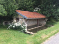
(2) Take the farm track on the left towards the village. At the Saint-Prix wash house, walk down Rue de Haute Saint-Prix opposite for 400 m.
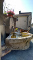
(3) At the junction, turn right onto Rue Thiers towards Rive Droite and the abbey church. At the war memorial, carry on straight on towards the church forecourt. Walk down to the left along Place Jehan d’Orbais. Before the fountain, take Ruelle des Arches on the right.
(4) At the end, turn left and cross the bridge over a stream. At the junction, turn right, cross the D11 carefully at the pedestrian crossing and follow the sign to the right towards Suizy-le-Franc. Take the avenue lined with plane trees for 250 m, until you reach the Surmelin bridge.
(5) Turn left in front of the Lehmann factory and follow the road towards La Pierrarderie. After the factory, carry on straight ahead, staying on the road until you reach the forest, then walk 500 m uphill to the hamlet. The road winds past the houses.
(6) Pass the last farm on your left and enter the woodland opposite. Follow the path along the edge of the woodland and re-enter the woodland. After 200 m, continue along the forest track opposite, which leads out into a meadow. Follow the edge of the woodland for 500 m, then head downhill to the right and re-enter the woodland
(7) The path emerges above the vineyards. Continue straight on along the farm track for 600 m. On the descent, just before the edge of the woodland ends, turn left back into the woodland. Follow this path uphill until you come out onto the Marquerie village road. Continue to the right towards the hamlet of Champ des Chèvres.
(8) At the entrance to the hamlet, follow the arrow on the right towards Suizy-le-Franc until you reach the junction with the D11. Cross carefully at the pedestrian crossing and walk down the road opposite towards Mondelin for 500 m until you reach the village. At the junction, turn right towards the town hall square (S/E).
 Local authority
 Easy

 Visorando Member
 Difficult