Country:
 City:


You can park on Place Alix Dehec in Mareuil-en-Brie, near the Vallée du Surmelin tourist sign.
(S/E) Leaving Place Alix Dehec, turn right onto Rue Beauregard, following the one-way system. After 100 m, at the junction with Rue de l’Église, continue straight on along Rue Beauregard. At the stop sign on Rue du Gain, continue straight on along Rue Beauregard.
(1) At the junction, turn right onto Rue du Tourniquet and continue for 250 m, with a view of the Surmelin Valley on your left . At the junction, the path continues downhill to the right towards the stop sign.
(2) Cross Rue du Château (D18) and take Rue du Moulin opposite. Follow this road downhill; after 100 m, you’ll leave the village and continue for a further 300 m until you reach the junction with the local road.
(3) Turn left onto it towards the mill. Continue to the ‘Stop’ sign on the D18 and turn right onto it towards Corribert (watch out for traffic). Cross the Surmelin bridge. Mareuil Castle is on your right. Continue for a further 150 m.
(4) Leave the D18 by taking the local track on the right. After 500 m, the track leads to La Dehaye en Brie farm. When you reach the farm, turn right onto the track towards the forest. 50 m past the forest entrance, follow the arrow on the right towards Orbais l’Abbaye for 300 m.
(5) Head up the forest track on the left. After 200 m, turn right to leave the forest. Continue for 600 m along the edge of the forest until you reach the local road. Turn right until you reach the junction and follow the arrow on the right towards Suizy-le-Franc.
(6) Follow the local road as it descends towards the village. After 1.2 km, you’ll cross a bridge over the Surmelin. Walk up Rue du Pont for 150 m until you reach a junction.
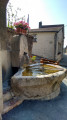
(7) Carry on straight ahead along Route de la Fontaine Lassin, pass the fountain and head back up towards the village.
(8) Cross the D11 using the pedestrian crossing and head up Rue de la Marquerie on the left towards the hamlet of Champ de Chèvres. After 350 m, follow the arrow on the right towards Mareuil-en-Brie
(9) Follow Rue du Champ de Chèvres to the right for 350 m to leave the hamlet. Cross the D18 with care, then take the farm track opposite to reach the village of Mareuil. After 500 m, at the stop sign, follow Rue des Écossières (D11) to the left and cross it at the pedestrian crossing to go down Rue du Herblet and reachPlace Alix Dehec (S/E).
 Local authority

 Visorando Member
 Difficult
 Moderate