From Montmort-Lucy to Étoges via the old CBR and the GRP® trails

On the outward journey, this walk follows the route of the former CBR (Reims Suburban Railway) and, on the return journey, passes along theGRP® Thibauld de Champagne and theGRP® du Surmelin.
This walk can be done on foot or by bike. It features long straight stretches that may seem monotonous, but it has the advantage of linking Montmort, a small town steeped in history, to Etoges, with its castle, ten spring-fed fountains and vineyard.

Details

550744
Creation:
Last update:
Last review:
  • Walking
    Activity: Walking
  • ↔
    Distance: 10.71 mi
  • ◔
    Average duration: 5h 15 
  • ▲
    Difficulty: Moderate

  • ⚐
    Back to start: Yes
  • ↗
    Ascent: + 358 ft
  • ↘
    Descent: - 358 ft

  • ▲
    Highest point: 791 ft
  • ▼
    Lowest point: 571 ft

Photos

Description of the walk

The route starts in front of Saint Pierre Church in Montmort, on the Route d’Étoges. It is possible to park two or three cars in front of the church outside mass times.

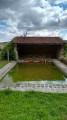
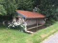
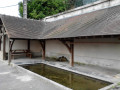
(S/E) Set off due south along the small road in the opposite direction to Montmort. Walk past the wash house, surrounded by fields. Continue to the bend, where there is a wayside cross.

(1) At the wayside cross, continue straight ahead. Walk until you reach a farm: Le Gros Moulin.

(2) In front of the building, turn left, walk 20 metres and then turn right straight away. Take the path which is the old CBR. Continue in the same direction, through woodland and farmland for about 4 km. Walk to the road where there is a petrol station. Cross the road.

(3) Opposite, follow a triangle of scrub to the right, then continue along the path to the left. At the next junction, turn left, then walk alongside the vineyards, veering slightly to the right. Walk to the small road (village of Fèrebrianges).

From point (4), take theGRP® Thibauld de Champagne trail, which is not always signposted.

(4) On the small road, turn left, walk 60 metres and follow the path on the left which climbs through the vineyards. Follow this path, which then turns left at a right angle. At the crossroads, head straight ahead and continue along the path which runs alongside the vineyards on your right, then enters the vineyard again. Walk to the junction at the entrance to Étoges.

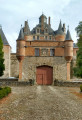
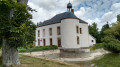
(5) At the crossroads, turn left and follow the small road leading to the entrance to the Château d’Étoges.

(6) Admire the château, then continue in the same direction along the tree-lined avenue. Walk to the Grande Rue, where there is a fountain; cross the road and head straight on into Rue Charron. At the T-junction, turn right onto Rue Saint Antoine. Walk past the back of the church and continue to the Y-junction before the cemetery.

(7) Turn right and walk along the bottom of the cemetery. The path continues through the vineyard. It reaches an area of fields, turns left at a right angle, then passes to the right of a vineyard. Walk until you reach a junction.

(8) At the junction, walk 10 metres to the right, then turn left. Follow the GRP®-marked path.

(9) Pass a junction and continue straight ahead. Then turn right, then immediately left, and walk until you reach the Rue Principale in Beaunay.

(10) At the T-junction, turn left (you’ll stray slightly from theGRP®). Follow the Rue Principale to the town hall, where you’ll rejoin theGRP®. Turn left and walk to the church.

(11) Just before the church, turn left towards Étoges and follow theGRP® as it runs alongside the fields, then the vineyard. After 500 m, look out for a path on the right that leads across the fields.

(12) Take this path, which now follows theGRP® du Surmelin.

(13) When you reach a small road, cross it and turn slightly to the right, then left, onto the path through the fields. The path runs past some equestrian facilities and joins a small road, the D18.

(14) Walk left along the small road for 500 metres.

(15) Turn right onto the path that enters the woods. Walk through the woods and turn left at the Y-junction. When you reach the houses, turn right and walk 200 m to the Moulin à Tan, where a grassy path branches off to the left.

(16) Take the grassy path and continue straight on to the church (S/E).

Waypoints

  1. S/E : mi 0 - alt. 633 ft - Saint-Pierre Church
  2. 1 : mi 0.15 - alt. 646 ft - Crossroads (calvary)
  3. 2 : mi 0.52 - alt. 627 ft - Crossroads
  4. 3 : mi 3.42 - alt. 764 ft - D933 road
  5. 4 : mi 3.83 - alt. 735 ft - T-junction
  6. 5 : mi 4.51 - alt. 653 ft - Crossroads
  7. 6 : mi 4.71 - alt. 627 ft - Château d'Etoges
  8. 7 : mi 5.06 - alt. 610 ft - Y-junction
  9. 8 : mi 5.58 - alt. 620 ft - Crossroads
  10. 9 : mi 5.75 - alt. 663 ft - Crossroads amongst the vineyards
  11. 10 : mi 6.03 - alt. 640 ft - Crossroads
  12. 11 : mi 6.3 - alt. 738 ft - T-junction
  13. 12 : mi 6.63 - alt. 755 ft - Start of the path
  14. 13 : mi 7.64 - alt. 778 ft - Small road
  15. 14 : mi 9.37 - alt. 732 ft - Route
  16. 15 : mi 9.71 - alt. 748 ft - Edge of the woodland and start of the path
  17. 16 : mi 10.46 - alt. 581 ft - Start of grassy path on the left
  18. S/E : mi 10.71 - alt. 633 ft - Saint Pierre Church

Notes

Plenty of fountains in Étoges. The water hasn’t been tested, but it is spring water.

Pass by the Beaunay cemetery to fill up with water.

Lovely picnic area in Étoges (just one table) near (6) on the D18 heading uphill, with a wash house and unanalysed running water.

Several shops in Étoges, including a chemist’s and a café.

Bakery and café-restaurant-hotel in Montmort.

Picnic table on the square behind Montmort Town Hall.

A shortcut is possible from (9) to (12).

Worth a visit

Reviews and comments

4.8 / 5
Based on 2 reviews

Reliability of the description
5 / 5
Ease of following the route
5 / 5
Route interest
4.5 / 5
Christelle1488
Christelle1488

With pleasure

Machine-translated

virgule
virgule

Thank you for this kind review.

Peace and quiet is one of the main attractions of our beautiful region.

Machine-translated

Christelle1488
Christelle1488

Overall rating : 5 / 5

Date of your route : Nov 24, 2024
Reliability of the description : ★★★★★ Very good
Ease of following the route : ★★★★★ Very good
Route interest : ★★★★★ Very good
Very busy route : No

We didn’t meet anyone; although it was a bit windy, the weather was brilliant, and the walk was lovely – it takes you through some pretty villages in Champagne.

Machine-translated

virgule
virgule

Hello,

I see that this route is marked as ‘very busy’.

I think that’s quite unusual; there must have been an event on that particular day. I often go to that area, and I never come across anyone there.

Machine-translated

champagne
champagne

Overall rating : 4.7 / 5

Date of your route : Jun 07, 2021
Reliability of the description : ★★★★★ Very good
Ease of following the route : ★★★★★ Very good
Route interest : ★★★★☆ Good
Very busy route : Yes

OK

Machine-translated

virgule
virgule
• Edited:

Hello,

do feel free to visit Montmort, a small village whose heritage is beautifully showcased by a local association.

Starting from Montmort, if you take a leisurely stroll, you can have a picnic in Etoges, by the wash house. Starting from Etoges, you can have a picnic in Montmort, either behind the town hall square or at the Pont de Pierre, where there’s also a lovely picnic area. There’s a third, very peaceful spot near the old CBR station, at the start of Rue de la Gare.

Machine-translated

Other walks in the area

For more walks, use our search engine .

The GPS track and description are the property of this route's author. Please do not copy them without permission.