Orbais l’Abbaye, Le Breuil and La Verdonnelle

This long day’s walk will take you through the Verdonnelle Valley, also known as the ‘Little Switzerland of the Condé-en-Brie region’.
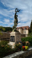
You can visit the village of Baulne-en-Brie, its church and its war memorial.

Details

n°322642
Creation:
Last update:
Last review:
  • Walking
    Activity: Walking
  • ↔
    Distance: 13.77 mi
  • ◔
    Average duration: 7h 05 
  • ▲
    Difficulty: Difficult

  • ⚐
    Back to start: Yes
  • ↗
    Ascent: + 856 ft
  • ↘
    Descent: - 856 ft

  • ▲
    Highest point: 768 ft
  • ▼
    Lowest point: 305 ft

Photos

Description of the walk

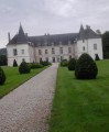
The route starts at the large car park in front of the late Romanesque Abbey of Saint-Pierre d’Orbais.

(S/E) With your back to the abbey, take Rue Notre-Dame to the right. Walk to the next junction.

(1) Take the first street on the left. From this point to the village of Le Breuil, the route follows theGRP® du Surmelin. Turn right, walk past the nursery school, then continue to the wayside cross (bus shelter).

(2) Turn right, then take the path opposite and continue in the same direction along the Chemin du Moulin de la Ville. After a while, the path crosses fields and a wooded area. Walk to the ford.

(3) At the ford, cross over and then turn right after the buildings. Cross the small bridge and enter the woods. Then turn left and cross a second bridge. Walk to Lohan Farm.

(4) In front of this farm, turn left and continue along the small road. Walk past the wash house and keep going in the same direction. The path reaches the vineyards and runs alongside them. Shortly after the retention basin, look out for a crossroads.

(5) At the junction, turn left towards the village of Le Breuil. Walk to the end of Rue de la Blatrerie.

(6) At the junction with Rue du Vieux Moulin, turn left. You’ll leave theGRP® trail. Then turn right onto Chemin de la Prairie, just before the bridge. Stay on this path, which follows the Surmelin stream at a distance, until you reach the first houses in Baulne-en-Brie.

(7) Enter Baulne-en-Brie via Rue Mortehaie. Then turn left onto Rue du Pont. Cross the bridge and walk past the sports ground (picnic area). Walk to the road (D4) and continue 50 m to the left along the road. Do not take theGR® opposite at the junction.

(8) Look out for the entrance to a narrow path on the right and take it. This path climbs through woodland and crosses a small road. You are now on theGRP® Tour de l’Omois, which is not always signposted. The path comes out onto the small road a second time; follow it for a few metres.

(9) Return to the path on the left and continue through the Bois de Faët for about one kilometre until you reach a T-junction.

(10) Turn right at the junction. Walk through the woods, then across fields until you reach a small road.

(11) Continue to the right, following the small road.

(12) Before you reach the first houses in Romandie, turn left. The path descends towards the bottom of the Verdonnelle valley.

(13) One hundred metres before the bridge over the Verdonnelle, take the path on the left, which follows the riverbed. This is the Chemin de la Bocquetterie. Walk past the Bocquetterie, then turn right and cross the bridge. Carry on straight ahead to the village of Violaine. In the village, you leave theGRP® route. Turn left onto Rue du Lavoir, then, opposite, take the Chemin de la Sente.

(14) Follow the Chemin de la Sente, which passes through a nature reserve. Walk past the isolated house and continue straight on. Walk to the village of Verdon.

(15) At the first houses in Verdon, turn left. Cross the bridge and take the first street on the right after the town hall (Le Fort). The street bends left, then right, and passes a farm. Walk to the crossroads where there are bales of straw and caravans.

(16) At the Hazeau crossroads, turn left onto the dirt track. Then turn right, then left into the fields. The track joins a woodland and runs alongside it. Walk to the edge of the woodland where the fields end.

(17) Enter the woodland and walk a few metres to a crossroads. Continue straight ahead (the second path on the left) and walk to a T-junction.

(18) At the crossroads, turn right. After 200 m, the path reaches some fields. Walk on to the small road.

(19) Cross the road and carry on straight ahead into the woods. Walk to Ferme le Tremblay.

(20) At the farm, turn left and walk alongside the buildings. Stay on this path as it passes through a wooded area. Walk 500 m until you reach a path entrance on the left.

(21) Take the path on the left and walk to Orbais-l’Abbaye. Turn right onto Rue Saint-Pierre, then left onto Rue Notre-Dame to return to the abbey car park (S/E).

Waypoints

  1. S/E : mi 0 - alt. 466 ft - Abbey car park
  2. 1 : mi 0.11 - alt. 453 ft - Crossroads
  3. 2 : mi 0.37 - alt. 479 ft - Calvary
  4. 3 : mi 1.19 - alt. 397 ft - Ford
  5. 4 : mi 1.58 - alt. 427 ft - Ferme du Lohan
  6. 5 : mi 3.25 - alt. 453 ft - Turn left at the junction
  7. 6 : mi 3.6 - alt. 344 ft - Junction with Rue du Vieux Moulin - Surmelin
  8. 7 : mi 5.52 - alt. 341 ft - Baulne-en-Brie
  9. 8 : mi 5.77 - alt. 331 ft - Start of the trail - Surmelin
  10. 9 : mi 6.07 - alt. 577 ft - Small road
  11. 10 : mi 6.86 - alt. 719 ft - T-junction
  12. 11 : mi 7.3 - alt. 640 ft - Small road
  13. 12 : mi 7.5 - alt. 568 ft - Romandie
  14. 13 : mi 7.94 - alt. 433 ft - T-junction before the bridge over the Verdonnelle
  15. 14 : mi 8.53 - alt. 545 ft - Start of the trail
  16. 15 : mi 9.51 - alt. 571 ft - Verdon
  17. 16 : mi 9.9 - alt. 620 ft - Le Hazeau
  18. 17 : mi 10.98 - alt. 735 ft - Entrance to the woods
  19. 18 : mi 11.46 - alt. 764 ft - T-junction
  20. 19 : mi 12.23 - alt. 676 ft - Crossing the road
  21. 20 : mi 13.01 - alt. 676 ft - Le Tremblay Farm
  22. 21 : mi 13.43 - alt. 600 ft - Trail start on the left
  23. S/E : mi 13.77 - alt. 466 ft - Abbey car park

Notes

Please note: the unmarked section is not easy. You’ll need to be able to read a map or use the app.

The path from (21) may be overgrown with nettles. If so, carry on straight ahead.

In wet weather, the woodland section from (9) to (11) may be impassable. In this case, you can take the small road from (9) to (12). There is very little traffic, and it is a shortcut.

Picnic area at Baulne-en-Brie by the sports ground, on the route.

One restaurant in Baulne-en-Brie, and two restaurants with terraces in Orbais.

Worth a visit

In Baulne-en-Brie (a few metres from the route):

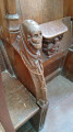
Saint-Barthélémy Church, listed as a historic monument since 1920, features one of the last remaining coffered wooden ceilings with criss-crossed slats in the world. This ceiling and the pulpit are listed as Historic Monuments.

Place Daniel Beaucreux in front of the church. In memory of the men and women of the canton of Condé-en-Brie and the surrounding region who were deported and died in the camps. The ‘Died in Deportation, Alive in Our Memories’ trail.

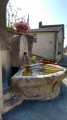
On the high street, a wash house has been decorated with a design based on the fable *The Milkmaid and the Milk Jug*.

In Orbais-l’Abbaye:

Saint-Pierre d’Orbais Abbey, situated in Orbais-l’Abbaye in the Marne department, was built in the late 12th and very early 13th centuries. Its abbey church is in the late Romanesque style.

Always be cautious and plan ahead when you're outdoors. Visorando and the author of this route cannot be held responsible for any accidents occurring on this route.

The GR® and PR® markings are the intellectual property of the Fédération Française de Randonnée Pédestre.

Reviews and comments

4.3 / 5
Based on 2 reviews

Reliability of the description
4.5 / 5
Ease of following the route
4 / 5
Route interest
4.5 / 5
virgule
virgule

A very, very little-used route. Two reviews in five years...

Machine-translated

crabillou
crabillou

Overall rating : 4.7 / 5

Date of your route : Aug 28, 2023
Reliability of the description : ★★★★★ Very good
Ease of following the route : ★★★★☆ Good
Route interest : ★★★★★ Very good
Very busy route : No

A lovely walk. Very varied. Fields, woods and a river. Very hilly. A wonderful way to discover this lovely region.

Machine-translated

virgule
virgule

Hello,

Thank you for this review. I did the route again this summer; the path at the top of Violaine hadn’t been mown, which is perhaps why you didn’t see it.

The trickiest bit is in the woods, towards the end of the route.

Machine-translated

linade
linade

Overall rating : 4 / 5

Date of your route : Oct 03, 2020
Reliability of the description : ★★★★☆ Good
Ease of following the route : ★★★★☆ Good
Route interest : ★★★★☆ Good
Very busy route : No

A lovely walk, with varied scenery (the Surmelin and Verdonnelle rivers, charming villages and hamlets, forests and vineyard-covered hillsides) and a rugged but interesting landscape.
Please note the route:

1/ Just before Baulne-en-Brie, I followed the arrows pointing north towards the vineyards; I soon realised my mistake and retraced my steps: the correct path has no arrows at this point.
2/ I went the wrong way at the top of the village of Violaine, where I did take Rue du Lavoir, but I failed to spot the left-hand turn onto a path that should have taken me to Verdon; I followed some arrows which led me straight onto a local road heading south and then, realising my mistake, I turned left (towards the east) to finally get back onto the right path.

All in all, a walk I’d recommend.

Machine-translated

virgule
virgule

I went on the walk again yesterday, including a visit to the abbey, which is well worth the trip.

There are two restaurants in Orbais, both of which have terraces – one on the square and the other in the back courtyard.

It’s worth noting that there are public toilets OPEN near the abbey, which are very clean. Thanks to the local council – this sort of initiative is rare.

Machine-translated

virgule
virgule
• Edited:

We did the walk again today. You can walk through the woods without getting your feet wet, but some of the grassy paths haven’t been mown.

A very pleasant picnic area in Baulne-en-Brie.

The ‘Sentier du Point’ trail (21) is overgrown with stinging nettles; it’s best to stick to the wider path.

Machine-translated

virgule
virgule
• Edited:

Hello,

if you go there (after 11 May), you’ll be the first hiker of the year

It’s less than 100 km from Paris. What a stroke of luck!

Machine-translated

Other walks in the area

For more walks, use our search engine .

The GPS track and description are the property of this route's author. Please do not copy them without permission.