


Refine your search for walks in La Bosse-de-Bretagne
La Bosse-de-Bretagne walks


 Via Le Plessis and Pouchard
 Visorando Member
 8.09 mi
 +541 ft
 -541 ft
 4h 10
4h 10
 Moderate
 Departure from La Bosse-de-Bretagne (Ille-et-Vilaine)
This unmarked route will allow you to explore the hills and valleys to the east of La Bosse-de-Bretagne, and enjoy views over part of the Semnon valley and the motocross track.It follows a number of paths through the villages of La Bosse-de-Bretagne and Tresbœuf.4.8 km of tarmac (local roads), gravel tracks and dirt tracks.
Via Sourg and Le Plessis from La Bosse-de-Bretagne
6.50 mi
+364 ft
-354 ft
3h 20
Moderate
Departure from La Bosse-de-Bretagne (Ille-et-Vilaine)
This unmarked route will allow you to explore the hills and valleys to the east of La Bosse-de-Bretagne, and to discover the motocross track.It follows a number of paths through the parishes of La Bosse-de-Bretagne and Tresbœuf.4.5 km of tarmac (local roads), gravel tracks and dirt tracks.
The Semnon circuit
6.94 mi
+318 ft
-322 ft
3h 30
Moderate
Departure from La Bosse-de-Bretagne (Ille-et-Vilaine)
This route, which is partly unmarked, will allow you to explore the hills and the Semnon valley around La Bosse-de-Bretagne, Ercé-en-Lamée and Tresbœuf. It partly follows the Pierres Grises and Asphodèles routes (Bretagne Porte de Loire Community) in Ercé-en-Lamée. 5.5 km of tarmac (local roads), gravel and dirt tracks.
Around Sel-de-Bretagne
 3.67 mi
+141 ft
-135 ft
1h 50
3.67 mi
+141 ft
-135 ft
1h 50
 Easy
Departure from Le Sel-de-Bretagne (Ille-et-Vilaine)
Easy
Departure from Le Sel-de-Bretagne (Ille-et-Vilaine)
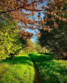
A tour around the village of Sel-de-Bretagne, allowing you to enjoy the rural paths preserved thanks to the efforts of Eugène Aulnette, a historic figure in the village. You will also pass by the Sainte-Anne Chapel, restored and decorated by this sculptor together with the villagers, and the menhirs found in the village.
Around Tresbœuf via the two hamlets known as La Hautais
5.94 mi
+105 ft
-121 ft
2h 50
Easy
Departure from Tresbœuf (Ille-et-Vilaine)
This unmarked route will take you on a tour of the south-eastern part of the village of Tresbœuf. It also follows paths in the commune of Lalleu. There are two localities named ‘Hautais’; one is the site of a mill visible on the 18th-century Cassini map, whilst the other is a farm featuring an unusual porch.
Please note: much of the route is on roads (6 km), making it ideal for winter; the rest consists of farm tracks.
Via Les Orgeries and Le Clos-Neuf
 7.92 mi
+167 ft
-174 ft
3h 45
Moderate
Departure from Tresbœuf (Ille-et-Vilaine)
7.92 mi
+167 ft
-174 ft
3h 45
Moderate
Departure from Tresbœuf (Ille-et-Vilaine)
This unmarked route will take you on a tour of the southern part of the village of Tresbœuf.It also follows paths through the villages of Lalleu and La Bosse-de-Bretagne. A few paths have managed to escape land consolidation, but despite this, half the route is tarmac.Panoramic views will allow you to take in a whole array of wind turbines as well as the hedgerow landscape.
To the north and west of Tresboeuf
5.85 mi
+154 ft
-167 ft
2h 50
Easy
Departure from Tresbœuf (Ille-et-Vilaine)
This unmarked route will allow you to explore the western and northern parts of the village of Tresbœuf.It also follows paths in the commune of La Bosse-de-Bretagne.
5.8 km of local roads and county roads, including gravel and dirt tracks.
La Beltière
6.17 mi
+240 ft
-269 ft
3h 05
Moderate
Departure from Tresbœuf (Ille-et-Vilaine)
This unmarked route will allow you to explore the eastern part of the village of Tresbœuf. It also follows paths in the commune of Lalleu. Panoramic views will allow you to enjoy the sight of the village and the surrounding countryside. For your information: 6 km of tarmac-surfaced local or departmental roads; the rest consists of land consolidation tracks and footpaths.
Around Tresbœuf – eastern section
7.35 mi
+210 ft
-240 ft
3h 35
Moderate
Departure from Tresbœuf (Ille-et-Vilaine)
This unmarked route will allow you to explore the eastern part of the village of Tresbœuf.It also follows paths in the commune of Lalleu. Panoramic views will allow you to enjoy the sight of the village and the surrounding countryside.
For your information: 6.5 km of tarmac-surfaced local roads or county roads; the rest consists of land consolidation tracks and footpaths.
The countryside around Lossac
7.04 mi
+157 ft
-177 ft
3h 25
Moderate
Departure from Saulnières (Ille-et-Vilaine) (Ille-et-Vilaine)
This unmarked route through the countryside around Lossac allows you to extend the ‘Circuit des Charmes’ route proposed by the Bretagne Porte de Loire Community to 11 km.
Le Tertre Gris on the slopes of the "Volcano"
 2.14 mi
+404 ft
-404 ft
1h 20
Moderate
Departure from Poligné (Ille-et-Vilaine)
2.14 mi
+404 ft
-404 ft
1h 20
Moderate
Departure from Poligné (Ille-et-Vilaine)
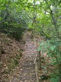
Straddling the municipalities of Pancé, Poligné and Pléchâtel, the Tertre Gris site is steeped in history: geological, historical, industrial and environmental.
Seven discovery stations are located along the path near the banks of the Semnon. You will be able to read the landscape from the viewpoint, understand the "Volcano" and the geology of the Tertre, and savour its legends (at the summit and at the foot of the volcano).Please note that this route is not signposted.
The Landes d’Ercé
7.35 mi
+30 ft
-30 ft
3h 25
Moderate
Departure from Ercé-en-Lamée (Ille-et-Vilaine)
This route largely follows the Circuits des Pierres Grises and the Circuits des Asphodèles (Bretagne Porte de Loire Communauté). Partly signposted, it will allow you to explore the Landes d’Ercé, de la Fleuriais and du Fayel. For your information: 1.25 km of tarmac-surfaced local roads; the rest consists of farm tracks and footpaths.
Bain-de-Bretagne via the back roads
 6.41 mi
+338 ft
-315 ft
3h 15
Moderate
Departure from Bain-de-Bretagne (Ille-et-Vilaine)
6.41 mi
+338 ft
-315 ft
3h 15
Moderate
Departure from Bain-de-Bretagne (Ille-et-Vilaine)
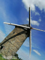
I suggest you discover this charming little town and its lake in an original way, by taking the small side roads.
Small change due to a ban on crossing the small wood next to the Moulin de Bertaud.
Around La Couyère
5.18 mi
+256 ft
-256 ft
2h 35
Easy
Departure from La Couyère (Ille-et-Vilaine)
This unmarked route will allow you to explore the village of La Couyère, Château du Plessis and the Astronomy Centre. N.B. A long stretch of road (5 km); the rest consists of paths and tracks.
The Greenway at Teillay
7.73 mi
+98 ft
-102 ft
3h 40
Moderate
Departure from Teillay (Ille-et-Vilaine)
This route, which is partly unmarked, will allow you to explore part of the ‘Voie Verte’ cycle path, built on a former railway line, running from Teillay to Guipry-Messac. You’ll walk alongside the Teillay Forest, passing the Saint-Eustache Chapel and some ponds.