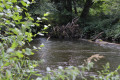
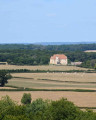
The series of 16 locks and the Rigole d’Yonne

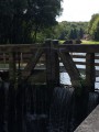
As you float along, set off to explore the idyllic Canal du Nivernais and the Rigole d’Yonne. From Port-Brûlé, the route invites you to admire a remarkable series of 16 locks, enabling boats to gradually negotiate the difference in level and continue their journey along the canal. It is a journey through the canal’s heritage, nature and peaceful landscapes.

Details

107284490
Creation:
Last update:
Last review:
  • Walking
    Activity: Walking
  • ↔
    Distance: 6.69 mi
  • ◔
    Average duration: 3h 15 
  • ▲
    Difficulty: Moderate

  • ⚐
    Back to start: Yes
  • ↗
    Ascent: + 154 ft
  • ↘
    Descent: - 154 ft

  • ▲
    Highest point: 879 ft
  • ▼
    Lowest point: 725 ft

Description of the walk

Park in the car park just behind the wash house in Sardy-lès-Épiry.

(S/E) From the wash house, continue straight on at the first Fork in the road. When you reach the last houses, take the left-hand road towards Blin. Continue along this road for 1 km.

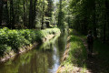
(1) Without crossing the bridge over the Yonne canal, turn right onto the path. Follow the canal bank on the right-hand side for several kilometres.

(2) When you reach the tarmac-surfaced greenway of the Canal du Nivernais, cross the bridge then turn right. Pass through the hamlet of Port Brûlé then continue along the towpath to lock number 16.

(3) At the junction with the D297, turn right onto it to reach the village of Sardy-lès-Epiry (S/E).

Waypoints

  1. S/E : mi 0 - alt. 725 ft - Sardy-lès-Epiry wash house
  2. 1 : mi 0.77 - alt. 869 ft - Passing point - Rigole d'Yonne
  3. 2 : mi 4.21 - alt. 876 ft - Port Brûlé
  4. 3 : mi 6.39 - alt. 738 ft - Lock 16 - Canal du Nivarnais
  5. S/E : mi 6.69 - alt. 725 ft - Sardy-lès-Epiry washhouse

Notes

Blue Markings

Tourist information office at Lock No. 16 in Sardy-lès-Epiry, open during the summer season; ice cream and drinks available.

Tea room open during the summer season at Lock No. 6.

Worth a visit

The 16-lock stretch: this is a sequence of 16 locks stretching for nearly 4 km, designed to manage a 40-metre drop in water level. The towpaths running alongside this stretch were once used solely by horses and men pulling the barges.

Sardy-lès-Epiry wash house: this19th-century wash house is situated below road level, with a low wall protecting the basin. This classic structure is very common in the Nièvre department. Nearby, you can see a structure adjoining an old forge. This apparatus was used for shoeing oxen.

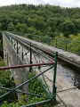
Yonne Canal: this masonry-built canal partly supplies the Nivernais Canal and is 28 km long. It was built in 1838 and carries water from the River Yonne, from Lake Pannecière to the leat (Seine and Loire), the highest point of the canal. In themid-20th century, to improve the flow of water through the Yonne Canal, several sections of the route were altered, notably through the construction of aqueducts.

Canal du Nivernais: the construction of the Canal du Nivernais spanned more than half a century. Work began in 1757 and, after being interrupted several times, was completed in 1843. Originally, the aim was to create a timber-floating channel enabling firewood from the Bazois region to reach the existing network in order to supply Paris. It was soon decided to build a navigable canal that would allow barges carrying heavy loads to pass through, linking the Loire and Seine river basins. As the canal was no longer suitable for the size of modern barges, the early 1970s saw the growth of recreational boating.

Other walks in the area

For more walks, use our search engine .

The GPS track and description are the property of this route's author. Please do not copy them without permission.