The Dragonfly Nature Trail at the Vaux Ponds

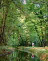
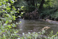
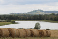
With family or friends, explore the unspoilt natural surroundings of Étang de la Perchette and the food chain of the ponds. The nature trails allow us to discover the Sensitive Natural Areas of our department. These are sites open to the public to raise awareness of the preservation of natural heritage and local landscapes.

Details

107290289
Creation:
Last update:
Last review:
  • Walking
    Activity: Walking
  • ↔
    Distance: 1.55 mi
  • ◔
    Average duration: 0h 45 
  • ▲
    Difficulty: Easy

  • ⚐
    Back to start: No
  • ↗
    Ascent: + 7 ft
  • ↘
    Descent: - 7 ft

  • ▲
    Highest point: 879 ft
  • ▼
    Lowest point: 869 ft
  • ⚐ Country: France
  • ⚐
    Area: Morvan
  • ⚐ City: Vitry-Laché (58420)
  • ⚑
    Start: N 47.191478° / E 3.613564°
  • ⚑
    End: N 47.181237° / E 3.615496°
  • ❏
    IGN map(s): Ref. 2723SB
  • Hour-by-hour weather

Description of the walk

Park at the car park on the embankment between Étang de Vaux and Étang de la Perchette.

(S) Cross the embankment to the hamlet of Vaux.

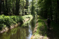
(1) Turn left onto the Sentier de la Libellule, which runs alongside the Étang de la Perchette.

(2) Retrace your steps back to the dyke.

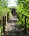
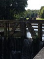
(1) Cross the wooden footbridge opposite, then follow the edge of the Étang de Vaux to the causeway between the Étang de Vaux and the Étang de Baye. Arrive at the car park on the causeway between the Étang de Vaux and the Étang de Baye (E).

Waypoints

  1. S : mi 0 - alt. 876 ft - Car park at the dyke between the ponds - Alnain (cours d'eau) - Affluent de l'Aron
  2. 1 : mi 0.21 - alt. 879 ft - The Dragonfly Trail - Alnain (cours d'eau) - Affluent de l'Aron
  3. 2 : mi 0.51 - alt. 873 ft - Turn-around point
  4. E : mi 1.55 - alt. 876 ft - Car park at the dyke between Étang de Vaux and Étang de Baye - Grand Étang de Vaux

Notes

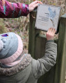
Educational signposts.

As this is a one-way walk, you will need to leave one car at the starting point and another at the finishing point.

Worth a visit

Leisure centre at Baye Pond.

Other walks in the area

For more walks, use our search engine .

The GPS track and description are the property of this route's author. Please do not copy them without permission.