The Voûtes de La Collancelle and the Étang Gouffier

A short route starting from the Étang de Baye, allowing you to explore the tunnels of the Canal du Nivernais and the Étang Gouffier.

Details

n°31186262
Creation:
Last update:
Last review:
  • Walking
    Activity: Walking
  • ↔
    Distance: 3.58 mi
  • ◔
    Average duration: 1h 45 
  • ▲
    Difficulty: Easy

  • ⚐
    Back to start: Yes
  • ↗
    Ascent: + 75 ft
  • ↘
    Descent: - 75 ft

  • ▲
    Highest point: 951 ft
  • ▼
    Lowest point: 869 ft

Description of the walk

Start from the river port car park, near the D35 bridge over the Canal du Nivernais.

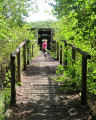
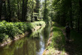
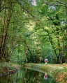
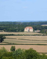
(S/E) Cross the bridge and follow the canal to the left, under the trees. At the top of the hill, look back for a view of the Étang de Baye. Below you is thefirst tunnel; you can reach its entrance by going downhill. Continue along the road.

(1) At the junction, turn left. Cross a small bridge and continue to a junction at the foot of La Collancelle church.

(2) Turn slightly to the right, leaving the church on your left. Walk past the town hall and join the D958 at Bourguéreau. Follow the road to the left with care and walk through the hamlet.

(3) After about 500, take the first path on the left. Continue to the dyke at Étang Gouffier.

(4) Walk along the right-hand side of the pond. Just after crossing a spillway, turn left onto the path. This soon widens and leads back to La Collancelle near the cemetery.

(5) Turn right onto the D523 and pass the Sauvin farm. You will come out onto the D135.

(6) Follow this road to the left with care, keeping the pond at a distance on your right. This will take you to the car park just before the bridge over the canal (S/E).


Waypoints

  1. S/E : mi 0 - alt. 876 ft - D135 road – River port - Canal du Nivarnais
  2. 1 : mi 0.67 - alt. 938 ft - Road junction - Voûtes de la Collancelle
  3. 2 : mi 1.08 - alt. 925 ft - D523 road - Église Saint-Sulpice (La Collancelle)
  4. 3 : mi 1.58 - alt. 928 ft - Start of the path
  5. 4 : mi 1.82 - alt. 925 ft - Étang Gouffier
  6. 5 : mi 2.23 - alt. 925 ft - D523 road
  7. 6 : mi 2.96 - alt. 879 ft - D135 road - Étang de Baye
  8. S/E : mi 3.58 - alt. 876 ft - D135 road – Confluence of the canal and - Alnain (cours d'eau) - Affluent de l'Aron

Notes

After (1), you can continue to the entrance of the second tunnel (the longest one), go down into it too and, for the more adventurous, walk inside along the stone path with a handrail. Be very careful; a head torch may come in handy.

Shops in La Collancelle.

Restaurant, campsite and motorhome pitches in Baye.
Boat hire centre, electric boats, boat trips, “Aquafluvial” at the Port des Poujats.

Worth a visit

Leisure centre: sailing, canoeing, kayaking.
Pond fishing.
River tourism and cycle route along the Canal du Nivernais.
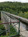
Vaults (tunnels), canal cutting: an exceptional spot.
Port Brûlé, the series of sixteen locks at Sardy, the Yonne watercourse: a picturesque spot.

Reviews and comments

3.3 / 5
Based on 4 reviews

Reliability of the description
3.3 / 5
Ease of following the route
3.3 / 5
Route interest
3.3 / 5
gillesmorvan
gillesmorvan

Overall rating : 3.7 / 5

Date of your route : Aug 27, 2026
Reliability of the description : ★★★★☆ Good
Ease of following the route : ★★★★☆ Good
Route interest : ★★★☆☆ Average
Very busy route : No

Easy to follow, but access to the vaults is rather awkward; the route isn’t particularly interesting.

Machine-translated

Randonneur1956
Randonneur1956

Overall rating : 2.7 / 5

Date of your route : Oct 13, 2025
Reliability of the description : ★★☆☆☆ Disappointing
Ease of following the route : ★★★☆☆ Average
Route interest : ★★★☆☆ Average
Very busy route : No

Not a very interesting route. In the village, we took a parish specific to Brittany busy road to get to Gouffier Pond, which we had to pass by, but
Didn't see anything except that it was dry! The only positive point was the beautiful autumn scenery at this time of year.

Machine-translated

MARCHE CSI
MARCHE CSI

Thank you for your comment and rating, which, fortunately, contradict the previous one.
As for the flooded path, that’s just the vagaries of the weather, especially at the moment.

Machine-translated

bcr
bcr

Overall rating : 4.3 / 5

Date of your route : Feb 24, 2024
Reliability of the description : ★★★★★ Very good
Ease of following the route : ★★★☆☆ Average
Route interest : ★★★★★ Very good
Very busy route : No

An interesting and varied route. A wooded section along the canal (which you can just make out as it lies at the bottom of a gorge), then fields and a village – it was a shame the church was closed – followed by a pond. However, we ran into a major problem at point 4: it had rained and the path was impassable as it was completely flooded between two hedges… We eventually managed to get through a meadow (by climbing over the hedge…) and then passed close to a large farm before reaching the Baye pond. Rather than following the road, we took a path running alongside the bank.

Machine-translated

Thomas67550
Thomas67550

Overall rating : 2.3 / 5

Date of your route : Jul 21, 2023
Reliability of the description : ★★☆☆☆ Disappointing
Ease of following the route : ★★★☆☆ Average
Route interest : ★★☆☆☆ Disappointing
Very busy route : No

A rather uninspiring walk; much of the route follows local roads. The first section along the canal is inaccessible and hasn’t been mown; ideally, you should take the cycle path, though it’s far less picturesque.
The final section can be walked along the Étang de Baye, 50 metres to the right after the last junction.
The only highlight is the view of Étang Gouffier.

Machine-translated

Other walks in the area

For more walks, use our search engine .

The GPS track and description are the property of this route's author. Please do not copy them without permission.