


Refine your search for walks in Haumont-près-Samogneux
Haumont-près-Samogneux walks
 Walk in the Azannais
 Visorando Member
 6.05 mi
 +509 ft
 -505 ft
 3h 15
3h 15
 Easy
Easy
 Departure from Azannes-et-Soumazannes (Meuse)
A very pleasant walk with sweeping views.
Froideterre Fortification, Douaumont Ossuary and Zigzag Trench
 Association / Club / Walk leader
 7.22 mi
+768 ft
-755 ft
4h 00
7.22 mi
+768 ft
-755 ft
4h 00
 Moderate
Departure from Bras-sur-Meuse (Meuse)
Moderate
Departure from Bras-sur-Meuse (Meuse)
This history-filled route allows you to discover structures, shelters, command posts, entrenchments and an intermediate ammunition shelter still in good condition, as well as some remains of trenches and isolated combat posts.
Around Douaumont
7.61 mi
+840 ft
-866 ft
4h 15
Moderate
Departure from Fleury-devant-Douaumont (Meuse)
A route steeped in the history of the Great War.This route offers a chance to explore the woods replanted following the 1914–1918 war between France and Germany.There are several historical remains to explore, such as bunkers, shelters and buildings including the Douaumont Ossuary and Fort Douaumont.
Verdun battlefields
5.63 mi
+449 ft
-463 ft
3h 00
Easy
Departure from Fleury-devant-Douaumont (Meuse)
Connect, in 9 km, the memorial, the destroyed village of Fleury, the ossuary, the Zigzag Trench and Fort Douaumont.
From the Verdun Memorial to Bezonvaux via Fort Douaumont
 10.83 mi
+840 ft
-833 ft
5h 45
Moderate
Departure from Fleury-devant-Douaumont (Meuse)
10.83 mi
+840 ft
-833 ft
5h 45
Moderate
Departure from Fleury-devant-Douaumont (Meuse)
This walk takes you past many ruined structures, a destroyed village, monuments, memorial stones and recently restored trenches. It passes by Fort Douaumont and the Douaumont Cemetery. Look carefully at the ground – you’ll still find plenty of shell fragments and sometimes even whole shells.
From the Meuse Valley to the banks of the Meuse
 Tourist office
 9.25 mi
+909 ft
-896 ft
5h 05
Moderate
Departure from Doulcon (Meuse)
9.25 mi
+909 ft
-896 ft
5h 05
Moderate
Departure from Doulcon (Meuse)
Starting from Doulcon, you will discover the typical landscapes of the Meuse coast. A detour through the pretty village of Mont-devant-Sassey has some beautiful architectural surprises in store for you! You will then reach the village of Sassey-sur-Meuse via the coast before reaching Dun-sur-Meuse and then Doulcon via the towpath along the navigable Meuse. Passing through four municipalities: Dun-sur-Meuse, Doulcon, Mont-devant-Sassey and Sassey-sur-Meuse, you can start your walk from any of them. You can also split this walk to shorten it or avoid the forest during the hunting season.
Amel Pond
 4.86 mi
+46 ft
-46 ft
2h 15
Easy
Departure from Senon (Meuse)
4.86 mi
+46 ft
-46 ft
2h 15
Easy
Departure from Senon (Meuse)
The Étang d’Amel, owned by the Conservatoire d’espaces naturels de Lorraine, was designated, along with the adjoining land, as a Regional Nature Reserve in 2006 by the Lorraine Regional Council.
The Étang d’Amel nature route, which runs through the villages of Senon and Amel-sur-l’Étang, features information boards and two observation points. This allows you to watch the birds without disturbing them.
The Butte de Vauquois and the Mont des Allieux
3.65 mi
+404 ft
-394 ft
2h 00
Easy
Departure from Vauquois (Meuse)
A historical walk exploring the Butte de Vauquois and the National Necropolis of La Maize. The Battle of Vauquois took place during the First World War. The village was built on the hill of the same name, making it a strategic location. Vauquois is a key site associated with trench warfare, a tactic involving the digging of deep tunnels and the burial of tonnes of explosives within them to cause significant damage on the surface before launching an assault.
In the Meuse Argonne, starting from Neuvilly-en-Argonne
 6.79 mi
+328 ft
-344 ft
3h 25
Moderate
Departure from Neuvilly-en-Argonne (Meuse)
6.79 mi
+328 ft
-344 ft
3h 25
Moderate
Departure from Neuvilly-en-Argonne (Meuse)
You will discover the Étang des Bercettes, classified as a sensitive natural area, and walk along the Argonais massif.
TheGR®14climbs to reach the Haute Chevauchée. During this hike, you will explore part of the nature trail where you will find all manner of trees, including black walnut and silver fir.
Ariethal Trail
 Local authority
 6.67 mi
+423 ft
-400 ft
3h 25
Moderate
Departure from Fléville (Ardennes)
6.67 mi
+423 ft
-400 ft
3h 25
Moderate
Departure from Fléville (Ardennes)
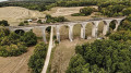
Fancy a walk that combines architectural prowess and forest? The Ariethal trail is for you. From Fléville, venture into an enchanting forest setting to admire the curves of the famous stone giant nestled in its green setting, the Ariethal Viaduct. This route will also invite you to enter the memorial plantation dedicated to the Big Red One, a living, green tribute that links this land to history.
 In the footsteps of Chanzy via the Ferme des Petites Censes
 9.08 mi
+702 ft
-699 ft
1.5 hrs
Moderate
Departure from Nouart (Ardennes)
9.08 mi
+702 ft
-699 ft
1.5 hrs
Moderate
Departure from Nouart (Ardennes)
This hilly mountain bike trail takes you to the heart of an authentic region combining forests, countryside and vast fields. Starting from Nouart, the birthplace of General Chanzy, the route passes through several villages and hamlets: Tailly, Barricourt, Les Petites Censes, Les Forgettes, Les Tuileries... where remarkable stone buildings, witnesses to the local heritage, can be seen. A varied and rhythmic trail, ideal for mountain bikers in search of nature, hills and historical discoveries.
In the footsteps of Chanzy
 13.08 mi
+968 ft
-984 ft
3 hrs
Moderate
Departure from Nouart (Ardennes)
13.08 mi
+968 ft
-984 ft
3 hrs
Moderate
Departure from Nouart (Ardennes)
This hilly mountain bike trail takes you into the heart of an authentic region combining forests, countryside and vast fields. Starting from Nouart, the birthplace of General Chanzy, the route passes through several villages and hamlets: Tailly, Barricourt, Les Petites Censes, Les Forgettes, Les Tuileries, Rémonville... where remarkable stone buildings, witnesses to the local heritage, can be seen. A varied and fast-paced trail, ideal for mountain bikers in search of nature, hills and historical discoveries.
Between Mémoire and Val d'Aire towards Châtel-Chéhéry
 8.21 mi
+518 ft
-512 ft
4h 15
Moderate
Departure from Chatel-Chéhéry (Ardennes)
8.21 mi
+518 ft
-512 ft
4h 15
Moderate
Departure from Chatel-Chéhéry (Ardennes)
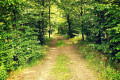
Nestled between the Aire Valley and the forest, this route starting from the village of Châtel-Chéhéry and its elegant château will take you to the outskirts of Apremont-sur-Aire to discover a significant memorial site: the German military cemetery, a UNESCO World Heritage Site.
The Crête des Éparges
 4.99 mi
+574 ft
-571 ft
2h 50
Moderate
Departure from Les Éparges (Meuse)
4.99 mi
+574 ft
-571 ft
2h 50
Moderate
Departure from Les Éparges (Meuse)
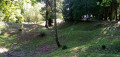
A memorial hike on a site where very deadly battles took place between February and April 1915, considered by some historians to be a prelude to the Battle of Verdun (nearby), which was triggered a year later. Several monuments and numerous remains mark the route, including impressive craters left by huge explosions.
Landreville Castle Trail
 7.26 mi
+302 ft
-299 ft
3h 35
Moderate
Departure from Buzancy (Ardennes) (Ardennes)
7.26 mi
+302 ft
-299 ft
3h 35
Moderate
Departure from Buzancy (Ardennes) (Ardennes)
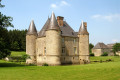
Starting from Sivry-les-Buzancy, the trail winds through fields and villages, passing through Bayonville and Imécourt, offering beautiful views of the surrounding countryside. The highlight of the route, Landreville Castle, reveals itself as you walk, adding a touch of heritage to this accessible and rejuvenating hike. Ideal for lovers of nature, tranquillity and local discoveries.
Les Vertiges du Val d'Aire
 23.66 mi
+1,207 ft
-1,227 ft
5 hrs
Moderate
Departure from Marcq (Ardennes)
23.66 mi
+1,207 ft
-1,227 ft
5 hrs
Moderate
Departure from Marcq (Ardennes)
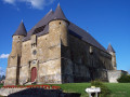
This hilly route around the Aire Valley, famous for its exceptional biodiversity, is the perfect combination of exercise and heritage! Hop on your mountain bike and tackle the Vertiges du Val d'Aire. This challenging route will thrill you with its forest trails and panoramic views of the bucolic Argonne countryside, while punctuating your route with the authentic charm of our rural villages and prestigious stops such as the fortified church of Saint-Juvin and the Abbey of Chéhéry.
Castle trail from Marcq
 7.64 mi
+525 ft
-525 ft
4h 00
Moderate
Departure from Marcq (Ardennes)
7.64 mi
+525 ft
-525 ft
4h 00
Moderate
Departure from Marcq (Ardennes)
A must for history buffs and cultural hikers! This route linking Marcq to Cornay offers a unique immersion in the region's architectural heritage. While enjoying the serenity of the undergrowth, walkers will have the privilege of admiring three remarkable castles, the view from the Croix du Bayle, and the elegance of these two Argonne villages.
Les Vertiges du Val d'Aire, via the Ariethal Viaduct and Chéhéry Abbey
 15.62 mi
+791 ft
-791 ft
3 hrs
Moderate
Departure from Marcq (Ardennes)
15.62 mi
+791 ft
-791 ft
3 hrs
Moderate
Departure from Marcq (Ardennes)
This hilly route around the Aire Valley, famous for its exceptional biodiversity, is the perfect combination of exercise and heritage! Hop on your mountain bike and tackle the Vertiges du Val d'Aire route. This challenging route will thrill you with its forest trails and panoramic views of the bucolic Argonne countryside, while punctuating your journey with the authentic charm of our rural villages and prestigious stops such as the Ariethal Viaduct and Chéhéry Abbey.
Route des Fontaines
 2.49 mi
+92 ft
-72 ft
1h 15
Easy
Departure from Mercy-le-Bas (Meurthe-et-Moselle)
2.49 mi
+92 ft
-72 ft
1h 15
Easy
Departure from Mercy-le-Bas (Meurthe-et-Moselle)
A beautiful walking route amongst the old stone buildings, tunnel fountains and the countryside.
Although described as a walking route, this route can also be tackled by mountain bike (in which case, adjust the starting point due to road signage; see description).
Mercéenne Valley
 5.68 mi
+243 ft
-269 ft
2h 50
Easy
Departure from Mercy-le-Bas (Meurthe-et-Moselle)
5.68 mi
+243 ft
-269 ft
2h 50
Easy
Departure from Mercy-le-Bas (Meurthe-et-Moselle)
Set in a very pretty rural setting with lush green valleys and a traditional village.
François Desportes trail in Champigneulle
 4.32 mi
+213 ft
-217 ft
2h 10
Easy
Departure from Champigneulle (Ardennes)
4.32 mi
+213 ft
-217 ft
2h 10
Easy
Departure from Champigneulle (Ardennes)
This route will introduce you to some iconic works by François Desportes, a painter little known to the general public who was born in Champigneulle. He was the animal and hunting scene painter for several kings. Enjoy exploring the village streets.
Odyssey around Buzancy
 28.96 mi
+1,624 ft
-1,617 ft
5 hrs
28.96 mi
+1,624 ft
-1,617 ft
5 hrs
 Difficult
Departure from Bar-lès-Buzancy (Ardennes)
Difficult
Departure from Bar-lès-Buzancy (Ardennes)
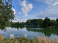
The Buzancy Mountain Bike Odyssey is a challenging, demanding route designed for thrill seekers and those who enjoy a good challenge. It follows beautiful rural paths offering sweeping views of the surrounding countryside, between valleys and open horizons. Throughout the route, the ride is an invitation to discover the local heritage, with the chapel of Masmes, the outbuildings of Château Augeard, and beautiful typical villages such as Autruche, Fossé and Saint-Pierremont, identifiable by their numerous elegant yellow stone houses.
Circular route around the ponds in the Valmy Forest
 10.16 mi
+479 ft
-453 ft
5h 05
Moderate
Departure from Sainte-Menehould (Marne)
10.16 mi
+479 ft
-453 ft
5h 05
Moderate
Departure from Sainte-Menehould (Marne)
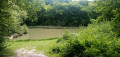
A hike mainly through woodland, in the southern Argonne. You’ll walk alongside streams and pass close to ponds, one of which, sadly, has been dry for some time… A change of scenery and tranquillity await you.
Along the Chiers between Lexy and Cons-la-Grandville
 6.30 mi
+433 ft
-456 ft
3h 15
Moderate
Departure from Lexy (Meurthe-et-Moselle)
6.30 mi
+433 ft
-456 ft
3h 15
Moderate
Departure from Lexy (Meurthe-et-Moselle)
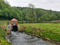
A walk along the Chiers, on a mainly tarmac-surfaced and easily accessible route. This walk takes you close to former industrial and production sites that are now disused. In the tranquillity of the forest, imagine the hum of activity from days gone by still echoing amongst the trees and the remnants of the past.
Meix-devant-Virton – Halanzy
 15.11 mi
+889 ft
-814 ft
7h 45
Difficult
Departure from Meix-devant-Virton (Province de Luxembourg)
15.11 mi
+889 ft
-814 ft
7h 45
Difficult
Departure from Meix-devant-Virton (Province de Luxembourg)
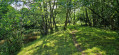
Leaving Meix-devant-Virton via roads with light to moderate traffic and arriving in Halanzy via similar roads does not mean the entire route is like this. No, there are quiet country lanes with beautiful views, farm tracks that turn into woodland paths, and a steep downhill stretch through a neighbourhood of holiday homes. And then there’s the River Ton, which sets the tone in its valley, along with more unexpected and unlikely paths and tracks. As I’m staying with a local, my stopping point is open to chance.
A short trip to Gaume
 7.26 mi
+568 ft
-554 ft
3h 50
Moderate
Departure from Florenville (Province de Luxembourg)
7.26 mi
+568 ft
-554 ft
3h 50
Moderate
Departure from Florenville (Province de Luxembourg)
A short walk along the border that will allow you to discover or rediscover Orval Abbey.
Autruche trail
 7.58 mi
+456 ft
-456 ft
3h 55
Moderate
Departure from Autruche (Ardennes)
7.58 mi
+456 ft
-456 ft
3h 55
Moderate
Departure from Autruche (Ardennes)
This countryside route starting from Autruche takes you across open fields to a remarkable viewpoint over the Tourbières de la Bar, a Natura 2000 classified natural site. Interpretive panels provide a better understanding of the ecological richness of these exceptional wetlands. An accessible and informative hike, ideal for lovers of nature and biodiversity, to discover a preserved natural heritage.
Shortcut
 1.58 mi
+62 ft
-62 ft
0h 45
Easy
Departure from Lahaymeix (Meuse)
1.58 mi
+62 ft
-62 ft
0h 45
Easy
Departure from Lahaymeix (Meuse)
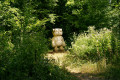
Near the village of Lahaymeix, this 3 km Vent des Forêts walk takes you on a journey to discover various works by artists in the heart of the Meuse forest.
Route of the three fountains in the Marcaulieu National Forest
 4.81 mi
+446 ft
-453 ft
2h 35
Easy
Departure from Dompcevrin (Meuse)
4.81 mi
+446 ft
-453 ft
2h 35
Easy
Departure from Dompcevrin (Meuse)
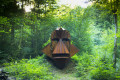
Close to the village of Dompcevrin, this Vent des Forêts hike takes you on a journey of discovery through the works of various artists in the heart of the Meuse forest.
Gros Caillou Route
 7.47 mi
+512 ft
-531 ft
3h 55
Moderate
Departure from Dompcevrin (Meuse)
7.47 mi
+512 ft
-531 ft
3h 55
Moderate
Departure from Dompcevrin (Meuse)
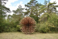
Near the village of Dompcevrin, this 12 km Vent des Forêts hike takes you on a journey of discovery through the Meuse forest, where you can admire various works of art.
The Gros Charme route in the Pierrefitte Forest
 6.05 mi
+331 ft
-335 ft
3h 05
Easy
Departure from Pierrefitte-sur-Aire (Meuse)
6.05 mi
+331 ft
-335 ft
3h 05
Easy
Departure from Pierrefitte-sur-Aire (Meuse)
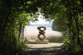
Near the village of Pierrefitte-sur-Aire, this 10 km Vent des Forêts walk takes you on a journey to discover various works by artists in the heart of the Meuse forest.
The Prés d'Orval Nature Reserve
 6.45 mi
+341 ft
-341 ft
3h 15
Moderate
Departure from Florenville (Province de Luxembourg)
6.45 mi
+341 ft
-341 ft
3h 15
Moderate
Departure from Florenville (Province de Luxembourg)
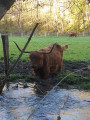
Walk between France and Belgium from Orval Abbey to the small village of Williers on the French side.
Hike along forest trails, guided by the murmur of a stream. Encounter a herd of Highland cows and, more unusually, observe traces of Gallo-Roman remains.
In the footsteps of the iron miners
 11.60 mi
+1,585 ft
-1,568 ft
6h 45
Moderate
Departure from Musson (Province de Luxembourg)
11.60 mi
+1,585 ft
-1,568 ft
6h 45
Moderate
Departure from Musson (Province de Luxembourg)
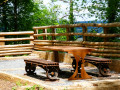
This very natural route takes you on a journey of discovery through the wooded hills on the border between the Batte (Belgium) and Coulmy (France) valleys.Anyone with even a passing interest in the region's industrial history will also discover its mining and steel-making past, highlighted by the Transfrontier Iron Mines Trail and a number of information panels along the route.The trail passes by some of the iron mines that brought prosperity to the region in the 19th and 20th centuries, as well as the Musson slag heap, which over time collected all the slag from the mines on the Musson and Halanzy sides. Now cleaned up, it has been turned into a nature reserve managed by the DNF (Nature and Forestry Division).
The Montauban Spring and Fourneau Marchand
 9.70 mi
+709 ft
-725 ft
5h 05
Moderate
Departure from Etalle (Belgique) (Province de Luxembourg)
9.70 mi
+709 ft
-725 ft
5h 05
Moderate
Departure from Etalle (Belgique) (Province de Luxembourg)
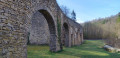
A pleasant walk passing through Montauban, the Fourneau Marchand fish market and crossing the old railway line. In summer, you can enjoy a drink on the terrace at the Fourneau Marchand!
The Trou des Fées and the woods of Bonlieu and Lacquet
 4.70 mi
+220 ft
-246 ft
2h 20
Easy
Departure from Etalle (Belgique) (Province de Luxembourg)
4.70 mi
+220 ft
-246 ft
2h 20
Easy
Departure from Etalle (Belgique) (Province de Luxembourg)
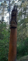
What a lovely, enchanting walk! Enter the great Gaume forest. Passing through another beautiful high forest, you’ll follow a magnificent path winding through a secluded valley, where you’ll discover the Trou des Fées right at its heart. This astonishing sand dune is made up of several galleries carved out by natural erosion.
La Truche and Lombut Castle
 9.01 mi
+1,030 ft
-1,027 ft
5h 00
Moderate
Departure from Mouzon (Ardennes)
9.01 mi
+1,030 ft
-1,027 ft
5h 00
Moderate
Departure from Mouzon (Ardennes)
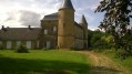
A walk starting from Mouzon, offering lovely views of the Meuse and Chiers valleys and the neighbouring villages throughout the route.
The gentle and peaceful Gaume region from Willancourt
 11.16 mi
+974 ft
-974 ft
6h 00
Moderate
Departure from Aubange (Province de Luxembourg)
11.16 mi
+974 ft
-974 ft
6h 00
Moderate
Departure from Aubange (Province de Luxembourg)
Gaume, this beautiful hilly region in southern Belgium, is known for its mild climate. However, I have no idea if the area is popular with hikers... There are hiking markers all along the route. It is possible that you will encounter few or no people.
Route de la Croix Camonin
 8.38 mi
+623 ft
-600 ft
4h 25
Moderate
Departure from Fresnes-au-Mont (Meuse)
8.38 mi
+623 ft
-600 ft
4h 25
Moderate
Departure from Fresnes-au-Mont (Meuse)
Starting from the village of Fresnes-au-Mont, this ‘Vent des Forêts’ walk takes you on a journey to discover various works by artists in the heart of the Meuse forest.
Halanzy – Habay-la-Neuve
 14.09 mi
+991 ft
-568 ft
7h 20
Difficult
Departure from Aubange (Province de Luxembourg)
14.09 mi
+991 ft
-568 ft
7h 20
Difficult
Departure from Aubange (Province de Luxembourg)
As the weather is set to be rainy with thunderstorms all day, I’m sticking to the main roads – even the major routes – to get to my destination for the day, Habay-la-Neuve, as quickly as possible. I’m staying in a hotel in the town. The stop (E) is therefore at my discretion.
Lachaussée Pond and its satellite lakes
 8.99 mi
+30 ft
-30 ft
4h 10
Moderate
Departure from Lachaussée (Meuse)
8.99 mi
+30 ft
-30 ft
4h 10
Moderate
Departure from Lachaussée (Meuse)
Listed as a Regional Nature Reserve, the Lachaussée pond has remained in its natural state. Many birds have made their home there or stop off during their migration. It is a haven of peace for flora and fauna.Please note: it is forbidden to stray from the existing paths, particularly around the ponds, otherwise you may be liable for a hefty fine.
 From the Vieille Hage farm, Tintigny to Chassepierre
18.66 mi
+951 ft
-1,122 ft
2.5 hrs
Difficult
Departure from Tintigny (Province de Luxembourg)
For this second stage, if the cockerel wakes us up early enough after a night’s camping on the farm, we’ll have no trouble packing up the tent and cycling the 30 km to Chassepierre,We’ll even be able to visit Orval Abbey halfway there. We’ll be cycling through the forest for most of the way.
In the Gaume Natural Park
 7.17 mi
+568 ft
-581 ft
3h 50
Moderate
Departure from Saint-Léger (Belgique) (Province de Luxembourg)
7.17 mi
+568 ft
-581 ft
3h 50
Moderate
Departure from Saint-Léger (Belgique) (Province de Luxembourg)
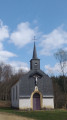
Start at the Ermitage de Saint-Léger, continue towards the Trou du Pérou and its waterfall, pass by the Étang du Fourneau David, then the Source Pétrifiante, and finish by crossing the Bois de Saint-Léger.
On the hill at Stonne
6.30 mi
+492 ft
-515 ft
3h 20
Moderate
Departure from Les Grandes-Armoises (Ardennes)
Before reaching Stonne, with its highest point known as ‘le pain de sucre’, its panoramic views and its orientation table, you’ll walk through the shade of the forest.
The short ‘mountainous’ section around the village can be avoided. The return route takes you across a plateau amidst meadows and fields.
The village of Stonne was the scene of fierce fighting in May 1940 following the German army’s breakthrough at Sedan.
Within the grounds of the Chartreuse du Mont-Dieu
9.24 mi
+814 ft
-787 ft
4h 55
Moderate
Departure from Les Grandes-Armoises (Ardennes)
This walk is a journey back in time.
Starting from areas of livestock farming and crop cultivation, you’ll come across monuments and information boards along the route that recount the resistance to the German invasion during the Battle of Stonne in May 1940.
You’ll journey back to the 12th century with the Chartreuse du Mont-Dieu, the forest and the estates that belonged to it, and finish the route on the Roman road that led from Reims to Trier.
Gaume circular between Rachecourt and Battincourt
 8.87 mi
+961 ft
-984 ft
4h 55
Moderate
Departure from Aubange (Province de Luxembourg)
8.87 mi
+961 ft
-984 ft
4h 55
Moderate
Departure from Aubange (Province de Luxembourg)
A pleasant walk in Gaume, even in gloomy weather, through countryside and forests.The route begins by climbing up to the plateau overlooking Rachecourt before descending into the depths of the Batte valley.After the small reed pond, the route crosses the country ridge before descending to Battincourt, where the playground offers a few benches and a welcome picnic table.In Battincourt, the walk follows the marked "Les Sept Sources" trail in the opposite direction until just beyond the Battincourt ponds.On the way back, the route passes through a lovely arboretum!Please note that some sections, such as the Bois de Pertot, can be very muddy.
The Meixoise via Gros Cron
 11.39 mi
+791 ft
-801 ft
5h 55
Moderate
Departure from Tintigny (Province de Luxembourg)
11.39 mi
+791 ft
-801 ft
5h 55
Moderate
Departure from Tintigny (Province de Luxembourg)
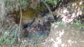
Starting from Bellefontaine, a small village in the Gaume region, this is a lovely walk through the forests of Gaume to Meix-devant-Virton, following both sides of the Chevratte valley. Along the way, you’ll discover the Gros Cron (a remarkable geological formation in the Belgian Gaume) and its spring.
Savonnières - Woinville route
 9.61 mi
+938 ft
-925 ft
5h 15
Moderate
Departure from Valbois (Meuse)
9.61 mi
+938 ft
-925 ft
5h 15
Moderate
Departure from Valbois (Meuse)
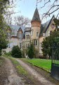
A route combining rural forest landscapes and some interesting monuments from the Great War. There is also a lovely view of the Woëvre plain, Montsec and Lake Madine.
Above the Ruisseau de Marsoupe
 5.91 mi
+446 ft
-436 ft
3h 05
Easy
Departure from Saint-Mihiel (Meuse)
5.91 mi
+446 ft
-436 ft
3h 05
Easy
Departure from Saint-Mihiel (Meuse)
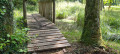
A beautiful walk near Saint-Mihiel on small paths where you can see orchids, a menhir and animals.
Franco-Belgian circular from Fratin
61.75 mi
+2,822 ft
-2,831 ft
5 hrs
 Very difficult
Departure from Etalle (Belgique) (Province de Luxembourg)
Very difficult
Departure from Etalle (Belgique) (Province de Luxembourg)
A beautiful gravel route with varied landscapes and stunning views. It’s a chance to pass by Orval Abbey and perhaps stop off at the Brasserie de La Rulles. This route takes in a variety of surfaces, including roads, farm tracks and forest paths. Please note: the route is quite challenging, with some steep climbs along the way.
Panoramic views of the Côtes de Meuse from Buxerulles
 4.21 mi
+522 ft
-522 ft
2h 25
Easy
Departure from Buxières-sous-les-Côtes (Meuse)
4.21 mi
+522 ft
-522 ft
2h 25
Easy
Departure from Buxières-sous-les-Côtes (Meuse)
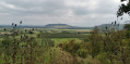
This route takes in the villages of Buxerulles, Buxières-sous-les-Côtes and Woinville. It passes through vineyards, orchards and woodland. It can be regarded as the ‘balcony of the Côtes’, overlooking Lake Madine. There are lovely views over the plain, the Côtes de Meuse and the Montsec hill.
Walk through the Ennemane valley and on to the Meuse valley
19.65 mi
+636 ft
-646 ft
3 hrs
Moderate
Departure from Remilly-Aillicourt (Ardennes)
This mountain bike route, which presents no technical difficulties, features two sections of greenway, traditional farm and forest tracks, and even a section of the Roman road that linked Reims to Trier.
Tour of Lake Madine from Montsec
 14.76 mi
+233 ft
-253 ft
3 hrs
Moderate
Departure from Montsec (Meuse)
14.76 mi
+233 ft
-253 ft
3 hrs
Moderate
Departure from Montsec (Meuse)
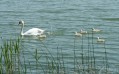
This lake is a reserve with sensitive natural environments, home to a diverse range of flora and fauna.It is a wild environment except on its northern shore, where there are leisure centres that are very pleasant during the summer months, but don't be put off by the crowds and don't hesitate to pay for parking.
La Marfée
 5.69 mi
+358 ft
-335 ft
2h 55
Easy
Departure from Noyers-Pont-Maugis (Ardennes)
5.69 mi
+358 ft
-335 ft
2h 55
Easy
Departure from Noyers-Pont-Maugis (Ardennes)
The Col de la Marfée, the village of Chaumont and its superb inscriptions on the pediments of the houses, panoramic views of Cheuveuges, the Meuse valley and Sedan: this is what awaits you on this walk, which takes you effortlessly through meadows, fields and forest.