


Refine your search for walks in Habkern
Habkern walks


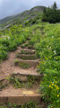
 Short tour of the Augstmatthorn
 Visorando Member
 3.92 mi
 +1,831 ft
 -1,837 ft
 3h 25
 Moderate
 Departure from Habkern (Canton of Bern)
Park at the starting point of this circuit and begin the ascent to the Augstmatthorn immediately, following the signs.
The terrain can be very slippery, even impassable, after or during rain.
The Roteflue Peak circular walk starting from Habkern
10.03 mi
+3,727 ft
-3,734 ft
7h 50
 Difficult
Departure from Habkern (Canton of Bern)
A circular walk starting from Habkern, leading to the ridge trail via the village of Schwendi to Harderkulm, which overlooks the town of Interlaken. Return to Habkern via Schwendi, crossing alpine pastures along a mix of footpaths and roads.
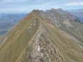
The Brienzersee viewpoints between Harderkulm and Rothorn
 13.56 mi
+6,942 ft
-3,986 ft
8 hrs
 Very difficult
Departure from Unterseen (Canton of Bern)
This hike follows the ridge path along the northern shore of Lake Brienz for its entire length, from Harderkulm hill to the summit of the Brienzer Rothorn. The route offers panoramic views almost throughout, and is relatively quiet except at the start and finish (accessible by funicular). There are several slightly vertiginous sections, but no real technical difficulty. The main challenge is the cumulative elevation gain, which ends up being considerable, as the jagged ridge involves many successive ascents and descents, often steep.
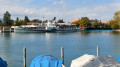
Panorama Rundweg Thunersee
 40.03 mi
+7,106 ft
-7,159 ft
4 days
Moderate
Departure from Unterseen (Canton of Bern)
Four-day panoramic tour around Lake Thun. This route offers numerous views of the lake and the peaks of the Bernese Oberland. In good weather, you can see the Eiger, Mönch and Jungfrau mountains, as well as the Schreckhorn. You will also discover the charm of the towns along the way. Interlaken, at the eastern end of Lake Thun, is the starting point for this itinerary.
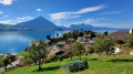
Interlaken - Sigriswil via the Panorama Rundweg Thunersee
 10.66 mi
+3,028 ft
-2,257 ft
7h 30
Difficult
Departure from Unterseen (Canton of Bern)
Interlaken, a cosmopolitan town, is the starting point for this tour around Lake Thun. You’ll be able to admire the three famous peaks of the Bernese Oberland: the Eiger, the Mönch and the Jungfrau. This beautiful route follows the northern shore of the lake. You’ll look out over the lake near the Saint Béat Caves, then pass through the pretty village of Merligen. You’ll enjoy stunning views of both the lake and the peaks, such as the Niederhorn and the Rothorn in Sigriswil.
From Schynige Platte to First via Faulhorn
10.94 mi
+3,553 ft
-2,956 ft
8h 05
Difficult
Departure from Gsteigwiler (Canton of Bern)
The Faulhorn rises to an altitude of 2,680 metres. It offers a 360-degree view of the Alps, with some peaks over 4,000 metres high, such as the Grosses-Fiescherhorn. The two main access points to the Folhorn are via the Schynige Platte or First. However, with good logistics (see practical information), it is also possible to make a one-way trip and return by public transport. The hike is a gradual climb, but offers splendid views of the first Alpine glaciers and other peaks in the surrounding area. There are restaurants where you can eat and take a break in pleasant surroundings.
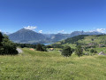
The Sigriswil Rothorn from Schwanden
 7.08 mi
+3,474 ft
-3,461 ft
6h 15
Difficult
Departure from Sigriswil (Canton of Bern)
A walk offering magnificent views of Lake Thun and the snow-capped mountains.
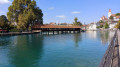
Sigriswil - Thun via the Panorama Rundweg Thunersee
 7.40 mi
+1,142 ft
-1,959 ft
4h 25
Moderate
Departure from Sigriswil (Canton of Bern)
This second stage begins with a highlight: crossing the panoramic bridge at Sigriswil. At 340 metres long and suspended 180 metres above the Guntebach Gorge, you can enjoy a magnificent panorama. The route overlooks the lake for a long time before descending to the town of Thun. This town has many historic buildings. A visit to the historic centre is a must.
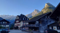
Spiez - Kiental
 9.59 mi
+2,372 ft
-1,106 ft
6h 30
Difficult
Departure from Spiez (Canton of Bern)
This first stage will take you from Spiez on the shores of Lake Thun to the small valley of Kiental.After following the lake’s shore as far as Faulensee, the climb up to Aeschi offers views of the pyramid-shaped Niesen, which towers over Spiez. You’ll also be impressed by the steep gradient of the funicular railway that climbs up to the Niesen. You’ll appreciate the tranquillity of the village of Kiental.
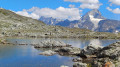
Spiez - Leukerbad (Rinderhütte) via the Lötschenpass
 44.96 mi
+18,156 ft
-12,448 ft
5 days
Difficult
Departure from Spiez (Canton of Bern)
A magnificent route starting from Lake Thun in the canton of Bern and ending at the pretty spa resort of Leukerbad in Valais.
You will cross the Lötsche Glacier and the Lötsche Pass (the highest point of the hike), which marks the border between the cantons of Bern and Valais.
This route offers numerous views of the peaks of the Bernese Oberland and Valais.
Spiez - Interlaken via the Panorama Rundweg Thunersee
 12.51 mi
+2,215 ft
-2,234 ft
7h 40
Difficult
Departure from Spiez (Canton of Bern)
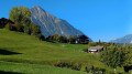
For this fourth stage, you will once again enjoy the lakeside on the Strandweg. The walk along the lake from Spiez to Faulensee is magnificent. The route then climbs from Kratttigen to Meielisalp. You will enjoy numerous views of the lake and have another opportunity to cross the 140-metre-long Leissigen bridge, suspended 60 metres above the Spissibach Gorge.
Circular Lauberhorn from Kleine Scheidegg
 2.80 mi
+1,283 ft
-1,283 ft
2h 25
Moderate
Departure from Lauterbrunnen (Canton of Bern)
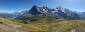
The Lauberhorn is a modest peak, yet legendary amongst downhill skiers, situated above Kleine Scheidegg. It offers a superb panorama of the Grindelwald and Lauterbrunnen valleys, but above all of the majestic trio formed by the Eiger, the Mönch and the Jungfrau.
Mürren – Lauterbrunnen
5.15 mi
+528 ft
-3,291 ft
2h 50
Difficult
Departure from Lauterbrunnen (Canton of Bern)
Depart from the Mürren campsite to visit Lauterbrunnen. You can take a stroll around the town and its surroundings before heading to Lauterbrunnen station to return to Geneva. It’s a quiet day to relax.
Langnau im Emmental - Münsingen via the Alpenpanorama Weg
 15.79 mi
+2,388 ft
-2,779 ft
9h 20
Difficult
Departure from Langnau im Emmental (Canton of Bern)
This stage will take you from Langnau im Emmental to Münsingen. Starting from the Emme Valley, you will descend towards the Aare Valley. The route offers more panoramic views, particularly at Blasenfluh, the highest point of the day. Despite the loss of altitude, there is enough distance to still see the giants of the Bernese Alps.
Kiental - Kandersteg
 12.21 mi
+4,098 ft
-3,360 ft
9h 10
Very difficult
Departure from Reichenbach im Kandertal (Canton of Bern)
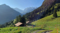
This second stage will take you from Kiental to Kandersteg. After a fairly challenging climb to Ramslauenen, you will cross the beautiful Horewald forest and then overlook the Kander valley. You will enjoy more views of Lake Thun and the Niesen. You will also have a bird's eye view of the trains on the Lötschberg line. Kandersteg is the station where vehicles board the shuttle trains before the Lötschberg railway tunnel.
More walks in Habkern
Select a point of interest below: