Country:

 City:
City:


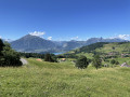
Park in the centre of Säge.
(S/E) Start the walk by taking the path opposite, marked White-Red-White, then turn immediately right and continue along the path until you reach a reservoir.
(1) Carry on straight ahead to reach a junction of roads and paths near a farm.
(2) Take the road on the left, passing through the cattle grid. Continue along the road for 300 m, then turn left and rejoin the path marked White-Red-White. Follow this path and you’ll soon reach a crossroads at a place called Obermatte.
(3) Turn right onto the road, then immediately left, and follow the signposted path again. Continue uphill until you reach a four-way junction at the Zettenalpegg mountain pasture.
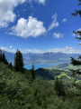
(4) Turn slightly to the right, enter the forest and, via numerous tight hairpin bends, reach the Schafloch tunnel, which passes through the mountain
(5) Take care here: the path is very narrow with a drop on all sides.
Continue along the path; there is a short, fairly steep section, after which the path levels out until you reach Mont Schaflager.
(6) Take the path opposite which descends onto the plateau – in summer there may be sheep – until you come to a low wall that you need to climb over; once you’ve crossed it, you’ll reach the foot of the Sigriswiler Rothorn.
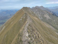
(7) Turn right and complete the ascent to the summit of the Sigriswiler Rothorn.
(8) Return in the opposite direction to the previous junction.
(7) Turn right and follow the red-white-red markings. After passing a mountain hut, you’ll reach a crossroads.
(9) Take the path on the right and continue the descent until you reach another junction.
(10) Take the path on the right again, passing through two cattle grids. You’ll reach the hamlet of Bodmi at the end of the road.
(11) Turn right onto the road, then at thefirst bend continue along the path opposite until you reach the farm you passed on the way out.
(2) Follow the path you took on the way there, but in the opposite direction, to return to the Säge car park (S/E)

 Visorando Member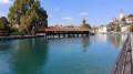
 Moderate
 Very difficult