The Roteflue Peak circular walk starting from Habkern

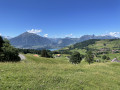
A circular walk starting from Habkern, leading to the ridge trail via the village of Schwendi to Harderkulm, which overlooks the town of Interlaken. Return to Habkern via Schwendi, crossing alpine pastures along a mix of footpaths and roads.

Details

n°21393090
Creation:
Last update:
Last review:
  • Walking
    Activity: Walking
  • ↔
    Distance: 10.03 mi
  • ◔
    Average duration: 7h 50 
  • ▲
    Difficulty: Difficult

  • ⚐
    Back to start: Yes
  • ↗
    Ascent: + 3,727 ft
  • ↘
    Descent: - 3,734 ft

  • ▲
    Highest point: 5,620 ft
  • ▼
    Lowest point: 2,956 ft

Description of the walk

Park in the car park near the Habkern Hotel.

(S/E) Take the road through Habkern heading north-east, cross the Troubach stream via the bridge and you’ll soon reach a junction of paths.

(1) Take the path on the right. Continue uphill until you reach a Y-junction before the village of Schwendi.

(2) Keep left, walk through the village and continue until you reach a crossroads in the village of Tschiemen.

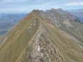
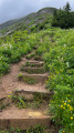
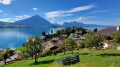
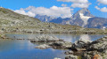
(3) Turn right onto this path, then enter the forest and continue the climb via a series of hairpin bends. On emerging from the forest, pass between the three chalets that make up the hamlet of Horetalp. You will then reach the famous Hardergrat ridge path, also known as the Brienzergratweg. Enjoy the panoramic view over Lake Brienz.

(4) Turn right and head down the ridge to reach the Roteflue peak.

(5) Continue along the ridge until you reach the summit of the Wannichnubel.

(6) Continue downhill to reach the Harder Kulm, which offers a stunning view over Interlaken.

(7) Stay on the ridge for about a hundred metres, then turn right. Leave the path leading down to Interlaken on your left. Follow a few hairpin bends until you emerge into a clearing, where you’ll find a chalet.

(8) Keep to the right, skirting the clearing and the woodland. Enter the woodland and you’ll come to another clearing and a chalet.

(9) Go round this chalet, then turn left and head first up through the clearing and then through the woods. As you emerge from the woods, you’ll come to the Luegibode clearing.

(10) Here, alternate between ascents and descents to reach the River Lombach.

(11) Cross the river and then head uphill to reach the Unter den Fuhren neighbourhood. Continue along the road and enter Schwendi at the junction you passed on the way out.

(2) Follow the route back in the opposite direction to the outward journey and return easily to the car park near the Habkern Hotel (S/E).

Waypoints

  1. S/E : mi 0 - alt. 3,517 ft - Car park near the Habkern Hotel
  2. 1 : mi 0.34 - alt. 3,448 ft - Trail junction
  3. 2 : mi 0.64 - alt. 3,720 ft - Junction of the circular loop
  4. 3 : mi 1.24 - alt. 3,852 ft - Tschiemen crossroads
  5. 4 : mi 2.72 - alt. 5,571 ft - Ridge Trail
  6. 5 : mi 3.44 - alt. 5,476 ft - Roteflue Peak
  7. 6 : mi 4.61 - alt. 5,043 ft - Wannichnubel Peak
  8. 7 : mi 5.37 - alt. 4,262 ft - Harderkulm Peak
  9. 8 : mi 7.07 - alt. 3,258 ft - Crossroads 1°°re°° clearing
  10. 9 : mi 7.48 - alt. 3,474 ft - Crossroads 2°°e°° clearing
  11. 10 : mi 8.42 - alt. 3,642 ft - Luegibode
  12. 11 : mi 8.88 - alt. 3,415 ft - Lombach River
  13. S/E : mi 10.03 - alt. 3,517 ft - Car park near the Habkern Hotel

Notes

This hike takes in steep sections and narrow ridges along the mountainside. Keep an eye on the weather conditions and be aware that there may be snow at higher altitudes.
There are few shelters along the route, so make sure you are properly equipped.
Please note: Paid car park: 8 CHF for 12 hours; accepts Swiss cash only, no credit cards.

Reviews and comments

5 / 5
Based on 1 review

Reliability of the description
5 / 5
Ease of following the route
5 / 5
Route interest
5 / 5
baf9901
baf9901

Overall rating : 5 / 5

Date of your route : Aug 03, 2023
Reliability of the description : ★★★★★ Very good
Ease of following the route : ★★★★★ Very good
Route interest : ★★★★★ Very good
Very busy route : No

A magnificent hike with a wide variety of terrain and absolutely superb views.
Please note that there is virtually no path between points 8 and 9, so follow the forest road.
The car park at Habkern now accepts payment by credit card.

Machine-translated

Other walks in the area

For more walks, use our search engine .

The GPS track and description are the property of this route's author. Please do not copy them without permission.