


Refine your search for walks in Grotte Vallier
Grotte Vallier walks


 Le Moucherotte via Saint-Nizier
 Visorando Member
 7.64 mi
 +3,179 ft
 -3,150 ft
 6h 15
 Moderate
 Departure from Saint-Nizier-du-Moucherotte (Isère)
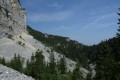
Climbing the Moucherotte via the east face from Saint-Nizier is a wild and little-known route. The return via the large ski jump (on foot, fortunately) is also unusual.
Yellow and green markings, as well as white/red.
Le Moucherotte via the east face
 4.41 mi
+2,694 ft
-2,700 ft
4 hrs
 Very difficult
Departure from Saint-Nizier-du-Moucherotte (Isère)
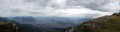
A beautiful circular loop that climbs up to Moucherotte via the east face (the steepest face) and descends via the ridges, avoiding the busiest paths.
Please note: the climb is demanding: sections with cables in the rocks, sections requiring the use of your hands, trail not always easy to find.
Moderator's note added on 14/09/2021 (still relevant on 24 April 2023): the cable section is currently closed and undergoing renovation work. See comments at the bottom of the page.
Trou Saint-Michel and Moucherotte
 8.81 mi
+5,305 ft
-5,276 ft
6 hrs
 Extremely difficult
Departure from Saint-Nizier-du-Moucherotte (Isère)
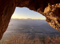
A splendid circular route around the Moucherotte, allowing you to (literally) pass through the rock to reach a ledge right on the cliff face above Grenoble, where you can enjoy a unique view of the city and the mountain ranges from Belledonne to Dévoluy, taking in Les Rousses, Oisans and Le Taillefer. The wild Vallon des Forges is on the itinerary.This hike may require a 30-metre rope (or a 15-metre abseil rope as an alternative) in the Trou Saint-Michel if you’re not comfortable descending a grade 3 section.
Tour of the Trois Pucelles and Moucherotte via the Vallon des Forges
5.92 mi
+3,225 ft
-3,225 ft
5h 30
 Difficult
Departure from Saint-Nizier-du-Moucherotte (Isère)
Variations on the theme of: balcony, woodland, scree, cliffs, summit, carpet of flowers, undergrowth, viewpoint, sporting culture surrounding the 90-metre ski jump from the Grenoble Olympic Games.
Le Moucherotte via its eastern slope
 8.86 mi
+3,537 ft
-3,530 ft
7h 10
Difficult
Departure from Claix (Isère) (Isère)
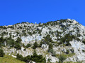
From the Drac valley, the approach to the Moucherotte via its eastern slope may seem vertiginous, yet this is not the case. The view from the front is deceptive; the average gradient at the top is only 30 per cent. The little-used path is relatively well marked with blue markings. It skilfully navigates the rocky terraces by making the most of their natural features. The climbing sections remain easy with good handholds, but some exposed passages may put off those prone to vertigo.The ascent takes place through woodland up to 1,500 m, then over scree and limestone rock amidst sparse vegetation. Throughout this second section, you can enjoy magnificent views of the valley and the surrounding mountains. The return journey follows theGR®® 91 to join the East Balcony path, which leads back to the car park.
Walks near Grotte Vallier
Saint-Nizier-du-Moucherotte - Cabane de Roybon
 12.38 mi
+4,573 ft
-3,652 ft
9h 40
Difficult
Departure from Saint-Nizier-du-Moucherotte (Isère)
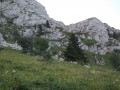
First stage of the circular route from Saint Nizier to Corrençon en Vercors, with a stop at the Cabane de Roybon below the Col Vert.Whilst the first part is easy, the section between Col de l’Arc and Col Vertis challenging, with sections over a sheer drop!Take great care.
Saint-Nizier-du-Moucherotte - La Fauge Shelter
 12.57 mi
+2,559 ft
-2,070 ft
8h 00
Difficult
Departure from Saint-Nizier-du-Moucherotte (Isère)
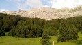
The second stage of the Vercors crossing, offering stunning views of the villages of the Vercors.
 Saint-Nizier-du-Moucherotte – Lans-en-Vercors
 6.55 mi
+2,425 ft
-1,686 ft
6 hrs
Moderate
Departure from Saint-Nizier-du-Moucherotte (Isère)
Following theGR®9route connects Saint-Nizier-du-Moucherotte to the Lans-en-Vercors Ski Centre via Moucherotte. Two vehicles are required.
Crossing the Vercors from Engins to Saint-Gervais
21.71 mi
+5,394 ft
-7,323 ft
14h 40
Extremely difficult
Departure from Engins (Isère)
This traverse of the northern Vercors links Engins to Saint-Gervais from east to west, passing over three peaks and through particularly wild sections. The route offers a wonderful variety of landscapes, ranging from forests to mountain pastures and the ridges typical of the Vercors. The higher ground offers stunning views over the Isère valley, the Chartreuse and the surrounding Alpine massifs. The route alternates between open stretches and more wooded sections, some of which are very remote.
⚠️ This route is intended solely for experienced and well-trained walkers. A GPX track is essential. See practical information.
Pic Saint-Michel via the Vertige des Cimes
6.58 mi
+2,110 ft
-2,474 ft
4h 50
Moderate
Departure from Lans-en-Vercors (Isère)
A very classic route that takes you to four remarkable viewpoints in succession, offering views of Grenoble and its valley, as well as the Vercors plateau, the Rocher de l’Ours and the Roc Cornafion. It’s a hike you should do at least once if you’re in the area.
Ideally, you should take two cars up and leave one at the finish, which is at the Parking des Barnets, two hairpin bends below the start point at the Lans-en-Vercors resort.
5-day crossing of the Vercors from Grenoble to Châtillon-en-Diois
 54.77 mi
+10,781 ft
-9,482 ft
5 days
Difficult
Departure from Seyssinet-Pariset (Isère)
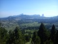
This is a trek across the Vercors via the high plateaus, the wildest and most unspoilt part of the Vercors.
From the north to the south of the Vercors, an 88km hike through spectacular landscapes. You’ll be camping in tents or in the various shelters lining theGR®.
Fountain - Saint-Nizier-du-Moucherotte
 6.11 mi
+3,196 ft
-49 ft
5h 35
Moderate
Departure from Seyssinet-Pariset (Isère)
This first stage takes you on an assault on the Vercors, gradually leaving the urban environment behind you.
From Sassenage to Noyarey on the slopes of the Vercors
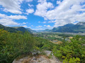 3.77 mi
+1,125 ft
-1,119 ft
2h 45
Moderate
Departure from Sassenage (Isère)
This exploratory hike along the paths on the northern flank of the Vercors should be treated as a training session if it is cold higher up. There are three viewpoints, two of which have been developed.
That said, the constant change in gradient along this route is sure to please any hiker or runner hoping to tackle the drovers' road leading to the Sornin plateau at a later date.
This walk is only enjoyable in dry weather, as the slopes become slippery after rain.
Eybens - Vizille
9.63 mi
+1,381 ft
-1,266 ft
5h 40
Moderate
Departure from Eybens (Isère)
A special hike organised as part of both the Grenoble-Vizille half marathon and the hike itself.
Grenoble and the Isère Greenway
 5.31 mi
+16 ft
-7 ft
2h 25
 Easy
Departure from Grenoble (Isère)
You’ll pass through the narrow streets of Grenoble city centre and on to the wide open green spaces on the northern outskirts of the city. In particular, you’ll pass through the Parc de l’Île d’Amour (suitable for all ages…) and the arboretum at the university campus. You’ll hardly feel as though you’re in an urban setting anymore.