Saint-Nizier-du-Moucherotte – Lans-en-Vercors

Following theGR®9route connects Saint-Nizier-du-Moucherotte to the Lans-en-Vercors Ski Centre via Moucherotte. Two vehicles are required.

Details

n°49176
Creation:
Last update:
Last review:
  • Snowshoeing
    Activity: Snowshoeing
  • ↔
    Distance: 6.55 mi
  • ◔
    Duration according to the author: 6 hrs 
  • ▲
    Difficulty: Average

  • ⚐
    Back to start: No
  • ↗
    Ascent: + 2,425 ft
  • ↘
    Descent: - 1,686 ft

  • ▲
    Highest point: 6,148 ft
  • ▼
    Lowest point: 3,812 ft

Photos

Description of the walk

Leave one car at the Lans-en-Vercors stadium (E), and park the second vehicle at the Saint-Nizier-du-Moucherotte car park (S).

(S) Take the road leading to the ski jump car park.

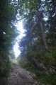
(1) Walk past this car park and take the wide track. Follow it for about 300 metres, then turn left onto theGR®9(signposted ‘Moucherotte’). Cross the old ski run to enter the woods. Climb steeply, rejoin the track and continue along it until you reach a crossroads.
Turn right onto theGR® (signposted ‘Moucherotte’) and head towards the hamlet known as La Cheminée.

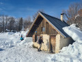
(2) Follow the signposts, ignoring the path on the right leading to the Vallon des Forges, until you reach the hut below the summit.

(3) Take the wide tracks leading to the old hotel and, keeping parallel to the ridge, reach the summit of Moucherotte.

(4) Descend diagonally to join the wide path shared bythe GR®91and theGRP® Tour des Quatre Montagnes, which heads towards Lans-en-Vercors. Reach the junction at the Cabane des Ramées.

(5) Turn left and head for the hut.

(6). Continue straight ahead to join the Moucherotte–Lans-en-Vercors link path and, following the tracks, reach a downhill ski run.

(7) Keep well to the right to reach the car park (E) and car no. 1.

Waypoints

  1. S : mi 0 - alt. 3,816 ft - Saint Nizier stadium car park
  2. 1 : mi 0.84 - alt. 4,039 ft - Car park at the ski jump
  3. 2 : mi 1.81 - alt. 5,187 ft - A place known as ‘La Cheminée’
  4. 3 : mi 2.85 - alt. 5,994 ft - Moucherotte Hut
  5. 4 : mi 3.09 - alt. 6,122 ft - Moucherotte (le)
  6. 5 : mi 4.11 - alt. 5,620 ft - Crossroads at the Cabane des Ramées
  7. 6 : mi 4.81 - alt. 5,331 ft - Ramées Mountain Hut
  8. 7 : mi 5.88 - alt. 4,747 ft - GR91 towards Lans-en-Vercors
  9. E : mi 6.55 - alt. 4,564 ft - Lans-en-Vercors stadium car park

Notes

A trickle of cold water flows alongside theGR® after the Cheminée.
The routes I have recorded using my GPS and which are shown on the attached map are for guidance only. Hikers are, of course, free to create their own route, whilst staying close to the one described here.
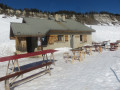
The Moucherotte and Ramées huts are particularly pleasant places to stay and are open all year round.

Worth a visit

Lans-en-Vercors and the Magic of Automata.
Villard-de-Lans.
Autrans and its ski jumps.
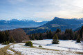
At the summit of the Moucherotte, a famous hotel was built where the high society set would come to spend a few evenings. The cable car allowed them to reach the summit all year round. Left to fall into disrepair, it was demolished in the early 2000s. In its place, a large open space now offers a fascinating view of Grenoble, Belledonne and Mont Blanc.

Always be cautious and plan ahead when you're outdoors. Visorando and the author of this route cannot be held responsible for any accidents occurring on this route.

The GR® and PR® markings are the intellectual property of the Fédération Française de Randonnée Pédestre.

Reviews and comments

4.3 / 5
Based on 2 reviews

Reliability of the description
4 / 5
Ease of following the route
4.5 / 5
Route interest
4.5 / 5
brigitte38
brigitte38

Overall rating : 5 / 5

Date of your route : Jun 11, 2026
Reliability of the description : ★★★★★ Very good
Ease of following the route : ★★★★★ Very good
Route interest : ★★★★★ Very good
Very busy route : No

A fairly busy route, on a very sunny day.
I did the route in the opposite direction, starting from Lans – a bit steeper, with the added thrill of the vertigo-inducing peaks. Picnic and a nap at the top of Moucherotte with a magnificent view of the still snow-capped mountains facing us! The descent this way is longer and quite stony, so you need to be careful! But a lovely afternoon snack awaited us at Sensations et Chocolats in St Nizier, where we received a very warm welcome!

Machine-translated

chaflanino
chaflanino

Overall rating : 3.7 / 5

Date of your route : Aug 05, 2018
Reliability of the description : ★★★☆☆ Average
Ease of following the route : ★★★★☆ Good
Route interest : ★★★★☆ Good

A lovely walk, but it’s a bit of a faff at the start trying to find the right path. That said, the dizzying views from the peaks are brilliant, as is the viewpoint at the top of Le Moucherotte.

Machine-translated

Other walks in the area

For more walks, use our search engine .

The GPS track and description are the property of this route's author. Please do not copy them without permission.