Country:

 City:
City:


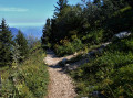
By car: from Grenoble via the A480 motorway (south), take the Seyssins D6 exit, then Avenue Louis Vicat, Route de Comboire D106D, Allée du Pré Balmet and the narrow Route du Peuil. At a level stretch of road at the junction for Le Peuil, ignore the road leading up to the hamlet and continue straight on for about twenty metres. At the crossroads, take the path leading to the car park opposite.
(S/E) Take the road blocked to traffic by a barrier. It climbs (north) to the Punais farm, passes between the farm and the Peuil peat bog to reach a junction. You can avoid the road by taking the grassy and often waterlogged path on the left as you leave the car park.
(1) Leave the track that turns left and take the one on the right, heading towards Saint-Nizier-du-Moucherotte. Photo: Start of the path Pass through another barrier and follow the yellow markings. Ignore the path on the right at a hairpin bend and, after 100 m, leave a track on the right. Continue for a further 200 m to reach a junction with a signpost.
(2) Leave the track you have been following, which continues straight on, and take the one on the right, still heading towards Saint-Nizier. Straight and slightly uphill (north), after 1 km it curves round a wide clearing from which, on the left, a path leads into the woods (north-west). Photo: Towards the Balcon Est
(3) At the signpost at the junction, leave the track and take this path towards Saint-Nizier, known as the “East Balcony”, marked in yellow.
(4) After about 800 m, pass two paths on the left and right marked with a Yellow Cross. A good two kilometres after leaving the track, the path joins another wide track further down the slope.
(5) At this junction, do not follow any of the signs for “Châtelard” (alt. 1,230 m). Just before the track, look out for two paths on the left, marked with a Yellow Cross and a Blue Cross on a large beech tree . Photo: Junction towards Château Bouvier. Ignore the one on the left (south-west) and follow the one on the right (north-west), which is less steep, regularly signposted and has recently been marked in blue. It climbs above the track, then winds steeply upwards through the forest (west).
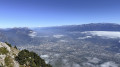
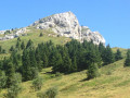
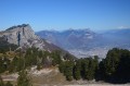
(6) Leave the woodland to cross a series of rocky terraces, still heading west. Walk along the face of a rocky outcrop, Château Bouvier. Photo: View from Château-Bouvier. After a few terraces, cross a scree slope then a sparse woodland, pass in front of a cave and, after a short, level stretch, reach a small pass. Follow the blue arrow on a large rock to the left, cross a small hill through some scrub and reach a junction.
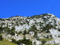
(7) Ignore the path leading down to the right towards the Grotte Vallier and take the ascending path to the left (west).Photo: Marking the fork. Follow the path to the right, marked by a cairn, which leads into a woodland. On emerging from the woodland, at the base of a scree slope, you’ll see the east face you need to climb. Photo: Rocky steps
The path, clearly marked, is well signposted with blue paint marks. To avoid getting lost, take the time to spot these before continuing, and do not hesitate to retrace your steps if you lose sight of them. After a rocky step, climb up the scree slope. Cross small rocky outcrops using easy climbing moves accompanied by a few exposed traverses, following a route slightly to the left of the summit (west), up to an altitude of 1,800 metres, then head south-west, moving away from the summit.
(8) At around 1,850 m, as you approach the ridge, the path turns north and, via an almost level traverse, reaches the summit.
(9) The summit of Moucherotte (alt. 1,901 m) features an orientation table situated on the concrete platform of the large antenna. Leave the summit via the west to rejoin the path just below. Follow it to the right (north) until you reach a junction sign.
(10) Turn left and follow theGR®® 91 (red/white) towards Saint-Nizier. The path passes in front of a building and, shortly afterwards, leaves a path on the right as it continues its descent (south). After a hairpin bend, it heads north for 2 km before reaching a junction.
(11) At the ‘Les Forges’ sign (alt. 1,630 m), leave theGR®® 91 – which continues straight on – and take the path on the right (east). Photo: Junction marker. The path climbs for 50 m before joining a wide track. Follow the track down to the left, pass a 180° bend and then, at the next bend, look to the right in the woods, against the cliff face, for the start of a path. Photo: Junction marker towards Poussebou
(12) Leave the track and take this path towards Poussebou, which is consistently marked in yellow and green. Through the woodland, it reaches a hollow and climbs again, running alongside the cliff. It emerges from the woods and climbs up a large scree slope. Its long traverse consists of a series of short ascents and descents. After a level section, it descends a slope through scree and gravel. It continues its descent in switchbacks through the forest (east) to an altitude of 1,350 m, where it turns north onto a gentler slope to rejoin the Balcon Est track.
(13) At the Poussebou signpost (1,254 m), turn right onto the track towards Le Peuil (yellow markings) and rejoin the outbound path at the Châtelard signpost.
(5) Follow the entire ascent route in the opposite direction to return to the car park (S/E).


 Visorando Member
 Moderate
 Very difficult