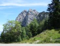
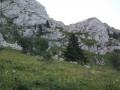
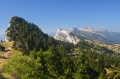
Tour of the Trois Pucelles and Moucherotte via the Vallon des Forges

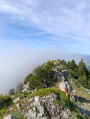
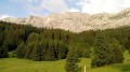
Variations on the theme of: balcony, woodland, scree, cliffs, summit, carpet of flowers, undergrowth, viewpoint, sporting culture surrounding the 90-metre ski jump from the Grenoble Olympic Games.

Details

52381966
Creation:
Last update:
Last review:
  • Walking
    Activity: Walking
  • ↔
    Distance: 5.92 mi
  • ◔
    Average duration: 5h 30 
  • ▲
    Difficulty: Difficult

  • ⚐
    Back to start: Yes
  • ↗
    Ascent: + 3,225 ft
  • ↘
    Descent: - 3,225 ft

  • ▲
    Highest point: 6,168 ft
  • ▼
    Lowest point: 3,458 ft

Description of the walk

Park in the car park at the foot of the Saint-Nizier-du-Moucherotte ski jump.

(S/E) Walk slightly downhill to Rue ZA, Zone Artisanale, Espace Tremplin. Turn right onto the path and follow it to the Sentier de la Vie.

(1) Turn right onto it and head into the forest. Continue along this balcony path to reach the Trou Poussebou.

(2) Continue along this path, which now climbs, go round the Trois Pucelles rocks and then reach a three-way junction.

(3) Turn right onto the path marked in yellow and green, following the sign for Moucherotte via the Vallon des Forges. You’ll soon reach the entrance to the Grotte Vallier and the Ruisseau du Bessay.

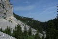
(4) Keep to the right to begin the fairly challenging ascent of the Vallon des Forges via tight hairpin bends. Take care here as the ground can be slippery in wet weather. Climb up the slope through the limestone scree to reach the edge of the cliff.

(5) Begin a short descent, then climb back up to reach a junction at the top of the cliff.

(6) Take the wide track on the left – this is the old ski run. Follow it until you reach theGR®9further up, then turn left onto it to reach the Refuge du Moucherotte.

(7) Carry on to reach the summit of the Moucherotte.

(8) Descend from the summit of the Moucherotte via the same route as on the way up, until you reach the junction at the edge of the cliff that you passed on the way up.

(6) Here, take theGR®, pass through ‘La Cheminée’, then rejoin a very wide path where stones may roll underfoot once again, and continue to a junction at the foot of the Roc de Bataillon.

(9) Take the narrow path – this is also theGR® marked in white and red – to the right; take care here as there are roots. Reach the foot of the Petites Pucelles and come to another junction.

(10) Continue straight ahead on theGR® to reach the top of the ski jump, marked by a concrete tower.

(11) Take the steps made of wooden logs to descend; be careful, as this is a tricky and impressive section along the north-west face.

(12) Pass beneath the nose of the ski jump and join another flight of steps – also rather daunting – with concrete risers running alongside the slope. Continue on to reach the ski jump car park (S/E).


Waypoints

  1. S/E : mi 0 - alt. 3,622 ft - Ski jump car park - Mémorial et nécropole de Saint-Nizier-du-Moucherotte.
  2. 1 : mi 0.15 - alt. 3,570 ft - Path of Life
  3. 2 : mi 0.43 - alt. 3,481 ft - Trou Poussebou
  4. 3 : mi 1.3 - alt. 4,177 ft - Herb’s three-way junction
  5. 4 : mi 1.57 - alt. 4,498 ft - Grotte Vallier
  6. 5 : mi 2.15 - alt. 5,495 ft - Edge of the cliff
  7. 6 : mi 2.52 - alt. 5,387 ft - Crossroads at the circular loop
  8. 7 : mi 3.15 - alt. 5,991 ft - Moucherotte Mountain Hut
  9. 8 : mi 3.31 - alt. 6,168 ft - Moucherotte (le)
  10. 9 : mi 4.68 - alt. 4,724 ft - Roc de Bataillon
  11. 10 : mi 5.25 - alt. 4,222 ft - Towards the ski jump
  12. 11 : mi 5.47 - alt. 4,154 ft - Top of the ski jump
  13. 12 : mi 5.57 - alt. 3,973 ft - Nose of the ski jump
  14. S/E : mi 5.92 - alt. 3,622 ft - Ski jump car park

This route passes through multiple protected areas, which may be subject to special regulations:

Worth a visit

(S/E) Concrete ski jump, jump take-off, landing area, stands.
Shortly afterwards (2) View of the Grande Pucelle, a climbing site with equipment.
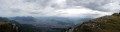
Between (4) and The landscape gradually opens up to offer a magnificent view of the Drac, Grenoble, Échirolles and Belledonne on one side, and the east face of the Moucherotte on the other.
(7) Moucherotte refuge: here you can enjoy an exhibition of photographs and quotes about the mountains and physical endeavour. This refuge has been refurbished and is open to the public, but it is unstaffed. Please help to keep it in good condition and, above all, take your rubbish back down with you.
(8) Moucherotte summit: the orientation board here provides a perfect overview of the surrounding area. Also note the sign detailing the specifications of the weather station.
(11) Ski jump: leave the marked path to visit the ski jump site. Please note, however, that the concrete structure itself is not accessible as the concrete is too badly damaged.
(12) Ski jump landing area: here you can see the structures that once housed the television cameras, as well as the remains of the scoreboard as you pass by. The stands are on the other side of the landing area, which has not been used since 1987.

Always be cautious and plan ahead when you're outdoors. Visorando and the author of this route cannot be held responsible for any accidents occurring on this route.

The GR® and PR® markings are the intellectual property of the Fédération Française de Randonnée Pédestre.

Reviews and comments

4.5 / 5
Based on 3 reviews

Reliability of the description
4.5 / 5
Ease of following the route
4.3 / 5
Route interest
4.7 / 5
Chamois38
Chamois38

Overall rating : 5 / 5

Date of your route : Jul 28, 2026
Reliability of the description : ★★★★★ Very good
Ease of following the route : ★★★★★ Very good
Route interest : ★★★★★ Very good
Very busy route : No

I love this circular route – it has a wild feel to it, is very, very quiet, and every time I go there I come across animals going about their business in their natural habitat. Well signposted, the route is easy to follow, very varied and quite steep. It has everything you need for a challenging yet enjoyable hike, thanks to its closeness to nature. On the descent from Moucherotte, I follow the GR trail, then the track for about a hundred metres, before turning right onto the ‘Chemin de la Découverte’ – a balcony-like path leading directly to the car park at the bottom of the ski jump landing area. The path is suitable for teenagers, and dogs must be kept on a lead. I didn’t come across any herds.

Machine-translated

rete540
rete540

Overall rating : 4.3 / 5

Date of your route : Jul 12, 2026
Reliability of the description : ★★★★☆ Good
Ease of following the route : ★★★★☆ Good
Route interest : ★★★★★ Very good
Very busy route : No

Not many people out this morning!
The first part of the trail is quiet, which is lovely.
I’d recommend it; I’d happily do it again...

Machine-translated

denrem
denrem

Overall rating : 4 / 5

Date of your route : Jun 15, 2026
Reliability of the description : Not used / Not applicable
Ease of following the route : ★★★★☆ Good
Route interest : ★★★★☆ Good
Very busy route : No

A route that isn’t very busy, except when approaching Moucherotte.
The descent is along a very rutted path, to be attempted only in dry weather. We cut across after the roped-off section to reach the landing strip of the large ski jump directly.
It’s an interesting alternative route to the one starting from Lans

Machine-translated

Other walks in the area

For more walks, use our search engine .

The GPS track and description are the property of this route's author. Please do not copy them without permission.