


Refine your search for walks in Grignon (Savoie)
Grignon (Savoie) walks


 Circular walk on the hills above Grignon via La Baraque Noire.
 Visorando Member
 7.56 mi
 +2,264 ft
 -2,264 ft
 5h 25
5h 25
 Moderate
 Departure from Grignon (Savoie) (Savoie)
This walk takes place, for the most part, in the forest, on paths and trails, and presents no particular difficulty, either technical or in terms of navigation. It offers beautiful panoramic views of the Isère valley, the Bauges, the Beaufortain, etc.
Circular walk around the Pointe de la Sambuy in Albertville
29.29 mi
+10,397 ft
-10,443 ft
4 days
 Difficult
Departure from Albertville (Savoie)
Difficult
Departure from Albertville (Savoie)
A 4-day hiking tour with wild camping, starting and finishing at Albertville railway station
The route takes you through the Bauges Game and Wildlife Reserve, where you’ll discover the highest points of the Bauges Massif: the Pointe de Chaurionde (alt. 2,173 m) and the Col de l’Alpettaz (alt. 1,580 m), passing through the forests of Tamié, Saint-Ruph and Les Héris.
From Albertville station to the Refuge du Soplat des Streams
 7.03 mi
+4,177 ft
-604 ft
6h 50
Difficult
Departure from Albertville (Savoie)
7.03 mi
+4,177 ft
-604 ft
6h 50
Difficult
Departure from Albertville (Savoie)
A lovely climb starting from Albertville, passing through the medieval town of Conflans and pretty mountain hamlets with views of the Tarentaise Valley, before reaching the Refuge du Soplat des Stream. The refuge is ideally located near the Tour du Beaufortain with a beautiful view of Albertville and the Olympic Park. Hike to be done from May to November: avalanche risk in winter above 1,100 metres.
Route of the heights of Conflans to Albertville
6.06 mi
+2,556 ft
-2,556 ft
5h 00
Moderate
Departure from Albertville (Savoie)
A beautiful circular route above the medieval town of Conflans with lovely panoramic views of the Combe de Savoie.
Farette - Bettex - Fort du Mont - Le Chataîgner - Farette
 4.44 mi
+2,185 ft
-2,185 ft
3h 55
Moderate
Departure from Albertville (Savoie)
4.44 mi
+2,185 ft
-2,185 ft
3h 55
Moderate
Departure from Albertville (Savoie)
If you love the mountains and beautiful places, and you're not afraid of a little effort, then set off on this walk to discover Fort du Mont and admire the views on the way up and the large pine forests on the way down.
Route in the hills above Albertville
3.11 mi
+558 ft
-558 ft
1h 55
 Easy
Departure from Albertville (Savoie)
Easy
Departure from Albertville (Savoie)
A lovely, peaceful route to rediscover the old Beaufort road, with beautiful views of Albertville.
The Balconies of Saint-Thomas (Lé lôzè dè Saint Thomas)
 4.47 mi
+1,562 ft
-1,535 ft
3h 25
Moderate
Departure from Esserts-Blay (Savoie)
4.47 mi
+1,562 ft
-1,535 ft
3h 25
Moderate
Departure from Esserts-Blay (Savoie)
A route that will take you through the remote hamlets of the village of Saint-Thomas, overlooking the valley with magnificent views, a route alternating between footpaths, tracks and roads.
A sunny route early in the morning with very little traffic – enjoy it to your heart’s content.
Notre-Dame de Tamié Abbey
8.75 mi
+2,362 ft
-2,388 ft
6h 05
Moderate
Departure from Mercury (Savoie)
This circular starts in Mercury and climbs up to the small pass of Tamié, then continues to Notre-Dame de Tamié Abbey. It continues via the small pass of Tamié before descending towards Plancherine and returning to Mercury .
Route des hauts de Mercury via Fort de Tamié
6.44 mi
+1,686 ft
-1,657 ft
4h 25
Moderate
Departure from Mercury (Savoie)
A challenging hike above Mercury through the undergrowth to discover the balconies of Tamié.
Route of the Gallo-Roman villa at Gilly-sur-Isère
 5.94 mi
+705 ft
-679 ft
3h 20
Easy
Departure from Mercury (Savoie)
5.94 mi
+705 ft
-679 ft
3h 20
Easy
Departure from Mercury (Savoie)
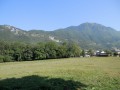
A hike that will allow you to discover the Savoyard countryside and step back a few centuries with the Gallo-Roman ruins in the village of Gilly. The church and the castle are well worth a visit.
The Palatieux Balconies (Lè lôzè du Palatchu)
 2.51 mi
+1,270 ft
-1,260 ft
2h 15
Moderate
Departure from Tours-en-Savoie (Savoie)
2.51 mi
+1,270 ft
-1,260 ft
2h 15
Moderate
Departure from Tours-en-Savoie (Savoie)
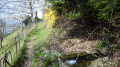
A lovely path running along a ridge overlooking the Tarentaise valley with stunning views of Tours-en-Savoie.
La Dent du Corbeau
3.53 mi
+2,234 ft
-2,234 ft
3h 35
Difficult
Departure from Notre-Dame-des-Millières (Savoie)
La Dent du Corbeau forms part of the Grand Arc massif. From the ridge, there is a superb view of the valley stretching towards Montmélian, the head of the Tarentaise valley, Mont Blanc (of course!), and the Aravis range.
Route around Césarches via the Col de Montessuit
 4.84 mi
+935 ft
-935 ft
3h 00
Moderate
Departure from Césarches (Savoie)
4.84 mi
+935 ft
-935 ft
3h 00
Moderate
Departure from Césarches (Savoie)
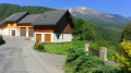
A lovely, peaceful walk alternating between roads and paths, suitable for all seasons, with lovely views of the surrounding mountains. An ideal route in early spring to get back into the swing of things.
Belle Étoile circular, return via Chalet Périllet
 4.07 mi
+2,484 ft
-2,484 ft
4h 00
Moderate
Departure from Mercury (Savoie)
4.07 mi
+2,484 ft
-2,484 ft
4h 00
Moderate
Departure from Mercury (Savoie)
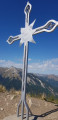
From the summit of Belle Étoile, you will be treated to breathtaking views. Following a path that runs almost entirely through the woods, you will reach the Croix de Périllet and then, after a steep section, the Croix du Sommet de Belle Étoile. On one side, you will overlook Mercury and the Olympic city of Albertville (1992 Winter Olympics) and on the other, the Tamié valley and its Cistercian-Trappist monastery. In the distance, you can see Lake Annecy, Mont Blanc and Mont Granier.
Route de la Belle Étoile and La Négresse / Roc Rouge
 5.64 mi
+3,159 ft
-3,133 ft
5h 20
Difficult
Departure from Mercury (Savoie)
5.64 mi
+3,159 ft
-3,133 ft
5h 20
Difficult
Departure from Mercury (Savoie)
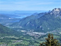
A very lovely hike on the border between Savoie and Haute-Savoie, on the iconic peaks of Albertville: the beautiful Étoile and the Négresse.
In the background, the Bauges massif, the Beaufortain, the Lauzière, Mont Blanc and Lake Annecy.
A hike best undertaken in dry weather, featuring exposed sections equipped with ladders and handrails.
The Pointières Discovery Trail in Queige:
 3.27 mi
+866 ft
-850 ft
2h 15
Easy
Departure from Queige (Savoie)
3.27 mi
+866 ft
-850 ft
2h 15
Easy
Departure from Queige (Savoie)
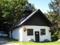
Whether you do it alone or with your family, this hike will allow you to discover how people lived around 60 years ago. It is a pleasant walk through a hundred hectares of forest and small plains. Along the way, you will find barns furnished with tools from the period and numerous photos.
A very interesting route that will take you back to your starting point, where a guest book awaits you.