


Refine your search for walks in Grèzes (Lot)
Grèzes (Lot) walks


 On the limestone plateau at the start of Grèzes
 Visorando Member
 13.13 mi
 +1,053 ft
 -1,043 ft
 6h 55
6h 55
 Difficult
 Departure from Grèzes (Lot) (Lot)
This hike, which is not particularly difficult, takes walkers from the village of Grèzes to the cliffs overlooking the River Célé at Espagnac-Sainte-Eulalie. It then heads north to the Bélinac menhir (one of the few menhirs in the department) before returning to the village of Livernon and then Grèzes.
It mostly follows wide limestone paths, lined with moss-covered walls and shaded by oak trees.
Route of the Espédaillac farmhouses
 6.49 mi
+276 ft
-259 ft
3h 15
6.49 mi
+276 ft
-259 ft
3h 15
 Moderate
Departure from Espédaillac (Lot)
Moderate
Departure from Espédaillac (Lot)
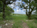
This route takes you on a tour of various farmhouses around the village of Espédaillac, along beautiful paths lined with dry stone walls. This circular route is marked with small signs depicting a hiker in a yellow arrow.
Discovery trail exploring the small heritage sites of Espédaillac and the trees of the Causse.
 4.98 mi
+269 ft
-279 ft
2h 30
4.98 mi
+269 ft
-279 ft
2h 30
 Easy
Departure from Espédaillac (Lot)
Easy
Departure from Espédaillac (Lot)
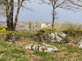
This route introduces you to around twenty trees, shrubs and bushes, as well as some examples of vernacular heritage, commonly referred to as "small heritage", found on the Causse.
During your walk, you can enrich your knowledge by scanning the QR code on each sign to access a detailed information sheet.
Approximately 8 km long, it complements the 2.5 km route (tree discovery) that already exists on Visorando, which starts at the same point.
Route to discover the trees, shrubs and small trees of Espédaillac
 1.55 mi
+49 ft
-66 ft
0h 45
Easy
Departure from Espédaillac (Lot)
1.55 mi
+49 ft
-66 ft
0h 45
Easy
Departure from Espédaillac (Lot)
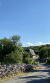
This route introduces you to around twenty trees, shrubs and small trees found on the Causse.
At the foot of each one, you’ll find a sign indicating the tree’s name.
You’ll also find a QR code which you can scan using your smartphone.
See the ‘Practical Information’ section.
Sheep trail in Espédaillac
 2.47 mi
+200 ft
-203 ft
1h 20
Easy
Departure from Espédaillac (Lot)
2.47 mi
+200 ft
-203 ft
1h 20
Easy
Departure from Espédaillac (Lot)
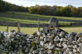
This route invites you to discover sheep and their environment. At each stage, it reveals how sheep farming has shaped the landscapes of the Causse.
On the cliffs of the Célé, starting from Espagnac-Sainte-Eulalie
11.87 mi
+2,228 ft
-2,247 ft
7h 25
Difficult
Departure from Espagnac-Sainte-Eulalie (Lot)
Between Figeac and its confluence with the Lot, the Célé river crosses a limestone plateau. It winds its way between cliffs offering stunning views of the valley. This hike follows part of the river's course. The elevation gain on this walk will delight the more athletic, but it can also be easily split into two to suit everyone.
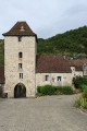
Espagnac – Marcilhac-sur-Célé
 9.80 mi
+1,929 ft
-1,936 ft
6h 10
Moderate
Departure from Espagnac-Sainte-Eulalie (Lot)
9.80 mi
+1,929 ft
-1,936 ft
6h 10
Moderate
Departure from Espagnac-Sainte-Eulalie (Lot)
Thissecond stage on theGR®651takes you through places with ancient stone buildings: the Priory of Espagnac, the Château des Anglais in Saint-Sulpice, troglodyte houses and the caselles of Marcilhac. It also offers magnificent views of the Célé valley from the balcony-like path on the plateau.
This stage also allows you to explore the causse and its network of low stone walls, evidence of the region’s once-thriving agricultural past.
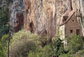
Espagnac-Sainte-Eulalie - Sauliac-sur-Célé
 15.03 mi
+2,605 ft
-2,677 ft
9h 10
Difficult
Departure from Espagnac-Sainte-Eulalie (Lot)
15.03 mi
+2,605 ft
-2,677 ft
9h 10
Difficult
Departure from Espagnac-Sainte-Eulalie (Lot)
The twenty-eighth stage of the Camino de Santiago. A truly beautiful stage that winds through the Célé Valley. As you follow the river, the rocky cliffs open up to reveal their dark caves, pretty villages, cave dwellings and mills. The Célé Valley undulates along a route that is both wild and poetic, and is sure to fill you with wonder!
Route of the Château des Anglais in Brengues
 Association / Club / Walk leader5.12 mi
+1,184 ft
-1,184 ft
3h 25
Moderate
Departure from Brengues (Lot)
Association / Club / Walk leader5.12 mi
+1,184 ft
-1,184 ft
3h 25
Moderate
Departure from Brengues (Lot)
This splendid route has many attractions: the Château des Anglais clinging to the cliff, the Priory of Espagnac-Sainte-Eulalie and several superb views of the Célé Valley.
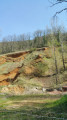
Cavarrot and Monteil mills from Boussac
 5.06 mi
+653 ft
-643 ft
2h 55
Easy
Departure from Boussac (Lot) (Lot)
5.06 mi
+653 ft
-643 ft
2h 55
Easy
Departure from Boussac (Lot) (Lot)
A route that will allow you to discover the landscapes of the Gorges du Célé, the small shaded paths on the Causse and the meadows along the river. It follows small roads and public paths that are often inaccessible to motor vehicles.
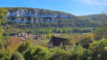
Circular Caselles from Marcilhac-sur-Célé
 5.67 mi
+653 ft
-640 ft
3h 10
Easy
Departure from Marcilhac-sur-Célé (Lot)
5.67 mi
+653 ft
-640 ft
3h 10
Easy
Departure from Marcilhac-sur-Célé (Lot)
This easy circular route will allow you to discover the pretty village of Marcilhac-sur-Célé and its abbey, the peaceful, shaded banks of the Célé and, higher up, the Quercy limestone plateaus and their rural heritage: dry stone walls, caselles (stone huts), cayrou (stone shelters) and compte-moutons (stone sheep pens).
This route follows theGR®651and thePR®20departmental route of the Caselles de Marcilhac at times.
The gariottes of Théminettes
 2.65 mi
+138 ft
-115 ft
1h 20
Easy
Departure from Théminettes (Lot)
2.65 mi
+138 ft
-115 ft
1h 20
Easy
Departure from Théminettes (Lot)
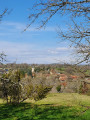
A short walk starting from the village of Théminettes in the heart of the Causses du Quercy Regional Nature Park. You will discover beautiful dry stone huts, imposing low walls, the famous Francès sinkhole (after an eventful underground journey, its waters reappear at Cabouy, near Rocamadour, before flowing into the Dordogne at Lacave) and the village of Théminettes.
Around Cabrone and its legend
 4.55 mi
+354 ft
-328 ft
2h 25
Easy
Departure from Saint-Chels (Lot)
4.55 mi
+354 ft
-328 ft
2h 25
Easy
Departure from Saint-Chels (Lot)
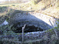
Come and discover Cabrone with its unique views of the Causse and the Tirondel Valley, its dolmens and the legend of the Foun del lout.
The 7 dolmens of the Causse de Saint-Chels
 7.08 mi
+594 ft
-623 ft
3h 45
Moderate
Departure from Saint-Chels (Lot)
7.08 mi
+594 ft
-623 ft
3h 45
Moderate
Departure from Saint-Chels (Lot)
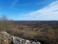
Come and discover the dolmen hike on the Causse de Saint-Chels, in the heart of the Causses du Quercy Regional Nature Park.
 Route of discovery of the commune of Saint-Chels
 15.58 mi
+1,473 ft
-1,457 ft
3 hrs
Moderate
Departure from Saint-Chels (Lot)
15.58 mi
+1,473 ft
-1,457 ft
3 hrs
Moderate
Departure from Saint-Chels (Lot)
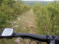
Come and discover the small village of Saint-Chels, situated in the heart of the Causses du Quercy Regional Nature Park, via this route. Along the way, you’ll see dolmens, cazelles, wells, springs and unique viewpoints.