


Refine your search for walks in Gare de Mont-Pèlerin
Gare de Mont-Pèlerin walks


 From Palézieux to Chardonne via Mont Pèlerin
 Visorando Member
 6.09 mi
 +1,467 ft
 -1,004 ft
 4h 05
 Moderate
 Departure from Palézieux (Vaud)
A circular walk that starts on the Vaud plateau and ends overlooking Lake Geneva on the heights of Lavaux, a region listed as a UNESCO World Heritage Site. There is a short stretch of tarmac road at the start before crossing the forests of Mont Cheseau and then those of Mont Pèlerin, leading to a magnificent panorama: almost the entire length of Lake Geneva and the French Alps opposite. This walk offers moderate shade and is therefore best avoided during heatwaves; the month of May usually offers lovely fields of daffodils for enthusiasts.
Walks near Gare de Mont-Pèlerin
The Terraces of Lavaux, the Three Suns
6.83 mi
+899 ft
-787 ft
3h 55
Moderate
Departure from Vaud
A beautiful walk through the vineyards of Lavaux, discovering the different appellations. Lovely views of the lake and the Alps.
Local wines can be tasted throughout the hike.
N.B. Contrary to what is automatically indicated on the hike information sheet, the Lavaux terraces are located in the canton of Vaud and not in Valais.
Crossing the Pléiades from Blonay
 6.58 mi
+1,762 ft
-2,480 ft
4h 35
Moderate
Departure from Blonay (Vaud)
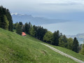
A classic destination in the region offering magnificent views of Lake Geneva and the surrounding mountains. The route is particularly recommended in spring and autumn. In summer, this largely shaded route limits excessive exposure to the sun. The hike is ideal for family activities, including a visit to the AstroPléiades educational site.
Saint Gingolph - La Chapelle d'Abondance
10.74 mi
+6,010 ft
-3,934 ft
10h 10
 Difficult
Departure from Saint-Gingolph (Haute-Savoie)
Itinéraire de la traversée des Alpes. Etape des rives du lac Léman au Val d'Abondance. Franchir les montagnes du Chablais par une longue grimpette de 1850m en traversant les alpages pour passer le Col de Bise puis redescendre à la station de ski de la Chapelle d'Abondance. Cet itinéraire offre de très beaux panoramas sur le plus grand lac d'Europe et sur le sommet des Cornettes de Bise.
GTA, Great Alpine Crossing via the GR®5 and GR®55. From Lake Geneva to Nice.
 342.76 mi
+99,633 ft
-100,915 ft
21 days
 Very difficult
Departure from Saint-Gingolph (Haute-Savoie)
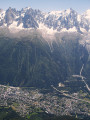
The Grande Traversée des Alpes (GTA) mainly follows the GR®5, with a few possible variations such as the crossing of the Haute Vanoise via the GR®55 and the Via Alpina, which this route takes instead of the GR®5 route via the Col de l’Iseran. It crosses the French Alps from north to south, from Saint-Gingolph to Nice. The guide includes web links to the many accommodation options along the route or nearby: mountain huts, lodges, campsites, cabins and shelters, excluding hotels. Although this guidebook details the GTA as a three-week trek, it can be adapted to suit your own pace, with stages of varying lengths, either completed in one go or in sections over several years. This journey, fuelled by the joy of freedom in unspoilt natural surroundings, will remain a superb and unforgettable experience, offering, moreover, the opportunity to meet many people with whom you can share this same passion for the mountains.
From Saint-Gingolph to the Chalets de Bise
 7.66 mi
+5,013 ft
-1,348 ft
7h 55
Difficult
Departure from Saint-Gingolph (Haute-Savoie)
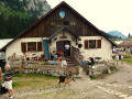
This first stage of the Grande Traversée des Alpes (GTA), from Lake Geneva to the Mediterranean, takes place in the Chablais massif. The path climbs up the Novel valley on the left bank of the Morge, below the hamlet of La Meurtaz, then follows the D30 road, which it overlooks after the hamlet of Jordy. On leaving Novel, the path winds its way above the hairpin bends of the D30 to La Planche. There, it leaves the main valley route to climb due south towards the chalets of Neuteu and on to the Col de Bise, before descending to the Chalets de Bise.
Les Paccots - Vevey
 13.66 mi
+1,657 ft
-4,098 ft
7h 45
Difficult
Departure from Châtel-Saint-Denis (Canton of Fribourg)
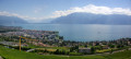
This last stage will take you to the shores of Lake Geneva in Vevey. From Les Paccots, a forest trail will lead you to the Fégire footbridge, where the Veveyse de Fégire marks the border between the cantons of Fribourg and Vaud. When you arrive at Laly and from the Pléiades trail, you can admire Lake Geneva and the surrounding Alpine peaks. You will pass through a few vineyards before arriving in Vevey.
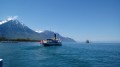
Along the shores of Lake Geneva from Villeneuve to Montreux.
 3.27 mi
+177 ft
-167 ft
1h 40
 Easy
Departure from Villeneuve (Canton de Vaud) (Vaud)
A pleasant walk along the "Riviera of Lake Geneva", with superb panoramic views of the lake and surrounding peaks, the grand residences of Montreux and the famous Château de Chillon. This walk is proposed as a one-way trip with the option of returning either by boat or on foot.
Taney – Saint-Gingolph
9.85 mi
+2,352 ft
-5,768 ft
6h 35
Difficult
Departure from Vouvry (Valais)
This eleventh stage will take you from Taney to Saint Gingolph. The route begins in the Loz valley at the foot of Mont Gardy and Les Jumelles, before climbing the final two passes, Lovenex and La Croix. The route continues along the River Morge, following the border with France. At Novel, the path turns towards Mont Cornin, passing through La Frîtaz and winding down towards Lake Geneva at Saint Gingolph.
From Lugrin to Meillerie via the hamlet of Les Combes
 4.50 mi
+1,115 ft
-1,112 ft
3h 00
Moderate
Departure from Lugrin (Haute-Savoie)
A linear hike, which requires careful planning, connecting two landing stages on Lake Geneva at a higher altitude. An often shaded route that nevertheless offers beautiful views of the lake. Oratories, chapels and churches are also along the way.
From the Chalets de Bise to the Trébentaz Refuge
 8.20 mi
+3,924 ft
-2,740 ft
7h 10
Difficult
Departure from La Chapelle-d'Abondance (Haute-Savoie)
This second stage continues the traverse of the Chablais. The route winds through the beautiful Abondance valley amidst magnificent, tranquil scenery. From the Chalet de Bise, there is a steep climb up to the Pas de la Bosse. From the pass, the path descends to the chalets of Chevenne, then follows the Sechet stream, continuing the descent along the right bank to the Chapelle d’Abondance. It runs alongside the Thoules stream and then the Dranse, which it leaves at the hamlet of Le Moulin, before climbing towards Sur Bayard to the Chalet des Crottes. From there, it is best to leave the main GR®5 route and, via a western path, follow the detour leading to the Refuge de Trébentaz, as the Refuge de la Haute Bise – shown on the IGN map – no longer offers accommodation.