From Palézieux to Chardonne via Mont Pèlerin

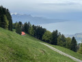
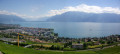
A circular walk that starts on the Vaud plateau and ends overlooking Lake Geneva on the heights of Lavaux, a region listed as a UNESCO World Heritage Site. There is a short stretch of tarmac road at the start before crossing the forests of Mont Cheseau and then those of Mont Pèlerin, leading to a magnificent panorama: almost the entire length of Lake Geneva and the French Alps opposite. This walk offers moderate shade and is therefore best avoided during heatwaves; the month of May usually offers lovely fields of daffodils for enthusiasts.

Details

n°55885864
Creation:
Last update:
Last review:
  • Walking
    Activity: Walking
  • ↔
    Distance: 6.09 mi
  • ◔
    Average duration: 4h 05 
  • ▲
    Difficulty: Moderate

  • ⚐
    Back to start: No
  • ↗
    Ascent: + 1,467 ft
  • ↘
    Descent: - 1,004 ft

  • ▲
    Highest point: 3,563 ft
  • ▼
    Lowest point: 2,185 ft

Description of the walk

The walk starts at Palézieux station (Swissrando marker).

(S) Head south and follow the tarmac road running alongside the railway line (towards Lausanne).

(1) After about 1 km, turn right to stay alongside the railway line.

(2) After about 400 m, turn left onto a grassy path that climbs towards La Cuvigne. Pass the Grands Champs farm on your left and continue uphill until you reach the tarmac road. Follow this road to the right, cross the Chemin de Puidoux on your right, carry on straight ahead and you’ll come to a junction.

(3) Turn right onto the Route de la Léchère, which climbs quite steeply. Carry on straight ahead until you reach the edge of the forest. The tarmac ends; continue along a track that enters the forest. After about a hundred metres, turn left onto the track and climb up to a clearing at a place called La Grangette.

(4) The track turns into a footpath and climbs to the right, more or less following the edge of the forest. It opens out onto a meadow, in the middle of which stands a magnificent oak tree several hundred years old. Walk up through the meadow, keeping to the left, and cross a small, unnamed pass. Descend to the Chesau mountain pasture (refreshment kiosk).

(5) Continue straight ahead (south) towards Mont Pèlerin. Reach the Mollie mountain pasture.

(6) Turn right (south-west) onto a pleasant path for a short climb. Enter the forest and descend slightly towards Chardonne.

(7) Just before leaving the forest, take a sharp left turn (be careful not to miss this turn-off). The path, which is quite steep, climbs towards Mont Pèlerin. After about 400 m heading north-east, turn right (south; follow the yellow markings carefully). This will take you to the “Mont Pèlerin” signpost.

(8) Turn left towards Mont Pèlerin Station, leaving the Mont Pèlerin tower on your right (yellow markings). Heading south-east, the path crosses a beautiful forest before joining a tarmac road (beautiful view over Lake Geneva).

(9) Follow the road to the left (Chemin de la Maison Jean) and go round an underground cistern on the left. Immediately afterwards, turn right onto a winding path, carefully following the yellow markings. After a dizzying descent (metal steps), you’ll emerge into meadows above the Mont Pèlerin resort.

(10) Follow the tarmac road to the right (Chemin du Pèlerin) to the upper station of the funicular (terminus of the Vevey–Mont-Pèlerin line) (E).

Waypoints

  1. S : mi 0 - alt. 2,205 ft - Gare de Palézieux
  2. 1 : mi 0.64 - alt. 2,205 ft - Junction
  3. 2 : mi 0.94 - alt. 2,201 ft - Junction
  4. 3 : mi 1.5 - alt. 2,503 ft - Chemin de la Léchère
  5. 4 : mi 2.33 - alt. 3,084 ft - La Grangette
  6. 5 : mi 2.84 - alt. 3,186 ft - Chesau mountain pasture refreshment hut
  7. 6 : mi 3.16 - alt. 3,127 ft - La Mollie mountain pasture
  8. 7 : mi 3.71 - alt. 3,278 ft - Edge of the forest
  9. 8 : mi 4.41 - alt. 3,547 ft - Waymark - Mont Pèlerin (1079 m)
  10. 9 : mi 5.42 - alt. 3,159 ft - Chemin de la Maison Jean – View of the - Lac Léman
  11. 10 : mi 5.88 - alt. 2,785 ft - Chemin du Pèlerin
  12. E : mi 6.09 - alt. 2,657 ft - Funicular - Gare de Mont-Pèlerin

Notes

We recommend taking the train there and the funicular back. Alternatively, arrange to use at least two vehicles for this round-trip hike.

The Chesau mountain pasture (5) serves as a mountain refreshment stop where you can have a bite to eat, have a drink and top up your water supplies if necessary.

Reviews and comments

4.7 / 5
Based on 1 review

Reliability of the description
5 / 5
Ease of following the route
5 / 5
Route interest
4 / 5
User 3888573

Overall rating : 4.7 / 5

Date of your route : Aug 08, 2025
Reliability of the description : ★★★★★ Very good
Ease of following the route : ★★★★★ Very good
Route interest : ★★★★☆ Good
Very busy route : No

Several paved sections, but beautiful moments in pleasant forests during this hot period.
It's a shame that the possibility of climbing the Mont Pèlerin tower, which offers a magnificent view, wasn't mentioned.
Thank you!

Machine-translated

Other walks in the area

For more walks, use our search engine .

The GPS track and description are the property of this route's author. Please do not copy them without permission.