


Refine your search for walks in Gare de Die
Gare de Die walks


 Châtillon-en-Diois (Le Beffroi) – Die (SNCF station), through the vineyards
 Visorando Member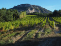
 11.32 mi
 +541 ft
 -1,152 ft
 5h 40
5h 40
 Moderate
 Departure from Châtillon-en-Diois (Drôme)
This lovely walk allows visitors staying in Châtillon-en-Diois to reach Die on foot, passing through vineyards and walnut groves situated in the foothills of the Glandasse, the southern outcrop of the Vercors overlooking the Drôme valley and the Baronnies.
The route allows time to appreciate the uniformity of this geographical landscape, which characterises the upper Drôme and its tributary, the Bez.
Walks near Gare de Die
From the Baraque du Pison to the Cabane de l’Essaure
 Association / Club / Walk leader
 6.53 mi
+1,234 ft
-889 ft
4h 05
Moderate
Departure from Romeyer (Drôme)
6.53 mi
+1,234 ft
-889 ft
4h 05
Moderate
Departure from Romeyer (Drôme)
This is the third stage of this Vercors traverse. We’re now reaching the southern part of the Vercors plateau, where the terrain and vegetation make navigation very tricky, but the scenery becomes absolutely stunning!
 Pré Peyret – Col de Vassieux Hut
10.33 mi
+2,047 ft
-2,818 ft
5 hrs
 Difficult
Departure from Gresse-en-Vercors (Isère)
Difficult
Departure from Gresse-en-Vercors (Isère)
The second stage of our Corrençon–Ambel–Corrençon circular route set off from the Cabane de Pré Peyret towards the Col du Rousset and then on to the Cabane du Col de Vassieux.
Pré Peyret Shelter - Chatillon-en-Diois
 12.95 mi
+1,962 ft
-5,259 ft
7h 40
Difficult
Departure from Gresse-en-Vercors (Isère)
12.95 mi
+1,962 ft
-5,259 ft
7h 40
Difficult
Departure from Gresse-en-Vercors (Isère)
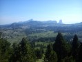
The fifth and final stage of this journey through the Vercors. We set off to tackle the Glandasse, with superb views of the high plateaus, the Veymont, Mont Aiguille and the Drôme Provençale.
Montagne de Faraud from Saint-Benoît-en-Diois
 10.94 mi
+3,205 ft
-3,199 ft
7h 50
Difficult
Departure from Saint-Benoit-en-Diois (Drôme)
10.94 mi
+3,205 ft
-3,199 ft
7h 50
Difficult
Departure from Saint-Benoit-en-Diois (Drôme)
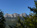
A beautiful circular leading to a summit offering stunning views of the Vercors, Diois and Trois Becs.
From the Druise Waterfall to Léoncel via the Gueulards Canyon
 8.99 mi
+2,300 ft
-1,220 ft
6h 10
Moderate
Departure from Omblèze (Drôme)
8.99 mi
+2,300 ft
-1,220 ft
6h 10
Moderate
Departure from Omblèze (Drôme)
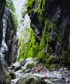
First stage of the circular route around Omblèze in the Southern Vercors. This route begins with a visit to the Chute de la Druise, one of the most beautiful waterfalls in the Vercors, which plunges 70 metres from the bottom of a narrow gorge. After passing through the Gervanne Gorge, you come to the charming little Pissoire Waterfall, followed by a crossing of the Gueulards Canyon, a unique geological feature that inspires both unease and delight, before reaching the small, isolated village of Léoncel and its 12th-century abbey, with its old-world charm, which offers hospitality in a discreet manner.
Pas of hollowed-out tree trunks serving as drinking troughs
 4.95 mi
+1,529 ft
-3,763 ft
3h 35
Difficult
Departure from Chichilianne (Isère)
4.95 mi
+1,529 ft
-3,763 ft
3h 35
Difficult
Departure from Chichilianne (Isère)
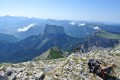
The second day takes you to the highest point of the route: Le Grand Veymont. It offers a magnificent view of the Vercors high plateaus, Mont Aiguille and the valley. There is a good chance of seeing ibex and marmots!
From the Cabane de l’Essaure to Clelles station
 5.54 mi
+174 ft
-2,858 ft
2h 40
5.54 mi
+174 ft
-2,858 ft
2h 40
 Easy
Departure from Treschenu-Creyers (Drôme)
Easy
Departure from Treschenu-Creyers (Drôme)
The fourth and final stage of the Vercors crossing. We leave the plateau to descend via Chichilianne to the foot of Mont Aiguille. Choosing Clelles station as the end point for this crossing means you can do the whole thing from Grenoble, but it’s of course possible to arrange for a car to be waiting in Chichilianne before setting off.
Tubanet Hut – Hollowed-Out Tree Trunk Serving as Drinking Trough
16.91 mi
+4,396 ft
-4,511 ft
10 hrs
 Very difficult
Departure from Omblèze (Drôme)
Very difficult
Departure from Omblèze (Drôme)
Stage4 sets off from the Cabane de Tubanet and returns to the high plateaus of the Vercors at the Cabane des Bachassons above Saint-Agnan-en-Vercors.A very long day. It is the longest of the tour.
Cabane des Aiguillettes - Corrençon-en-Vercors
15.15 mi
+666 ft
-3,110 ft
7h 35
Difficult
Departure from Gresse-en-Vercors (Isère)
The fourth and final day of the circular route leading from the L'Aiguillette hut at the foot of the Grand Veymont to the car park at the Corrençon-en-Vercors ski stadium, where we will have left a car.
From the Ambel Farm to Bouvante le Haut
 8.42 mi
+860 ft
-2,966 ft
6 hrs
Very difficult
Departure from Omblèze (Drôme)
8.42 mi
+860 ft
-2,966 ft
6 hrs
Very difficult
Departure from Omblèze (Drôme)
Pastoral plateau, undergrowth, flower-filled meadow. A varied and very pleasant route offering the chance to encounter a rich and unspoilt flora. This route features a very steep descent for the return to Bouvante le Haut via the Col de Rioupeysson.