


Refine your search for walks in Francheville
Francheville walks


 Around Curtil-Saint-Seine
 Visorando Member
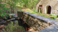
 10.31 mi
 +1,729 ft
 -1,729 ft
 6h 15
 Moderate
 Departure from Francheville (Côte-d'Or)
A lovely walk from the entrance to the Gouffre de la Combe aux Prêtres, passing through the small village of Curtil-Saint-Seine and overlooking the Val Suzon valley.
Hydraulic structures and sinkholes around Curtil-Saint-Seine
11.82 mi
+1,355 ft
-1,355 ft
6h 35
Moderate
Departure from Curtil-Saint-Seine (Côte-d'Or)
A testament to man’s ingenuity in constructing hydraulic works and his propensity to explore the depths.
Tour of the Fontaine des Essarts and the wash houses at Curtil-Saint-Seine
3.33 mi
+397 ft
-397 ft
1h 55
 Easy
Departure from Curtil-Saint-Seine (Côte-d'Or)
This lovely walk through woods and the village will take you to the magnificent site of the Fontaine des Essarts, with its spring, its wash house, its tuff waterfalls, and its two basins which were used to retting the hemp – that is, to soften the fibres by soaking them. You’ll also pass by the village washhouse and the pretty church. And finally, you’ll be able to admire some beautiful beech woods.
Le Châtelet d'Étaules
 4.79 mi
+876 ft
-869 ft
3h 00
Moderate
Departure from Val-Suzon (Côte-d'Or)
Walk in the listed Val-Suzon valley.
The prehistoric Châtelet d'Étaules and its spur bear witness to the early occupation of these places by humans. This valley has long been a crossing point connecting the Seine valley and the Saône valley.
Roche Tabot
 3.16 mi
+502 ft
-509 ft
1h 55
Moderate
Departure from Val-Suzon (Côte-d'Or)
A short, shaded walk along paths that are sometimes little-used, offering a beautiful view of Val-Suzon from Roche Tabot.
The Roche Tabot Tower, starting from Val-Suzon Haut
2.92 mi
+420 ft
-427 ft
1h 40
Easy
Departure from Val-Suzon (Côte-d'Or)
This lovely walk, which starts next to the old Val-Suzon Forges, will allow you to admire the charming old villages of Val-Suzon Haut and Bas, with their old houses, the church at Val-Suzon Bas, and the surrounding green valley. You’ll also walk through the Grande Combe Forest and enjoy the magnificent view from the Roche Tabot viewpoint, perched above the village of Val-Suzon Haut.
Around Val Suzon
7.21 mi
+748 ft
-755 ft
4h 00
Moderate
Departure from Étaules (Côte-d'Or) (Côte-d'Or)
Exploring the Val Suzon site above Sainte-Foy.
Around the Châtelet d’Étaules
 4.37 mi
+269 ft
-246 ft
2h 15
Easy
Departure from Darois (Côte-d'Or)
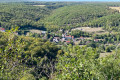
An easy walk to explore the prehistoric site of Châtelet d’Étaules, starting from the car park on the edge of the RD 971. The route takes in several magnificent viewpoints, including the one above the Combe du Diable and the balcony-like section overlooking the Combe Renevey, which offers views of the Éperon Barré and the plateaus on the left bank of the Val Suzon.
The Cèlerons caves
 6.09 mi
+764 ft
-758 ft
3h 30
Moderate
Departure from Val-Suzon (Côte-d'Or)
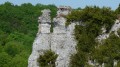
Magnificent valley at Vau de roche. Cliffs, rock shelters, caves, headlands and views of the famous Creux Percé abyss.
Medieval site of Bois de Cestres
12.41 mi
+833 ft
-823 ft
6h 25
Moderate
Departure from Saint-Martin-du-Mont (Côte-d'Or) (Côte-d'Or)
This route takes in the small Côte d'Orienne commune of Saint-Martin-du-Mont, the natural site of the Ru Blanc and the remains of a medieval village dating back to the 14th century.
Balcons du Suzon, part 3
 4.78 mi
+679 ft
-676 ft
2h 45
Easy
Departure from Val-Suzon (Côte-d'Or)
Part 3 of the “Les Balcons du Suzon” trail
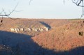
A lovely, gentle trail walk through light woodland and along the cliff face.
See notes in the practical information section.
The tower, the valleys and the forests at Saussy
6.17 mi
+479 ft
-472 ft
3h 15
Easy
Departure from Saussy (Côte-d'Or)
A short and easy hike to discover the valleys around Saussy, including the very wild Combe Quinquendolle, a nature reserve. This hike only uses public paths and forests!
Between Saussy and Vernot
5.17 mi
+735 ft
-735 ft
3h 00
Easy
Departure from Saussy (Côte-d'Or)
A lovely, shaded walk starting from Saussy, with easy parking near the cemetery.
Beautiful views over the Is-sur-Tille State Forest.
Saussy Tower and the Combe Quinquendolle viewpoint
4.07 mi
+177 ft
-174 ft
2h 00
Easy
Departure from Saussy (Côte-d'Or)
This family-friendly walk, with gentle gradients, allows you to admire the following along the way:- the Saussy wind tower, which was used to pump water from the spring situated below the village up to the village itself,- Saussy Castle and its riding arena, which is now used as a riding school, - the lovely Combe Quinquendolle viewpoint.
The best time to take this walk is in autumn or spring.
The Bredin towers at Saussy and Vernot
 13.56 mi
+1,818 ft
-1,837 ft
7h 50
 Difficult
Departure from Saussy (Côte-d'Or)
Circular route around Saussy, winding from valley to valley, which partly follows theGR® 7 and enters the regional nature reserve as well as the Is-sur-Tille State Forest.
It offers the chance to discover the curious history of the Bredin towers, designed to supply water to the village and the castle.
Also worth seeing is the magnificent umbrella-shaped roof structure of the riding school, built in the 19th century by the same architect (please book an appointment with the ASATS association on 0785742798 or 0786832079)
Tour of the washhouses of Saint-Martin-du-Mont
4.51 mi
+381 ft
-374 ft
2h 25
Easy
Departure from Saint-Martin-du-Mont (Côte-d'Or) (Côte-d'Or)
There are numerous hamlets in the commune of Saint-Martin-du-Mont, and each has its own picturesque washhouse! During this leafy walk through fields and villages, you can admire the wash houses at Cestres, Saint-Martin-du-Mont, Bordes Bricard and Froideville. The best time to take this walk is in early spring, when everything is turning green again, the first flowers are sprouting from the ground, and the streams and wash houses are overflowing with rushing water!
Between Etaules and Val Suzon
 4.69 mi
+666 ft
-669 ft
2h 45
Moderate
Departure from Étaules (Côte-d'Or) (Côte-d'Or)
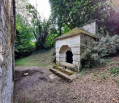
A lovely trail that passes by an old 18th-century washhouse, a spring and a promontory fort that takes us back 6,000 years.
Circular route through the Val Suzon via Pasques and the area around Panges.
10.73 mi
+840 ft
-853 ft
5h 40
Moderate
Departure from Saint-Martin-du-Mont (Côte-d'Or) (Côte-d'Or)
A walk in the Val Suzon which, for a while following an old railway line, takes us from caves to chasms in the vicinity of Pasques and Panges, through woods and fields.
Val Suzon: from springs to caves
 9.58 mi
+1,125 ft
-1,132 ft
5h 25
Moderate
Departure from Saint-Martin-du-Mont (Côte-d'Or) (Côte-d'Or)
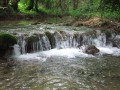
From the tufa-strewn torrent of the Rui Blanc, which cascades down to the Suzon via the steep heights of the Val Suzon, the route takes you through remote corners of the world, perched caves and climbing sections, through boxwood groves and along the edges of plateaus, before revealing a karstic cave – a geological curiosity unique to this region.
Abandoned dwellings from Cestres to Ru Blanc, passing by wash houses.
 11.80 mi
+833 ft
-814 ft
6h 10
Difficult
Departure from Saint-Martin-du-Mont (Côte-d'Or) (Côte-d'Or)
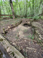
A pleasant, idyllic walk starting from Val Suzon, offering the chance to visit the archaeological site of Cestres – now abandoned dwellings – including the Puits Gaillard. It then takes us from one wash house to another between Cestres, Froideville and Les Bordes Bricard before heading back down theGR®®2to reach the Ru Blanc resurgence.
Ru Blanc circular loop
5.68 mi
+538 ft
-535 ft
3h 05
Easy
Departure from Saint-Martin-du-Mont (Côte-d'Or) (Côte-d'Or)
Hike starting from the picnic area, allowing you to climb up the pleasant Ru Blanc site. Pass by the Gaillard well and the ruins of the medieval settlement before descending the Combe d'Été to rejoin the old cart track.
The Balcons du Suzon are easy to access from the Maison Forestière du Roy Jeannot.
 5.40 mi
+423 ft
-427 ft
2h 50
Easy
Departure from Étaules (Côte-d'Or) (Côte-d'Or)
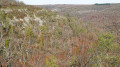
For an almost complete tour of the Suzon balconies, on the right bank, starting from the Maison Forestière du Roy Jeannot. An easy, not very long route with little elevation gain, allowing you to admire the most beautiful panoramas of this part of the Val Suzon.
Les Balcons du Suzon, part 2
 4.89 mi
+745 ft
-738 ft
2h 55
Easy
Departure from Messigny-et-Vantoux (Côte-d'Or)
This is another section (2) of the marked trail "Les Balcons du Suzon". It follows on from the first route starting from Messigny-et-Vantoux towards Sainte-Foy.
Part of the route is through woods and hillsides with views of the Val Suzon.
The walking time depends on the hiker. The time indicated was calculated based on half walking and half trail running.
From the start in Sainte Foy: 1 hour 30 minutes.
From Sainte Foy back via theGR®7: 30 minutes (jogging pace).
Circular Washhouses Tour, starting from Saint-Martin-du-Mont
11.52 mi
+909 ft
-915 ft
6h 05
Moderate
Departure from Saint-Martin-du-Mont (Côte-d'Or) (Côte-d'Or)
A pleasant walk starting from Saint-Martin-du-Mont, taking in wash houses, wind turbines and a beautiful abbey.
This discovery route takes you gently through green hills and vast fields.
The springs on the hillsides in Darois
4.65 mi
+630 ft
-630 ft
2h 40
Easy
Departure from Darois (Côte-d'Or)
A not-too-long walk to explore the three springs on the hillsides to the east of Darois, alternating between the GR®2 and the GR®7.
Darois–Étaules circular loop
 4.88 mi
+584 ft
-571 ft
2h 45
Moderate
Departure from Darois (Côte-d'Or)
A lovely walk, starting from Darois along part of the Bouton d’Or trail through the woods, then from Étaules through pleasant countryside overlooking the Dijon region.
The terrain south of Lamargelle
 5.95 mi
+709 ft
-722 ft
3h 20
Easy
Departure from Lamargelle (Côte-d'Or)
A circular route around Lamargelle, to discover this beautiful village on the banks of the Ignon, the Combe Saint-Seine and the sweeping landscapes of this secluded valley. This route showcases the village, set in the beautiful valley of the Ignon with its mills, wash houses and castle. It also takes you through the valleys linked to the golden legend of Saint-Seine, who founded the abbey of the same name, and whose abbots owned Lamargelle Castle.
The Suzon ridges
 9.18 mi
+1,398 ft
-1,398 ft
5h 25
Moderate
Departure from Messigny-et-Vantoux (Côte-d'Or)
Quite a varied route with many beautiful viewpoints. Several rocky passages, one of the Côte d'Or's most beautiful valleys.
Les Balcons du Suzon, part 4
 5.07 mi
+856 ft
-853 ft
3h 05
Moderate
Departure from Messigny-et-Vantoux (Côte-d'Or)
Last section of the Suzon balconies.
Route taken in the direction of the Route d'Étaules - Roche Tire-Barbe car park (there and back).
Beautiful trail along the edge of the cliffs with views of the Val Suzon.
In pursuit of the mares of Moloy and Courtivron
9.02 mi
+715 ft
-735 ft
4h 45
Moderate
Departure from Moloy (Côte-d'Or)
Through the valleys and forests around Moloy, this is a long summer walk, often in the shade, offering the chance to explore the valleys and springs of the Ignon Valley. The route passes by the two ‘Juments’ – Moloy and Courtivron – which are the two farms on the limestone plateaus above Moloy.
Circular route in the Moloy National Forest starting from L'Abergement.
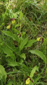 6.49 mi
+643 ft
-656 ft
3h 35
Moderate
Departure from Moloy (Côte-d'Or)
Walk in the Moloy National Forest. This walk will take you along the Bellefontaine Forest Road, past the summits and through numerous valleys. The Combe de Bellefontaine is home to a site famous for its wild orchids, the Lady’s Slipper orchids.
"Legend has it that, pursued by a satyr, Venus lost her clogs in the forest whilst running to escape him. Ever since that day, lady’s slippers have sprung up every spring."André Beuchot
The route to the Pasques sites
 6.75 mi
+449 ft
-476 ft
3h 30
Moderate
Departure from Pasques (Côte-d'Or)
An unusual and pleasant forest walk, made easier by the local council and residents of Pasques, leading to the Abîme du Creux Percé and the Poste du Président, as well as to the discovery of a few abandoned dwellings scattered here and there; places sometimes steeped in history dating from the Early Middle Ages or the 11th to 14th centuries.
Abandoned sites and dwellings at Pasques
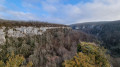 12.20 mi
+1,066 ft
-1,070 ft
6h 30
Moderate
Departure from Pasques (Côte-d'Or)
A walk that takes you off the beaten track to natural and unusual sites, as well as to ten abandoned dwellings. These are places sometimes steeped in history, dating from the Early Middle Ages or the 11th to the 14th centuries.
This walk would never have come about without the kind permission and involvement of the local councillors and members of the archaeological section of the Foyer Rural de Pasques, who have worked for eight years to showcase the sites described.
Carpe and mammoths on the Pasques plateau
 9.51 mi
+594 ft
-617 ft
4h 55
Moderate
Departure from Pasques (Côte-d'Or)
Discover several major attractions – Combe aux Mammouths, Saut à la Carpe and Creux Percé – from the village of Pasques. Not too much elevation gain and long stretches through the forest to shelter from the sun or wind.
Around Saulx-le-Duc
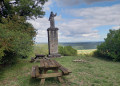 5.67 mi
+564 ft
-568 ft
3h 05
Easy
Departure from Saulx-le-Duc (Côte-d'Or)
A short, easy and very pleasant hike leading to the Butte Saint-Siméon in Saulx-le-Duc, the highest point offering a beautiful view of the Ignon valley. No technical difficulty, but the climb to the Butte Saint-Siméon is steady.
Fort d’Hauteville, Darois and Hauteville
 Association / Club / Walk leader
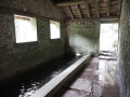 8.58 mi
+1,447 ft
-1,444 ft
5h 10
Moderate
Departure from Daix (Côte-d'Or)
This route is a continuation of the route entitled ‘Les Cabiotes and winegrowers' huts of Hauteville-les-Dijon’. It allows you to discover other aspects of the heritage of this vast plateau. Firstly, the Fort d’Hauteville, which is being given a new lease of life thanks to the Association des Amis du Fort d’Hauteville and the municipality of Hauteville-les-Dijon. It is one of the last military forts to have remained in active service, alongside that of La Motte Giron above the Combe à la Serpent.
You’ll discover one of the few lavender fields in the Dijon area, and Darois Aerodrome. Further on, you’ll find the Orée du Bois campsite, followed by a remarkable 19th-century wash house. Then come the two beautiful springs: the Fontaine de la Trouvée and the Chênaux. On the way back, once you’ve returned to the plateau, you’ll be treated to a lovely view of the Dijon plain and, as you pass by, the beautifully restored Rogne spring.
The cabiotes and winegrowers' huts around Hauteville-lès-Dijon
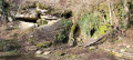 6.85 mi
+797 ft
-787 ft
3h 50
Moderate
Departure from Hauteville-lès-Dijon (Côte-d'Or)
In our region, there are many stone structures called cadoles, cabotes or cabiotes, which were once used as shelters by farmers. Winegrowers' huts are piles of stones gathered from fields, and a similar structure, murgers, refers to piles of stones left over from clearing fields. The proposed route allows you to discover some of these structures, which have been restored by a local association. You can find out more about their work and explanations on their website, with the participation of the "Sentiers" integration association. This is our small rural heritage. It is important to know about it (and to preserve it), as well as the customs of a bygone era, which have nevertheless shaped our landscapes.
In the region, the terms "cadoles" and "cabotes" refer to the same type of construction, often found near vineyards. However, the term "cabiote" is used very locally in the Hauteville-les-Dijon area.
Baulme-la-Roche site
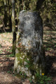 3.99 mi
+509 ft
-358 ft
2h 15
Easy
Departure from Baulme-la-Roche (Côte-d'Or)
A route mainly through woodland on the hills above Baulme-la-Roche, leading to La Roche Aiguë and past an old boundary marker. In spring, you can see martagon lilies, pick daffodils and admire the villages of Baulme and Malain. A remarkable natural site featuring limestone grasslands, this area has been listed as a natural heritage site since 1942. The cliffs are part of an Area of Special Interest.
Roche Aigüe and Baulme-la-Roche Cliffs Viewpoints
 4.46 mi
+604 ft
-574 ft
2h 35
Easy
Departure from Baulme-la-Roche (Côte-d'Or)
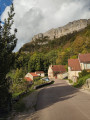
A lovely walk along the hills between Baulme-la-Roche and La Roche Aigüe, overlooking Malain and the Ouche valley. You can admire the springs of the Douix at the entrance to the village of Baulme-la-Roche, with a small cave, a restored wash house and a water reservoir nearby. You’ll pass through this picturesque village and, from above, can admire the lush green countryside stretching between Baulme-la-Roche and Malain.
The two springs at the start of Hauteville-lès-Dijon
 5.74 mi
+732 ft
-712 ft
3h 15
Moderate
Departure from Hauteville-lès-Dijon (Côte-d'Or)
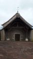
This circular route allows you to explore the village of Hauteville-lès-Dijon and see the recently restored Ronge fountain and the Chêneaux spring, which is still undergoing restoration.
Both springs are sensitive natural areas with protected species. Please respect these species and, in particular, keep your pets away from these areas.