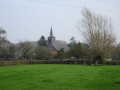
A green getaway between the Sambre and the countryside from Pont-sur-Sambre to Bachant

Discover the natural and cultural heritage of the towns of Pont-sur-Sambre and Bachant.

Details

n°49392778
Creation:
Last update:
Last review:
  • Walking
    Activity: Walking
  • ↔
    Distance: 7.31 mi
  • ◔
    Average duration: 3h 25 
  • ▲
    Difficulty: Moderate

  • ⚐
    Back to start: Yes
  • ↗
    Ascent: + 69 ft
  • ↘
    Descent: - 75 ft

  • ▲
    Highest point: 472 ft
  • ▼
    Lowest point: 410 ft

Photos

Description of the walk

Park on Grand Rue, near the Tour du Guet, in Pont-sur-Sambre.

(S/E) Take the path on the left, opposite No. 184, to explore the Pont-sur-Sambre water sports centre. Follow the path then the street (Ruelle Maitte), and return to the main road. Turn left (Grand Rue) then turn right onto Ruelle Jome, and you’ll arrive in front of the nursery school, Résidence Les Tilleuls.

(1) Turn left and take the second street on the right. Continue left until you reach a side street (Rue de Bel Air).

(2) Turn right onto this street, carry on straight ahead and ignore a footpath on the right and a street on the left. At the junction, turn left (Rue de Quartes), and head towards the Church of Quartes.

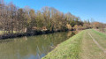
(3) Turn right in front of the church, towards Saint-Rémy du Nord, then turn right onto Rue de la Fontaine de Quartes. Opposite No. 26, turn left (Rue de Pantegnies), then cross the bridge over the Sambre and take the towpath on the left. Pass under the power lines and continue to the Pantegnies Nature Reserve.

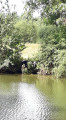
(4) Turn right and enter the reserve. Be sure to follow the recommended route outlined here to explore it. At the junction of two paths, take the one on the left, which curves round and leads to the observatory. Return to the path; at the junction, continue to the left and keep going until you reach a fork in the road.

(5) At this junction, carry on along the path to the left, and at the next junction, keep left. Then carry on straight ahead, ignoring the small paths on either side, until you reach the railway line.

(6) Turn onto the path on the right and cross the railway line. Carry on until you reach the road, passing under the power lines.

(7) Keep left through the Cité de Pantegnies, then take the first hairpin bend on the right (Chemin de Pont-sur-Sambre Maubeuge). Then turn left (Chemin Rural de Pantegnies), with the River Sambre below you. When you reach the houses, carry straight on (Rue de la Puissance), ignoring all side paths, until you reach a chapel.

(8) Carry on straight ahead along this street, passing the Church of Bachant on your left, until you reach a roundabout.

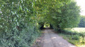
(9) Turn right (Rue Notre-Dame), ignore Rue de la Fontaine on your right and cross the bridge over the Sambre. Turn left immediately to follow theGR® 655 –GRP® towpath to the entrance to Pont-sur-Sambre.

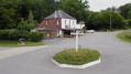
(10) Turn right (Grand Rue) and carry on straight ahead. You’ll see a wayside shrine on your left, as well as the Maison de Pays (the birthplace of Félix Del Marle). Continue straight ahead to the watchtower and return to the starting point (S/E).

Waypoints

  1. S/E : mi 0 - alt. 430 ft - Watchtower and boating stop at Pont-sur-Sambre
  2. 1 : mi 0.31 - alt. 446 ft - School
  3. 2 : mi 0.5 - alt. 453 ft - Rue de Bel Air
  4. 3 : mi 0.68 - alt. 436 ft - Church of Les Quartes
  5. 4 : mi 3.01 - alt. 413 ft - Pantegnies Nature Reserve - Sambre à finaliser
  6. 5 : mi 3.67 - alt. 446 ft - Fork in the Pantegnies Nature Reserve
  7. 6 : mi 4.16 - alt. 469 ft - Railway line
  8. 7 : mi 4.72 - alt. 463 ft - Chemin de Pont-sur-Sambre, Maubeuge.
  9. 8 : mi 5.72 - alt. 449 ft - Chapel
  10. 9 : mi 6.02 - alt. 420 ft - Roundabout
  11. 10 : mi 6.91 - alt. 430 ft - Grand Rue
  12. S/E : mi 7.31 - alt. 430 ft - Watchtower and water sports centre at Pont-sur-Sambre

Notes

This route is not signposted at present but will be soon as part of the ‘Escales Sambre’ scheme.

Short alternative route.
(7) Turn right at the Cité de Pantegnies and carry on straight ahead along Route de Pantegnies to reach the bridge over the Sambre; continue straight on towards the church. At (2), turn left into the Résidence les Tilleuls, then take the first right. Carry on straight ahead until you reach the nursery school, then turn right onto Ruelle Jome. At the end of the street, turn left onto Grand Rue and return to the starting point.

Worth a visit

Always be cautious and plan ahead when you're outdoors. Visorando and the author of this route cannot be held responsible for any accidents occurring on this route.

The GR® and PR® markings are the intellectual property of the Fédération Française de Randonnée Pédestre.

Reviews and comments

4.7 / 5
Based on 1 review

Reliability of the description
5 / 5
Ease of following the route
4 / 5
Route interest
5 / 5
SG59
SG59

Overall rating : 4.7 / 5

Date of your route : Nov 12, 2025
Reliability of the description : ★★★★★ Very good
Ease of following the route : ★★★★☆ Good
Route interest : ★★★★★ Very good
Very busy route : No

Very nice route overall. A little difficult to follow in the Pantegnies reserve.

Machine-translated

Other walks in the area

For more walks, use our search engine .

The GPS track and description are the property of this route's author. Please do not copy them without permission.