Between Foncegrive and Selongey via the Ferme des Groises

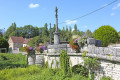
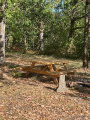
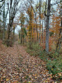
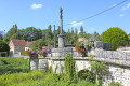
A circular route, mostly through woodland, between Foncegrive and Selongey, passing by the Ferme des Groises.

Details

n°16400725
Creation:
Last update:
Last review:
  • Walking
    Activity: Walking
  • ↔
    Distance: 6.80 mi
  • ◔
    Average duration: 3h 40 
  • ▲
    Difficulty: Moderate

  • ⚐
    Back to start: Yes
  • ↗
    Ascent: + 610 ft
  • ↘
    Descent: - 584 ft

  • ▲
    Highest point: 1,499 ft
  • ▼
    Lowest point: 1,001 ft
  • ⚐ Country: France
  • ⚐ City: Foncegrive (21260)
  • ⚑
    Start/End: N 47.611121° / E 5.156021°
  • ❏
    IGN map(s): Ref. 3121SB
  • Hour-by-hour weather

Photos

Description of the walk

The walk starts from the car park at Foncegrive Town Hall, Rue du Pont de la Venelle.

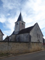
(S/E) Leave the car park and turn right onto Rue du Mont, passing in front of the church and continuing straight on.

(1) At the water tower, continue to the right along the small road which, further on, turns into a stony track.

(2) At the Y-junction, continue to the right along the stony track.

(3) At Les Herbues, leave the track and take a wide, grassy forest path on the left, marked with a Yellow Cross. At the next X-junction, carry on straight ahead.

(4) At the T-junction, turn left onto a wide, grassy forest track. At the end of the track, you’ll come to a track.

(5) Turn right onto it and, at the next Y-junction just after, turn right.

(6) At the T-junction in front of a gate, turn left then straight on along the fence, then follow the 90° bend and join a stony track.

(7) Take the hairpin bend to the left, then carry on straight ahead, passing the Ferme des Groises.

(8) Carry on straight ahead along this track and enter Selongey. The track becomes a small road, Rue de la Cote du Tertre.

(9) At the T-junction with a small roundabout, carry on straight ahead along Rue de la Cité. At the end of the street, turn left then right onto Rue de Marey.

(10) At the T-junction with a wide track, before house no. 4, take the track on the left known as Chemin de Grancey.

(11) At the Y-junction, turn left onto Chemin des Ruelles and continue along this path to reach Foncegrive, ignoring the turnings to the left and right. You will come to the junction by the water tower.

(1) Turn right and walk down Rue du Mont to reach the town hall (S/E).

Waypoints

  1. S/E : mi 0 - alt. 1,027 ft - Foncegrive Town Hall car park
  2. 1 : mi 0.26 - alt. 1,093 ft - Water tower
  3. 2 : mi 0.85 - alt. 1,368 ft - Bassot
  4. 3 : mi 1.12 - alt. 1,437 ft - Les Herbues
  5. 4 : mi 1.39 - alt. 1,499 ft - Above Les Herbues
  6. 5 : mi 1.94 - alt. 1,450 ft - Voie aux Foins
  7. 6 : mi 2.15 - alt. 1,460 ft - Gate in a fence.
  8. 7 : mi 3.02 - alt. 1,355 ft - Les Broussailles
  9. 8 : mi 3.52 - alt. 1,312 ft - Ferme des Groises
  10. 9 : mi 4.44 - alt. 1,102 ft - Rue de la Cité
  11. 10 : mi 4.66 - alt. 1,010 ft - Chemin de Grancey
  12. 11 : mi 4.86 - alt. 1,007 ft - Chemin des Ruelles
  13. S/E : mi 6.8 - alt. 1,027 ft - Foncegrive Town Hall car park

Notes

Please note: it is not possible to continue on to Marey-sur-Tille as the Marey Forest is completely fenced off.

Reviews and comments

4.7 / 5
Based on 1 review

Reliability of the description
5 / 5
Ease of following the route
5 / 5
Route interest
4 / 5
Chabanis
Chabanis

Overall rating : 4.7 / 5

Date of your route : Jun 24, 2025
Reliability of the description : ★★★★★ Very good
Ease of following the route : ★★★★★ Very good
Route interest : ★★★★☆ Good
Very busy route : No

The hike starts with a long, gradual climb of about 20 minutes to enter the forest.
It is easy going and very pleasant, mostly through the forest, which is very welcome in hot weather.
We highly recommend it!

Machine-translated

Other walks in the area

For more walks, use our search engine .

The GPS track and description are the property of this route's author. Please do not copy them without permission.