


Refine your search for walks in Ennepetal
Ennepetal walks


 Airy heights and babbling brooks, Ennepetal
 Tourism professional
 9.16 mi
 +1,148 ft
 -1,135 ft
 5h 15
5h 15
 Moderate
 Departure from Ennepetal (Regierungsbezirk Arnsberg)
The partly redesigned circular walk offers views of the Heilenbecke valley and two of its tributaries. At the start, the walk follows the Heilenbecker-Hangweg with virtually no incline. Other stops along the route include the village of Wittenstein with its old half-timbered houses, the Grimmelsberg and the Königsfeld spa clinic.
To the left and right of the Heilenbecke, Ennepetal
5.13 mi
+702 ft
-702 ft
3h 00
 Easy
Departure from Ennepetal (Regierungsbezirk Arnsberg)
Easy
Departure from Ennepetal (Regierungsbezirk Arnsberg)
The regional walking route “Left and Right of the Heilenbecke” is a circular walk from Uhlenbart via Rüggeberg, the Heilenbecke Dam, Ravenschlag and Wittenstein back to the starting point. Dense forests, meadows, quiet woodland paths and views of the Bergisch landscape characterise the route. The historic village of Wittenstein adds a touch of regional history to the scenic impressions.
Around Voerde, Ennepetal
4.13 mi
+397 ft
-387 ft
2h 15
Easy
Departure from Ennepetal (Regierungsbezirk Arnsberg)
The circular walking route around Ennepetal-Voerde begins and ends at the fairground. The route leads through Lindenstraße, along Friemannweg and via Vilvoorder Straße into the rural surroundings featuring fields, hills, farmsteads and wooded hillsides. Further stops include Störringen, Gut Braband and the Ferdinand Bilstein site. The circular route then leads back to the starting point.
Herbringhauser Acht
 Visorando Member
 9.71 mi
+817 ft
-794 ft
5h 10
Moderate
Departure from Remscheid (Regierungsbezirk Düsseldorf)
9.71 mi
+817 ft
-794 ft
5h 10
Moderate
Departure from Remscheid (Regierungsbezirk Düsseldorf)
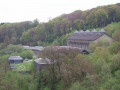
This walk starts in Remscheid-Lüttringhausen, near the A1 motorway, crosses the Herbringhausen Dam, follows the Herbringhausen Stream to the River Wupper and back, circles round Herbringhausen, then follows a figure-of-eight route back up to the dam and returns to the starting point. Parts of the route follow the Röntgenweg and the Wuppertal Circular Walk.
Through the Muttental and Bommerholz to the Mining Trail
 10.15 mi
+915 ft
-935 ft
5h 30
Moderate
Departure from Witten (Regierungsbezirk Arnsberg)
10.15 mi
+915 ft
-935 ft
5h 30
Moderate
Departure from Witten (Regierungsbezirk Arnsberg)
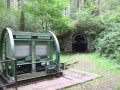
The route takes you through Muttental and Bommerholz, partly along the so-called Mining Trail, which offers small, museum-like insights into mining, down to the Hardenstein ruins on the River Ruhr and back to the starting point.
Muttental Mining Circular Walk
 6.32 mi
+653 ft
-636 ft
3h 30
Moderate
Departure from Witten (Regierungsbezirk Arnsberg)
6.32 mi
+653 ft
-636 ft
3h 30
Moderate
Departure from Witten (Regierungsbezirk Arnsberg)
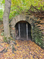
The historic Muttental Mining Circular Walk passes not only the Hardenstein Castle ruins on the banks of the Ruhr but also the Nachtigall Colliery. Here you’ll find a museum with an interesting exhibition.
Around the Dhünn Dam
 13.73 mi
+1,440 ft
-1,444 ft
7h 35
Moderate
Departure from Odenthal (Cologne Government Region)
13.73 mi
+1,440 ft
-1,444 ft
7h 35
Moderate
Departure from Odenthal (Cologne Government Region)
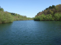
This tour takes you around the Dhünn Dam, Germany’s second-largest drinking-water reservoir, in the Bergisches Land.The Bergisches Land does not take its name from its landscape, as one might suppose, but from its former rulers, the Dukes of Berg.
Bergisch Panoramasteig, Stage 2
 11.95 mi
+1,545 ft
-1,762 ft
6h 50
Moderate
Departure from Kürten (Cologne Government Region)
11.95 mi
+1,545 ft
-1,762 ft
6h 50
Moderate
Departure from Kürten (Cologne Government Region)
From Biesfeld around the Wiesenberg, via Hommerich to Oberheiligenhoven at the LVR Lindlar Open-Air Museum.
About the Hoppenbruch and Hoheward spoil heaps
 6.03 mi
+525 ft
-499 ft
3h 15
Moderate
Departure from Gelsenkirchen (Regierungsbezirk Münster)
6.03 mi
+525 ft
-499 ft
3h 15
Moderate
Departure from Gelsenkirchen (Regierungsbezirk Münster)
On this walk, you’ll experience the traces of mining at the Hoppenbruch and Hoheward spoil heaps, as well as on the site of the former Ewald colliery, first-hand.
Kölner Weg - Stage 2 - From the Sülztal valley via the Lüderich to Kreuznaaf
 Association / Club / Walk leader11.36 mi
+1,243 ft
-1,306 ft
6h 20
Moderate
Departure from Rösrath (Cologne Government Region)
Association / Club / Walk leader11.36 mi
+1,243 ft
-1,306 ft
6h 20
Moderate
Departure from Rösrath (Cologne Government Region)
We hike along beautiful paths over the Lüderich, which has an eventful mining history, pass the winding tower of the Franziska shaft and skirt Hoffnungsthal. Later, we pass a grain distillery in Hofferhof, hike through the valley of the Kupfersiefer Bach and reach a viewpoint behind Oberschönrath with a view of the Cologne Bay and the Siebengebirge mountains. Via the Gammersbacher Mühle mill and the picturesque half-timbered village of Muchensiefen, we reach Kreuznaaf on the Naafbach stream.
The Cologne Trail
162.66 mi
+16,781 ft
-16,804 ft
17 days
Moderate
Departure from Cologne (Cologne Government Region)
The long-distance hiking trail opens up the Königsforst, the southern Bergisches Land, leads through the Westerwald to the monasteries of Marienthal and Marienstatt and into the Kroppacher Schweiz, one of the most charming areas of the Westerwald. We hike through Hachenburg and the Hoher Westerwald and reach the highest point of the Cologne Trail at 567 metres on the Marienberger Höhe. An impressive basalt park near Bad Marienberg and the Stöffel Tertiary Industry Adventure Park near Stockum-Püschen explain the importance of basalt mining. We will be transported to the unique cultural landscape of the Westerwald Lake District near Dreifelden and pass through Metteshahner Schweiz to Neustadt (Wied). On the last section, we will hike to the Drachenfels and Königswinter.
Kölner Weg - Stage 1 - Rath-Heumar through the Königsforst to Rösrath-Sülze
9.56 mi
+591 ft
-482 ft
4h 55
Moderate
Departure from Cologne (Cologne Government Region)
Königsforst is the name of the stop where tram line 9 ends in Cologne-Rath-Heumar, and this is where the Cologne Trail begins. The markings for the Cologne Trail, a white K on a black mirror, which we see for the first time at this point, will guide us safely through the southern Bergisches Land and the Westerwald for 253 kilometres to Königswinter.
We first stroll through a park-like landscape, then through unspoilt forest. On wide, gently ascending paths, we pass a water treading pool, the Kaisereiche oak tree and cross the former Bensberg-Rösrath railway line, hiking through the quiet Wahlbach valley until we reach Lehmbach and Sülze via the Tütberg.