Passing through Pont Saint-Vincent, Bainville and Frolois from Méréville

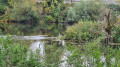
Starting from Méréville, a circular walk to see the does in the Bois du Moulin woods, a short stroll along the Madon before it joins the Moselle.
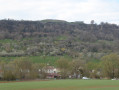
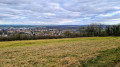
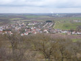
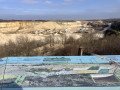
A stretch beneath Fort Pelissier with views over the Madon valley and the hillsides of Messein and Ludres
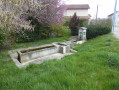
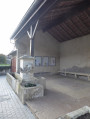
On Rue de la Gare in Bainville-sur-Madon, a stop at the Saint-Martin Fountain.
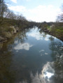
Return along the Madon before the climb up to Frolois and back to Méréville.

Details

n°7550360
Creation:
Last update:
Last review:
  • Walking
    Activity: Walking
  • ↔
    Distance: 9.99 mi
  • ◔
    Average duration: 5h 05 
  • ▲
    Difficulty: Average

  • ⚐
    Back to start: Yes
  • ↗
    Ascent: + 548 ft
  • ↘
    Descent: - 551 ft

  • ▲
    Highest point: 1,027 ft
  • ▼
    Lowest point: 712 ft
  • ⚐ Country: France
  • ⚐ City: Méréville (54850)
  • ⚑
    Start/End: N 48.591782° / E 6.144819°
  • Accessible from the train station Gare de Bainville.
  • ❏
    IGN map(s): Ref. 3315ET, 3416O
  • Hour-by-hour weather

Photos

Description of the walk

The walk starts at the Méréville cemetery, Chemin de la Gravière. Parking available

(S/E) Head towards the village and turn left immediately twice to join the cycle path on Rue de Pont Saint Vincent. At the first junction, veer left to cross over the dual carriageway. At the junction on the cycle path after the bridge, carry straight on then turn right to pass under the road running alongside the Madon.

(1) At the next T-junction, carry on straight ahead, then turn left at the next junction to cycle alongside a small pond. Take the small bridge over the River Madon, continue along the cycle path and go under the railway line.

(2) Turn left onto Rue Albert Thomas. At the end of the street, turn left onto Rue Jean Jaurès and walk past the town hall. At the station, cross the road at the pedestrian crossing and continue along Rue Jean Jaurès.

(3) Turn right onto Rue de Lorraine, then left onto Rue de Touraine. At the Y-junction, turn right.

(4) At the end of Rue de Touraine, turn left onto Rue d’Alsace. At the end of the street, carry on straight ahead along the track, following the green CCMM signposts. Turn 90°, climb up beneath Fort Pélissier and continue along the hillside.

(5) At the junction, take the path down towards Bainville on the left via the Chemin des Vignes and continue straight on between the car parks of the care home. Join the D974 and leave the signposted route.

(6) At the D974, turn right, cross the road at the pedestrian crossing and carry on to turn left onto Rue de la Gare. Walk past the Fontaine Saint-Martin and cross the railway line at the level crossing.

(7) After the railway line, turn right onto the track running alongside the D50. At the stadium, turn left. Opposite the Madon, turn right and follow the river to rejoin the D50.

(8) At the D50, turn left. At the next junction, turn left towards Frolois and cross over the River Madon.

(9) After the bridge over the Madon, turn right onto the ascending track to join the D50A at the entrance to Frolois at elevation 275.

(10) Continue to the right, then take the first road on the left. After the farm, the road turns into a track. Take the first track on the right at elevation 260 and join the D115B by continuing straight ahead.

(11) At the D115B, turn left and continue carefully along this road.

(12) Before reaching Merèville, at the edge of the woods, turn right onto Chemin de Saint-Thiebaut, then immediately left onto Allée Albert Camus and turn left. At the first junction, carry on straight ahead, then turn left and left again onto Allée Henri Cournault. Keep to the left and join Route de Frolois.

(13) Continue straight on along Rue du Moulin Bois. At the junction, go straight on along Rue du Moulin Bois, then turn right onto Rue de la Source.

(14) At the end of this street, turn left onto Impasse de la Source, then right onto Chemin de la Goulotte, then left onto Rue de Pont Saint-Vincent, which will take you back to the starting point (S/E).


Waypoints

  1. S/E : mi 0 - alt. 846 ft - Meréville Cemetery
  2. 1 : mi 2.2 - alt. 719 ft - Junction with Rue de Meréville
  3. 2 : mi 2.68 - alt. 715 ft - Rue Albert Thomas - Moselle (la)
  4. 3 : mi 3 - alt. 738 ft - Rue de Lorraine - Gare de Pont-St-Vincent
  5. 4 : mi 3.24 - alt. 810 ft - Rue d’Alsace
  6. 5 : mi 4.1 - alt. 883 ft - Chemin des Vignes
  7. 6 : mi 4.39 - alt. 741 ft - Rue Jacques Callot
  8. 7 : mi 4.56 - alt. 728 ft - Rue de la Gare
  9. 8 : mi 5.44 - alt. 738 ft - D50 road
  10. 9 : mi 5.7 - alt. 745 ft - The - Madon (le)
  11. 10 : mi 6.45 - alt. 906 ft - D50A road
  12. 11 : mi 8.38 - alt. 965 ft - D115B road
  13. 12 : mi 9.14 - alt. 971 ft - Chemin de Saint-Thiebaut
  14. 13 : mi 9.45 - alt. 896 ft - Route de Frolois
  15. 14 : mi 9.72 - alt. 846 ft - Impasse de la Source
  16. S/E : mi 9.99 - alt. 846 ft - Meréville Cemetery

Worth a visit

The does in the enclosures of the Bois du Moulin Bois
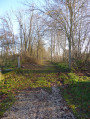
Paths along the River Madon
From beneath Fort Pelissier, views over the Madon valley and the hillsides of Messein and Ludres
The Saint-Martin Fountain in Bainville-sur-Madon

Reviews and comments

4.3 / 5
Based on 2 reviews

Reliability of the description
5 / 5
Ease of following the route
5 / 5
Route interest
3 / 5
Christecol
Christecol

Overall rating : 3.5 / 5

Date of your route : Oct 19, 2022
Reliability of the description : Not used / Not applicable
Ease of following the route : ★★★★★ Very good
Route interest : ★★☆☆☆ Disappointing
Very busy route : No

A few gravel roads have been tarmacked, which means that more than half of this walk is on tarmac!
This walk would be better suited to the mountain biking section rather than the walking section.
Personally, I wouldn’t do it again as it stands.

Machine-translated

franchie
franchie

Overall rating : 4.7 / 5

Date of your route : May 10, 2022
Reliability of the description : ★★★★★ Very good
Ease of following the route : ★★★★★ Very good
Route interest : ★★★★☆ Good
Very busy route : No

The first part of this walk was pleasant, but the final section (11) takes us along the county road for quite some time. The verges hadn’t been mown on this lovely May day. We arrive in the residential area of Méréville.
At point (7), we walk alongside the Madon through tall grass (no path).
At point (8), there’s the option to go round the back of the cement works, which avoids the short stretch along the D50.

Machine-translated

Other walks in the area

For more walks, use our search engine .

The GPS track and description are the property of this route's author. Please do not copy them without permission.