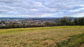
A short walk between Bainville-sur-Madon and Xeuilley

A circular walk starting from Bainville-sur-Madon, through the meadows alongside the River Madon to reach Xeuilley, then along a small road to join the D974 and up the hillside to admire the view over Xeuilley.

Details

16536085
Creation:
Last update:
Last review:
  • Walking
    Activity: Walking
  • ↔
    Distance: 6.05 mi
  • ◔
    Average duration: 3h 10 
  • ▲
    Difficulty: Moderate

  • ⚐
    Back to start: Yes
  • ↗
    Ascent: + 466 ft
  • ↘
    Descent: - 453 ft

  • ▲
    Highest point: 1,093 ft
  • ▼
    Lowest point: 728 ft
  • ⚐ Country: France
  • ⚐ City: Bainville-sur-Madon (54550)
  • ⚑
    Start/End: N 48.58636° / E 6.099804°
  • Accessible from the train station Gare de Bainville.
  • ❏
    IGN map(s): Ref. 3315ET
  • Hour-by-hour weather

Photos

Description of the walk

Parking is available in Bainville-sur-Madon, on Rue de la Gare, after the level crossing on a track running alongside the D50.

(S/E) Head towards the sports ground and turn left to reach the Madon.

(1) At the river, turn right onto a grassy track, pass under the dual carriageway and join the D50. Follow it to the left and walk alongside the road.

(2) At the junction leading into Xeuilley, cross the road and the railway line to continue along Rue de la Gare. Take the first street on the left, Rue Pasteur, then the first street on the left again.

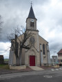
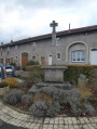
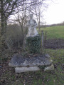
(3) At the end of the street, turn right into Rue Jacques Calloz. At the wayside cross, turn left, walk past the church and turn right

(4) At the junction, carry on straight ahead along Rue de la Libération and take the first street on the right to reach the Arbre de la Liberté, passing in front of the water tower.

(5) From the Place de l’Arbre de la Liberté, carry on left along Chemin du Lacé and take the third road on the right after passing a path on the left.

(6) Turn left onto Route de Maizières and continue straight on along it. Go over the dual carriageway and join the D974. Then continue to the right for about a hundred metres.

(7) Cross the departmental road with care and take the first road on the left. At the Y-junction, turn left onto Rue du Fort.

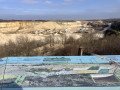
(8) At the 300° bend in the road, turn onto a track on the right and continue straight on until you reach the fence. Turn right, admire the view and head down towards the village. At the T-junction, turn left and then continue straight on along the Chemin des Vignes. Pass through the car park of the retirement home and join the D974.

(9) At the D974, turn right to cross the road at the pedestrian crossing, then at the junction on the left, turn into Rue de la Gare. Continue straight on to return to the starting point, passing the wash house (S/E).

Waypoints

  1. S/E : mi 0 - alt. 728 ft - Car park on Rue de la Gare
  2. 1 : mi 0.3 - alt. 732 ft - The - Madon (le)
  3. 2 : mi 1.4 - alt. 738 ft - Entering Xeuilley
  4. 3 : mi 1.72 - alt. 837 ft - Rue Jacques Calloz - Gare de Xeuilley
  5. 4 : mi 1.9 - alt. 856 ft - Rue de la Libération
  6. 5 : mi 2.07 - alt. 843 ft - Place de l’Arbre de la Liberté
  7. 6 : mi 2.41 - alt. 787 ft - Route de Maizières
  8. 7 : mi 4.2 - alt. 778 ft - Crossing the D974
  9. 8 : mi 5.2 - alt. 1,093 ft - Les Quichottes
  10. 9 : mi 5.87 - alt. 741 ft - Chemin des Vignes
  11. S/E : mi 6.05 - alt. 728 ft - Car park on Rue de la Gare

Worth a visit

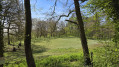
A short walk along the River Madon.
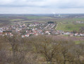
The village of Xeuilley.
At point (3), you can take a short detour by turning left onto Rue Jacques Callot and walking straight on to visit part of the Xeuilley quarry and then retrace your steps.
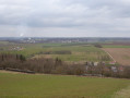
The hillside above Bainville-sur-Madon, with views over the plain.
The area below Fort Pélissier.

Reviews and comments

4.1 / 5
Based on 3 reviews

Reliability of the description
4.3 / 5
Ease of following the route
4.7 / 5
Route interest
3.3 / 5
franchie
franchie

Overall rating : 3.7 / 5

Date of your route : Feb 17, 2025
Reliability of the description : ★★★★☆ Good
Ease of following the route : ★★★★★ Very good
Route interest : ★★☆☆☆ Disappointing
Very busy route : No

I should have read the reviews before setting off on what turned out to be, for the most part, nothing more than tarmac roads. Along the D50 (between 1 and 2), I counted no fewer than 53 cars that overtook me...
Xeuilley isn’t exactly a picturesque village, to say the least! The final stretch is, in fact, very busy with lorries from the quarries, which envelop you in white dust. Then, just to nit-pick, at point 8, the signposting isn’t a round orange marker but rather a yellow ring (unless the colours have faded over time? ).

Machine-translated

Emma Le Kit
Emma Le Kit

Overall rating : 4.7 / 5

Date of your route : Jan 12, 2025
Reliability of the description : ★★★★★ Very good
Ease of following the route : ★★★★★ Very good
Route interest : ★★★★☆ Good
Very busy route : No

A pleasant route with lovely scenery, but quite a bit of walking on tarmac

Machine-translated

Pierre GUILMIN
Pierre GUILMIN

Overall rating : 4 / 5

Date of your route : Feb 11, 2022
Reliability of the description : ★★★★☆ Good
Ease of following the route : ★★★★☆ Good
Route interest : ★★★★☆ Good
Very busy route : No

A walk offering beautiful panoramic views between waypoints 7 and 9.
Two drawbacks:
- before reaching Xeuilley (between waypoints 1 and 2), there is a long stretch alongside a relatively busy road.
- between the section crossing the dual carriageway (bridge between markers 6 and 7) and marker 8, there is a constant stream of lorries travelling to and from the quarries, which are situated on the plateau.
In both cases, you’ll have to walk on the hard shoulder, as there’s no designated space for pedestrians
So avoid doing this walk on weekdays!

Machine-translated

Other walks in the area

For more walks, use our search engine .

The GPS track and description are the property of this route's author. Please do not copy them without permission.