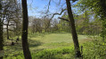
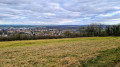
On the hillsides between Bainville and Viterne. Back to the lowlands and Maizières

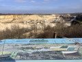
Starting from Bainville-sur-Madon, head up the hillside, passing through the Bois Fossé and the Viterne quarry; take a detour via the orientation table to see the impressive quarry.
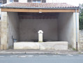
Head down towards Viterne through the woods, passing through the village with its fountain, washhouse and church.
Return across the plain, passing through the village of Maizières with its wash house, church and Stations of the Cross.

Details

18696286
Creation:
Last update:
Last review:
  • Walking
    Activity: Walking
  • ↔
    Distance: 10.07 mi
  • ◔
    Average duration: 5h 15 
  • ▲
    Difficulty: Moderate

  • ⚐
    Back to start: Yes
  • ↗
    Ascent: + 692 ft
  • ↘
    Descent: - 686 ft

  • ▲
    Highest point: 1,270 ft
  • ▼
    Lowest point: 728 ft
  • ⚐ Country: France
  • ⚐ City: Bainville-sur-Madon (54550)
  • ⚑
    Start/End: N 48.58642° / E 6.099784°
  • Accessible from the train station Gare de Bainville.
  • ❏
    IGN map(s): Ref. 3315ET
  • Hour-by-hour weather

Photos

Description of the walk

Start from Bainville-sur-Madon, Rue de la Gare, near the level crossing, on the access track to the sports ground; parking available.

(S/E) Set off along Rue de la Gare towards the village, cross the level crossing and pass the wash house; at the D974, turn right, then left to cross the road at the pedestrian crossing, then right.

(1) Take the first street on the left, towards Centre Parisot, cross the car parks and continue straight on along Chemin des Vignes. At the T-junction, go straight on up the grassy track. At the top of the track, turn left, following the orange round sign, and join the Route du Fort.

(2) Turn right and head uphill to the junction with the access road to Fort Pélissier.

(3) Turn left onto the track, marked with an orange circle and a Blue Cross, heading towards Maizières Town Hall, and carry on straight ahead to cross the Bois Fossé. Join a track (elevation 371) and turn left.

(4) At the entrance to the quarry, carry on straight ahead along the sandy track running alongside the quarry. At the junction with a high-voltage switchbox, take the private track on the right to climb up to the orientation table.

(6) Return to the junction.

(5) Head south-west along the track opposite, marked with a Blue Cross; the track turns into a road and leads into Viterne.

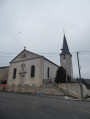
(7) At the end of the street, turn left into Rue du Docteur Sencert; at the junction, carry straight on and pass the Fontaine Poirot. At the Lavoir Moulin, turn left into Rue Antoine to pass in front of the church.

(8) At the top of the street, turn left into Rue de La République. At the cemetery, turn right and leave the village via the D52.

(9) At the junction with the D974, carry on straight ahead, cross the road with care and pass under the D331 to continue along the small road (D52).
Cross the Ruisseau de Rouau and the Sources des Blancs Bœufs and carry on to the right-hand bend.

(10) Then take the track on the left. At the T-junction, carry straight on and, running alongside the dual carriageway, turn left, then pass under this road. Turn right and continue for 100 m.

(11) Then turn left to enter the village of Maizières via Chemin Derrière la Ville and Rue de la Prairie. At the end of the street, turn right onto Rue Carnot and cross the village, passing the wash house and the church.

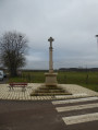
(12) After the church, towards the end of the village, turn right onto Route de Xeuilley, pass the wayside cross and leave the village.

(13) At the junction, veer to the right, cross over the dual carriageway and continue along the small road to Xeuilley.

(14) At the ruin by the small copse, take the track on the left, cross over the dual carriageway again and enter the village of Bainville via Chemin Le Comte, then Rue Le Comte. At the end of the street, turn right, cross the level crossing again and return to the starting point on Rue de la Gare (S/E).

Waypoints

  1. S/E : mi 0 - alt. 728 ft - Rue de la Gare. Near the - Madon (le)
  2. 1 : mi 0.18 - alt. 741 ft - Parisot Centre
  3. 2 : mi 0.86 - alt. 1,096 ft - Route du Fort
  4. 3 : mi 1.37 - alt. 1,270 ft - The Bois Fossé
  5. 4 : mi 2.66 - alt. 1,188 ft - Entrance to the quarry
  6. 5 : mi 3.1 - alt. 1,207 ft - Junction towards the - Table d'orientation de la Friche Midy
  7. 6 : mi 3.18 - alt. 1,260 ft - Table d'orientation de la Friche Midy
  8. 7 : mi 3.97 - alt. 925 ft - Rue du Docteur Sencert
  9. 8 : mi 4.34 - alt. 899 ft - Rue Antoine
  10. 9 : mi 4.97 - alt. 873 ft - D 974
  11. 10 : mi 5.57 - alt. 906 ft - Montreuil. Track
  12. 11 : mi 6.73 - alt. 801 ft - Towards Maizières
  13. 12 : mi 7.3 - alt. 807 ft - Road to Xeuilley
  14. 13 : mi 7.96 - alt. 817 ft - Petit Taupré
  15. 14 : mi 8.8 - alt. 869 ft - Vieille Corvée
  16. S/E : mi 10.07 - alt. 732 ft - Rue de la Gare

Worth a visit

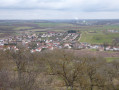
After the climb, a view of the village of Bainville-sur-Madon.
A walk through the Bois Fossé.
The impressive Viterne quarry.
Viterne with its fountain, one of those wash houses and the Church of All Saints.
A short walk across the plain.
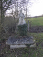
Maizières with its wash house, the Church of Notre-Dame and the wayside cross.

Reviews and comments

4.8 / 5
Based on 2 reviews

Reliability of the description
5 / 5
Ease of following the route
5 / 5
Route interest
4.5 / 5
MaurineDri
MaurineDri

Overall rating : 5 / 5

Date of your route : Feb 17, 2025
Reliability of the description : ★★★★★ Very good
Ease of following the route : ★★★★★ Very good
Route interest : ★★★★★ Very good
Very busy route : No

A lovely walk through woodland, past quarries and with some lovely views. We took our dog along, and he enjoyed it just as much as we did. Make sure you bring some sandwiches. The start of the walk is quite a climb, but it’s well worth it.
There’s a short, slightly tricky section along the side of the road.

Machine-translated

randovillers
randovillers

Overall rating : 4.7 / 5

Date of your route : Sep 23, 2024
Reliability of the description : ★★★★★ Very good
Ease of following the route : ★★★★★ Very good
Route interest : ★★★★☆ Good
Very busy route : No

A lovely walk in its first half, through the hills above Bainville. It gets a bit long-winded after Viterne, especially if it’s hot, and isn’t particularly interesting apart from making it a circular walk of 18km.

Machine-translated

Other walks in the area

For more walks, use our search engine .

The GPS track and description are the property of this route's author. Please do not copy them without permission.