


 Country:
 City:
City:


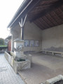
The walk starts at a small square at the beginning of Rue des Friches in Flavigny-sur-Moselle.
(S/E) Take the path running alongside the Canal de l’Est. Head towards Lock No. 44 and continue along the canal on the Chemin des Sources. At the Fork in the road, keep left to pass in front of the Villa des Sources, go through the barrier to keep cars out and continue along a branch of the Moselle.
(1) Before another vehicle barrier, take the path leading up into the forest on the left, marked with a Green Circle. Continue straight on along this ascending path until you reach the end of a track and the end of the signposting.
(2) At the end of the track, turn right, then at the Y-junction that appears immediately, turn left. At the end of the path, join a track, turn left and carry on straight ahead.
(3) At the end of the track, turn right. When you reach the yellow marker by the fence, continue along the small path to the right. At the crossroads (X-junction), turn left and carry on straight ahead along this descending path, which joins a track further down, at the edge of the forest.
(4) Turn left. When you reach the field, veer right, following the edge of the field, and continue along the path leading uphill into the forest.
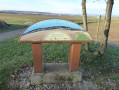
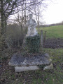
(5) At the end of the path, at the edge of the forest, turn left and carry on straight ahead. Walk past the orientation table, join a track and head straight towards the village. Join the D115a at the wayside cross.
(6) Turn left.
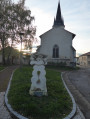
(7) At the roundabout, turn right onto Rue de la Fontaine, then take the first left onto Rue de la Mairie. Walk past the church and turn left onto Rue de l’Église to return to the roundabout.
(7) Turn right onto Rue du Fadeau. At the riding centre, turn left, go between the buildings, carry on straight ahead and take the S-bend.
(8) At the end of the road, turn right and carry on straight ahead. Before joining the D115, turn left towards the cemetery, then carry on straight ahead. At the end of the road, turn right to join the D115.
(9) Turn right, then left onto Rue Edmond Renauld. Then take the first left onto Grande Rue, followed by the first right onto Rue de l’Église, and walk past the church.
(10) Turn right onto Rue du Cugnot, and at the bend at the end of the street, continue straight ahead along the field path.
(11) When you reach the T-junction, carry on straight ahead and follow the yellow signposting. At the end of the track, turn left, then right, and finally straight ahead to reach the railway line.
(12) Turn left onto the track running alongside the railway line and follow the yellow and red markings of the GRP® du Grand Nancy. Continue straight ahead along this field path.
(13) At the end of the thorny hedge, at the Y-junction before the woodland, keep to the right. At the entrance to the woodland, turn left to reach a T-junction at the edge. Turn right, cross a small ditch and continue along the track.
(14) Further on, take a small path to the left, paying close attention to the yellow and red markings to leave the track. On the small path, follow the markings carefully from tree to tree.
After about 200 metres, join a track and turn left. At the next T-junction, turn left again.
(15) Keep to the left and continue straight on along the track to reach the D115.
(16) Turn right and then immediately left, cross the road carefully and join a track which you simply follow straight on to return to the starting point (S/E).


 Visorando Member
 Easy
Easy 

 Very difficult
