Circular walk via the Mont Pourri Refuge and Lac des Moutons from Arc1800

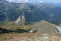
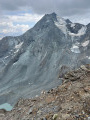
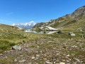
A short circular walk starting from the summit of Transarc, offering a beautiful panoramic view and the chance to get closer to Mont Pourri and the Dôme de la Sache, passing by the Mont Pourri Refuge and the former Regaud Refuge, now converted into a small eco-museum.

Details

n°107520596
Creation:
Last update:
Last review:
–
  • Walking
    Activity: Walking
  • ↔
    Distance: 6.74 mi
  • ◔
    Average duration: 4h 25 
  • ▲
    Difficulty: Average

  • ⚐
    Back to start: Yes
  • ↗
    Ascent: + 1,549 ft
  • ↘
    Descent: - 1,552 ft

  • ▲
    Highest point: 8,465 ft
  • ▼
    Lowest point: 7,759 ft

Photos

Description of the walk

Park at Arc 1800 in the Transarc 1 cable car car park. Take this cable car, then the Transarc 2 cable car. Get off at the top station.

(S/E) Take the track opposite downhill to reach the Col de la Chal.

(1) Turn right, continue downhill for a few metres until you reach a Y-junction at the bottom of this descent. Keep left to begin a long, gentle climb, leading to an unnamed pass.

(2) Continue downhill and, via a series of hairpin bends, reach a crossroads of paths.

(3) Continue downhill to the left and arrive at a fork in the path near the refuge.

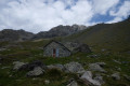
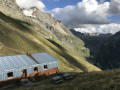
(4) Carry on to the right and you’ll soon reach the Mont Pourri refuge.

(5) Walk past the refuge, then head towards the path. Continue along the mountainside on a gentle incline until you reach the former Refuge Regaud, now converted into a small eco-museum.

(6) Return in the opposite direction to the Mont Pourri refuge and then to the junction you passed on the way there.

(4) Turn right onto the path leading up alongside the torrent, first at the bottom of the valley and then via a steep climb to join the path coming from the ridge.

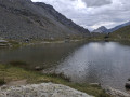
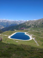
(7) Continue uphill to reach Lac des Moutons.

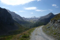
(8) Then head back down the wide track to rejoin the Col de la Chal.

(1) Follow the route you took on the way up in the opposite direction to the Transarc 2 top station (S/E).

Then take the cable cars or walk down to return to the Transarc 1 car park.

Waypoints

  1. S/E : mi 0 - alt. 8,340 ft - Transarc 2 summit
  2. 1 : mi 0.61 - alt. 8,081 ft - Col de la Chal
  3. 2 : mi 1.56 - alt. 8,327 ft - Unnamed pass
  4. 3 : mi 2.52 - alt. 7,844 ft - Junction
  5. 4 : mi 2.76 - alt. 7,802 ft - Crossroads before the - Refuge du Mont Pourri
  6. 5 : mi 2.88 - alt. 7,772 ft - Refuge du Mont Pourri
  7. 6 : mi 3.47 - alt. 8,068 ft - Ancien Refuge Regaud
  8. 7 : mi 4.76 - alt. 8,071 ft - Junction
  9. 8 : mi 5.48 - alt. 8,422 ft - Lac des Moutons
  10. S/E : mi 6.74 - alt. 8,337 ft - Transarc 2 summit

Notes

(5) The Mont Pourri refuge is open all day during the season.
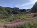
(8) Lac des Moutons takes its name from the small white flowers that surround it.

Worth a visit

(6) The eco-museum isthe former Regaud Refuge: it showcases the local history of mountaineering and the former refuge, featuring beautiful period photographs; admission is free and self-guided.

Other walks in the area

For more walks, use our search engine .

The GPS track and description are the property of this route's author. Please do not copy them without permission.