A circular route around the Aiguille Grive via the Col d’Entreporte and the Col de la Chal

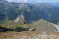
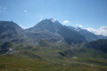
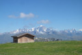
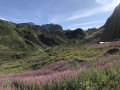
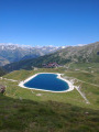
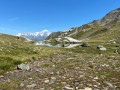
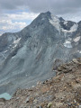
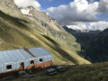
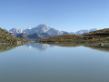
A lovely circular loop starting from the summit of Transarc/Arcabulle, offering beautiful views, particularly of the Mont Blanc massif, the Dôme de la Sache and Mont Pourri. The loop begins with a steep but short climb to the summit of the Aiguille Grive, then descends towards the Col d’Entreporte and returns to the starting point through the mountain pastures.

Details

107520959
Creation:
Last update:
Last review:
  • Walking
    Activity: Walking
  • ↔
    Distance: 3.53 mi
  • ◔
    Average duration: 2h 40 
  • ▲
    Difficulty: Moderate

  • ⚐
    Back to start: Yes
  • ↗
    Ascent: + 1,220 ft
  • ↘
    Descent: - 1,237 ft

  • ▲
    Highest point: 8,957 ft
  • ▼
    Lowest point: 7,723 ft

Photos

Description of the walk

To reach the start of this circular route, head to Arc 1800 (several parking areas available). Take the cable car to the top of the second section (Transarc 2) or to Arc 2000, then the Arcabulle chairlift.

(S/E) Upon exiting the cable car, take the track which descends a few metres to join the path that climbs steeply towards the summit of the Aiguille Grive. After a short but steep climb, you’ll reach the pass.

(1) Then head right along the ridge to reach the summit.

(2) Then head back down to the junction and take the path that descends to the right.

(3) At the junction of the paths, continue along the one that descends least steeply down the mountainside. After two hairpin bends, you’ll join another path.

(4) Turn right onto this path to reach the Col d’Entreporte.

(5) At the pass, take the path that winds round the base of the Aiguille Grive, keeping to the far left towards the Col du Chal, until you reach a track.

(6) Follow it uphill towards the Col du Chal, which you’ll reach quite quickly.

(7) At the pass, follow the wide track which climbs to the left towards the cable car terminus (S/E).

Descend by cable car or chairlift, or on foot for those who wish.

Waypoints

  1. S/E : mi 0 - alt. 8,337 ft - Upper station of the - Télécabine Transarc
  2. 1 : mi 0.36 - alt. 8,871 ft - Unnamed pass
  3. 2 : mi 0.47 - alt. 8,957 ft - Aiguille Grive
  4. 3 : mi 0.74 - alt. 8,497 ft - Junction
  5. 4 : mi 1.1 - alt. 8,041 ft - Junction
  6. 5 : mi 1.31 - alt. 7,841 ft - Col d'Entreporte
  7. 6 : mi 2.26 - alt. 7,789 ft - Trail
  8. 7 : mi 2.97 - alt. 8,081 ft - Col de la Chal
  9. S/E : mi 3.53 - alt. 8,323 ft - Upper station of the - Télécabine Transarc

Notes

An easy walk in terms of elevation gain and distance, but you’ll still need to wear good walking shoes as the ascent and the start of the descent are quite steep.

Worth a visit

(1) Panoramic view from the Aiguille Grive with an orientation board.

Other walks in the area

For more walks, use our search engine .

The GPS track and description are the property of this route's author. Please do not copy them without permission.