Country:

 City:
City:


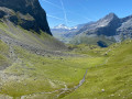
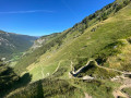
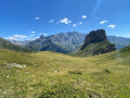
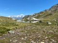
From Peisey-Nancroix, head towards the hamlet of Les Lanches, making your way to the Rosuel mountain hut at the bottom of the valley. Two small car parks at the entrance and exit of the hamlet provide easy parking.
In summer, a free shuttle bus runs from Peisey-Nancroix to Rosuel, stopping at the hamlet of Les Lanches.
(S/E) Walk through the hamlet of Les Lanches, cross the bridge over the Ponturin torrent, then pass the small chapel in the hamlet of Beaupraz before starting the climb towards Lac des Moutons. Continue to the crossroads at Combe du Barmail.
(1) Turn right, climb through the forest along a narrow, winding path and emerge at the junction with the balcony path.
(2) Take this path to the right to quickly reach another junction with a signpost.
(3) Leave the balcony path, turn left and continue the climb. You’ll emerge at the Sévolière stables.
(4) Follow the signs for Lac des Moutons along the track suitable for vehicles.
Note: you can turn right to pass by the Mont Pourri refuge, situated 400 metres away.
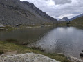
You will then reach a junction at a hairpin bend; follow the sign and take the path along the mountainside which leads to Lac des Moutons, running alongside the boundary of the Vanoise National Park.
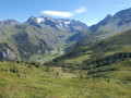
The view over this wild valley is magnificent.
(5) Set off again towards Arcs 2000 by taking the path on the left, then head for the Col de la Chal or Chail.
(6) Continue straight ahead to reach the top station of the Transarc cable cars.
(7) Follow the steeply ascending path to reach the Aiguille Grive orientation point. Take a moment here to enjoy the 360° panorama and read the information on the orientation board.
(8) Return to the foot of the peak and leave the ridge, turning right onto the path until you reach another junction.
(9) Here you have two options:
- stay on the ridge and follow the path to reach the Col d’Entreporte,
- head down to the left along a path – as shown on the map – which winds through the scree; the descent is not easy, but it also leads to the pass.
(10) Follow the direction of La Chail to reach these chalets
(11) Head down to the right onto the track and, after a few hairpin bends, join another track.
(12) Turn slightly to the left and continue on to reach a path junction at the Ruisseau des Rossets.
(13) Leave the track, turn right and cross the stream. Then continue the descent into the Vallon du Barmail and you’ll come back to the junction you passed on the way out.
(1) Follow the route you took on the way out in the opposite direction and return to the Lanches car park (S/E).
 Visorando Member
 Moderate
 Association / Club / Walk leader