Country:

 City:
City:


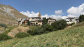
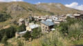
Park at the Camping le Gravelotte car park after asking for permission, which will be granted without any issues. However, if you’re leading a group with several vehicles and this is too many for the campsite, there’s the option to park a little further up the road.
(S/E) From the car park, walk back up the road you have just driven along and join the D1091. Cross with extreme caution: this is a busy road. Then head to the right to reach the small rest area.
(1) Follow the clearly marked path branching off to the left and start walking along this very pleasant path until you reach the first junction.
(2) Ignore the path that climbs to the right; continue straight on until you rejoin the D1091.
(3) Cross the road again with the same caution to enter the hamlet of Les Fréaux. After the first houses, take the path on the right to cross the bridge over the Torrent du Gâ, then head up the D2331 until you reach the D1091.
(4) Cross the departmental road a third time , taking extreme care, then take the path opposite, which is difficult to make out at first. Follow this short path, which will take you as close as possible to the superb Saut de la Pucelle waterfall .
(5) Head back down and rejoin a disused road, then the D1091. Carefully head up to the left without crossing the road until you reach the path you took on the way there.
(3) Follow it to the left until you reach the junction you also passed on the way there.
(2) Take the path that branches off to the left and climbs towards the chapel. From this point, the ascent begins; it will end at the hamlet of Le Chazelet. Make your way to the Chapel of Notre-Dame de Bon Repos: here you can take a break, admire the scenery and perhaps attend a mass.
(6) Continue along the path leading to Le Chazelet. You may explore the hamlet at your leisure, making the most of the various passages and alleyways: this optional visit is not included in the official walking route. The aim is to reach the road leading down to the village of La Grave.
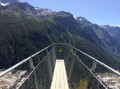
(7) Begin the descent towards La Grave by walking along the tarmac D33 road until you reachthe Oratory and the Meije Viewpoint: a footbridge suspended over the abyss, which is very impressive.
(8) Leave the road and continue downwards, following the GR®50 and GR®54. Pass through the hamlet of Les Terrasses and carry on to the village of La Grave, which you’ll reach at Rue des Abysses. Walk down this street, passing the Chapelle des Pénitents Blancs and the Église Notre-Dame de l’Assomption on your right. Continue along Rue de Dode until you rejoin the D1091.
(9) Cross at the pedestrian crossing and turn right, following the D1091 until you reach the car park on the left. Cross the entire car park, negotiating the two hairpin bends, and you’ll arrive in front of the lower station of the Glaciers de la Meije cable car.
(10) Take the path on the left, using the steps that lead down towards the Romanche. Just before the bridge over the river, take the path on the right to reach the campsite car park (S/E).
 Visorando Member

 Difficult
 Very difficult