


Refine your search for walks in Dissay
Dissay walks


 From Les Pendants de Dissay to the Forest of Moulière
 Visorando Member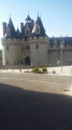
 7.24 mi
 +302 ft
 -302 ft
 3h 35
3h 35
 Moderate
 Departure from Dissay (Vienne)
An easy walk. It climbs slightly from the Chemin des Ribatons; there is very little road and the paths are well-maintained.
Must-sees: the castle, a lovely view over the Clain Valley and Futuroscope.
Dissay Vineyard Route
 3.62 mi
+135 ft
-135 ft
1h 45
3.62 mi
+135 ft
-135 ft
1h 45
 Easy
Departure from Dissay (Vienne)
Easy
Departure from Dissay (Vienne)
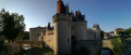
A walk through the fields.
Route suggested by the municipality of Dissay and the Les Randonneurs Pédestrians association.
The Pendants route in Dissay
 4.41 mi
+240 ft
-236 ft
2h 15
Easy
Departure from Dissay (Vienne)
4.41 mi
+240 ft
-236 ft
2h 15
Easy
Departure from Dissay (Vienne)
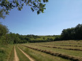
A walk through the fields, with panoramic views.
Route recommended by the Dissay local council and the Les Randonneurs Pédestrians association.
Jaunay-Marigny Cave Dwellings Route
 8.70 mi
+466 ft
-479 ft
4h 25
Moderate
Departure from Marigny-Brizay (Vienne)
8.70 mi
+466 ft
-479 ft
4h 25
Moderate
Departure from Marigny-Brizay (Vienne)
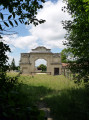
Route proposed by the municipality of Jaunay-Marigny and certified by the Vienne Departmental Hiking Committee. A route exploring the troglodytic landscapes, created by the exploitation of the Tuffeau quarries, with beautiful views over the Envigne valley. The route is marked in green, starting from the Marigny-Brizay town hall.
Montfaucon route from Jaunay-Marigny
 7.55 mi
+289 ft
-289 ft
3h 45
Moderate
Departure from Marigny-Brizay (Vienne)
7.55 mi
+289 ft
-289 ft
3h 45
Moderate
Departure from Marigny-Brizay (Vienne)
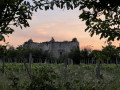
Set amongst market gardens and private castles, the Montfaucon route takes you to explore, in particular, the castle of the same name, a fine example of a small medieval keep. Built inthe 14th century, Montfaucon is the oldest civil building in the commune. It was remodelled inthe 15th century, at which point it lost some of its defensive character in favour of a more residential function.
From the centre of Montamisé to the forest
 4.14 mi
+167 ft
-167 ft
2h 05
Easy
Departure from Montamisé (Vienne)
4.14 mi
+167 ft
-167 ft
2h 05
Easy
Departure from Montamisé (Vienne)
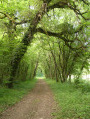
A mainly shaded walk through woodland, though with a large number of tarmac roads.
A ‘nature walk’ organised by the Greater Poitiers Urban Community, the town of Montamisé and the CDRP.
Le Rouhet
 Tourist office
 6.09 mi
+279 ft
-276 ft
3h 05
Easy
Departure from Colombiers (Vienne) (Vienne)
6.09 mi
+279 ft
-276 ft
3h 05
Easy
Departure from Colombiers (Vienne) (Vienne)
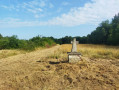
Take a break in nature along these beautiful wooded paths.
Walk from Clos Barault to Colombiers
4.17 mi
+194 ft
-210 ft
2h 05
Easy
Departure from Colombiers (Vienne) (Vienne)
A lovely family walk through the woods with beautiful views over the Envigne valley and Haut-Clairvaux.
In the Colombiers forest
 6.52 mi
+302 ft
-295 ft
3h 15
Moderate
Departure from Colombiers (Vienne) (Vienne)
6.52 mi
+302 ft
-295 ft
3h 15
Moderate
Departure from Colombiers (Vienne) (Vienne)
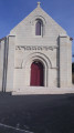
A lovely walk, partly through the forest. There are also beautiful views over the Ouzilly plain, with the chance to see tuffeau stone dwellings and a few cave dwellings.
Circular Baudiment in Naintré
6.76 mi
+312 ft
-305 ft
3h 25
Moderate
Departure from Naintré (Vienne)
Magnificent views of Moussais Castle and Colombiers Forest. This route has it all, from botany to built heritage, from the arboretum along the green corridor to the Beaumont Tower and the Madeleine Chapel. You'll be amazed!
In the Moulière forest
 6.87 mi
+98 ft
-98 ft
3h 15
Moderate
Departure from Montamisé (Vienne)
6.87 mi
+98 ft
-98 ft
3h 15
Moderate
Departure from Montamisé (Vienne)
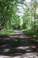
A bucolic hike in the forest with very little road walking.
Tree lovers should not hesitate to bring a book or app to help them identify the different species.
The Pinail Nature Reserve starting from Vouneuil-sur-Vienne
 Association / Club / Walk leader6.74 mi
+256 ft
-256 ft
3h 20
Moderate
Departure from Vouneuil-sur-Vienne (Vienne)
Association / Club / Walk leader6.74 mi
+256 ft
-256 ft
3h 20
Moderate
Departure from Vouneuil-sur-Vienne (Vienne)
A very beautiful hike with access to the Pinail Nature Reserve.
The site of the Battle of Poitiers, starting from Old Poitiers
 6.88 mi
+236 ft
-230 ft
3h 20
Moderate
Departure from Naintré (Vienne)
6.88 mi
+236 ft
-230 ft
3h 20
Moderate
Departure from Naintré (Vienne)
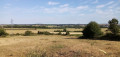
The Battle of Poitiers in the year 732 has been the subject of numerous myths, the foremost of which concerns the very location of the battle itself! This walk takes you to the site considered by contemporary historians to be the most likely location, situated considerably further north than the ancient capital of the Pictaves. The walk starts from the ruins of the Gallo-Roman amphitheatre in Old Poitiers.
The Marais de la Palu and the Gallo-Roman site of Tours Mirandes
 6.30 mi
+213 ft
-207 ft
3h 05
Moderate
Departure from Vendeuvre-du-Poitou (Vienne)
6.30 mi
+213 ft
-207 ft
3h 05
Moderate
Departure from Vendeuvre-du-Poitou (Vienne)
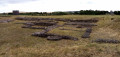
After climbing a hill offering sweeping views, the route takes you through former marshes now used for market gardening. A few castles dot the route, the highlight of which is the Gallo-Roman site, whose ruins, whilst not spectacular, are moving.
Around Cenon-sur-Vienne
7.87 mi
+171 ft
-171 ft
3h 45
Moderate
Departure from Cenon-sur-Vienne (Vienne)
This route takes us along the ancient Roman road and introduces us to the remains of the Gallo-Roman site of Old Poitiers. Take the time to stop for a break in the magnificent Parc de la Grande Maison and, if time allows, take a trip on an electric boat.
Short tour of the natural environments in Migné-Auxances
3.13 mi
+98 ft
-98 ft
1h 30
Easy
Departure from Migné-Auxances (Vienne)
A nature walk between fields and the banks of the Auxance. A short, easy walk.
Route developed by the Greater Poitiers Urban Community and the Departmental Hiking Committee.