The site of the Battle of Poitiers, starting from Old Poitiers

The Battle of Poitiers in the year 732 has been the subject of numerous myths, the foremost of which concerns the very location of the battle itself! This walk takes you to the site considered by contemporary historians to be the most likely location, situated considerably further north than the ancient capital of the Pictaves. The walk starts from the ruins of the Gallo-Roman amphitheatre in Old Poitiers.

Details

3642851
Creation:
Last update:
Last review:
  • Walking
    Activity: Walking
  • ↔
    Distance: 6.88 mi
  • ◔
    Average duration: 3h 20 
  • ▲
    Difficulty: Moderate

  • ⚐
    Back to start: Yes
  • ↗
    Ascent: + 236 ft
  • ↘
    Descent: - 230 ft

  • ▲
    Highest point: 387 ft
  • ▼
    Lowest point: 174 ft
  • ⚐ Country: France
  • ⚐ City: Naintré (86530)
  • ⚑
    Start/End: N 46.760978° / E 0.512576°
  • ❏
    IGN map(s): Ref. 1826SB
  • Hour-by-hour weather

Photos

Description of the walk

The walk starts from the car park at the Vieux Poitiers archaeological site, situated behind the ruins of the Gallo-Roman theatre.

The red and white markings ofthe GR®655and the red and yellow markings ofthe GRP® des Trois Batailles de Poitiers are present in both directions. The other markings are one-way, in the direction of this description. Signposts are located at major junctions.

Red and Yellow + Orange markings

(S/E) Head north and return to the access road to the archaeological site. Follow this road to the left. At the junction, go straight on and enter the hamlet of Les Berthons.

(1) Then take thefirst left onto Place Maubert. At the next junction, turn right and, at the junction that comes up shortly afterwards, turn left. Turn left with the street, cross Rue Jules Courtois on the left-hand side and continue straight ahead.

(2) At the ‘give way’ sign, turn right and pass through the hamlet of l’Archillac.

Red and yellow + yellow markings

(3) At the junction, veer left and follow a small road with a slightly deteriorated tarmac surface uphill.

Red and white markings

(4) At the next junction, turn right onto a path heading towards the Carrefour des Volbières. Further on, cross the access track to Le Coudreau and continue along the path opposite.

(5) At the edge of a woodland, take a shaded path on the left. Ignore a private entrance on the left and cross a meadow. Enter the woodland and head uphill. Ignore a path branching off to the right (not shown on the IGN map) and you’ll reach a crossroads.

(6) Turn right towards Poitiers-la-Bataille and stay within the woodland. At a T-junction, turn left. At a three-way junction, turn right and walk along the edge of the woodland on your right.

Red and white + dark blue + light blue markings

(7) At the next three-way junction, turn right towards Poitiers-la-Bataille. The path turns left and runs alongside a small vineyard. Cross the D23 and continue along the path opposite.

(8) At the crossroads, turn right; there are two paths: take the one on the right (not shown on the map), as the one on the left is private. Join the path on the left after a metal gate and continue westwards. Pass through the hamlet of Les Volbières (rural lodge) and continue along a gravel track. Turn left onto this track and you will soon reach the site of the Battle of Poitiers.

(9) Continue along a small tarmac road.

No signposting

At the Stop sign, turn left and walk through the village of Pied Sec for about 500 m.

(10) Turn left onto the Chemin des Pouges, which is tarmac-surfaced at first and then becomes grassy. At the foot of an electricity pylon, veer right onto the path that runs between the fields. At the foot of a solitary shrub on the left-hand side, veer left.

Red and white + orange markings

(8) At the junction you passed earlier, carry on straight ahead. Cross the D23 and follow the path opposite. Turn right onto the path and you’ll soon reach a three-way junction.

(7) Then turn left towards the Croix Salvert. At the next three-way junction, turn left and enter the woods. After about 150 m, turn right and stay in the woods.

Red and yellow markings (rare)

(6) At the crossroads, go straight on along a gravel path at the edge of the woods. Ignore a path branching off to the right, enter the woods and head gently downhill. Stay on the main path and pass under a power line. Ignore a path branching off to the left and leave the woods. Continue straight on until, on the left-hand side, you reach a small enclosed plot with two sheds.

(11) Then turn left onto a small tarmac road leading downhill. Pass under a power line twice and enter the hamlet of Les Métairies, which is a dairy farm.

(12) Take thefirst left, Rue Haute des Dairy Farms, towards Domine. Follow this small road for about 1 km.

Red and white + orange markings

(4) At a junction you passed on the way out, turn right. Continue straight ahead along a wide gravel track until you reach the car park where you started (S/E).


Waypoints

  1. S/E : mi 0 - alt. 213 ft - Car park at the - Théâtre Gallo Romain du Vieux Poitiers
  2. 1 : mi 0.46 - alt. 180 ft - Les Berthons
  3. 2 : mi 0.77 - alt. 184 ft - L’Archillac
  4. 3 : mi 0.98 - alt. 190 ft - La Chaterie
  5. 4 : mi 1.21 - alt. 249 ft - La Croix Salvert
  6. 5 : mi 1.63 - alt. 220 ft - Junction
  7. 6 : mi 2.35 - alt. 331 ft - Carrefour des Volbières
  8. 7 : mi 2.78 - alt. 358 ft - Three-way junction
  9. 8 : mi 2.93 - alt. 377 ft - Crossroads at the circular site
  10. 9 : mi 3.33 - alt. 361 ft - Site de la Bataille de Poitiers
  11. 10 : mi 3.85 - alt. 387 ft - Pied Sec
  12. 11 : mi 5.34 - alt. 331 ft - Bellevue
  13. 12 : mi 5.64 - alt. 262 ft - Les dairy farms
  14. S/E : mi 6.88 - alt. 213 ft - Car park at the - Théâtre Gallo Romain du Vieux Poitiers

Notes

A good pair of trainers should suffice for this walk, which follows paths in very good condition or small tarmac roads.

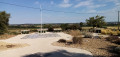
There is a water point and picnic tables at the site of the Battle of Poitiers (9).

A detailed map is useful (at the very least the one accompanying this description).

Walk completed by the author on 22 July 2020.

Worth a visit

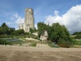
- Ruins of the Gallo-Roman Theatre in Old Poitiers (S/E).

- Site of the Battle of Poitiers (9): numerous information panels; paving featuring quotations, mostly of a pacifist nature. It is regrettable that ignorant individuals steeped in a repugnant ideology have taken the time to scratch out and deface all the Arabic names and references to Islam appearing on these information panels (as of August 2024).

Find out more about the Battle of Poitiers in the year 732.

Always be cautious and plan ahead when you're outdoors. Visorando and the author of this route cannot be held responsible for any accidents occurring on this route.

The GR® and PR® markings are the intellectual property of the Fédération Française de Randonnée Pédestre.

Reviews and comments

5 / 5
Based on 2 reviews

Reliability of the description
5 / 5
Ease of following the route
5 / 5
Route interest
5 / 5
AYRAULT DANIELLE
AYRAULT DANIELLE

Overall rating : 5 / 5

Date of your route : Sep 03, 2021
Reliability of the description : ★★★★★ Very good
Ease of following the route : ★★★★★ Very good
Route interest : ★★★★★ Very good
Very busy route : No

At number 3, the road going uphill is brand new!!!
A lovely ride in glorious sunshine – this is the second time I’ve done this route, and I’ve enjoyed it just as much as before

Machine-translated

rzboy
rzboy
• Edited:

Overall rating : 5 / 5

Date of your route : Oct 03, 2020
Reliability of the description : ★★★★★ Very good
Ease of following the route : ★★★★★ Very good
Route interest : ★★★★★ Very good
Very busy route : No

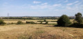
Under an autumnal sky, with the final stretch of the walk taking place in heavy rain, this was a magnificent hike offering beautiful views over the Clain Valley and Coudreau Castle, ending at the superbly designed and beautifully situated site commemorating the Battle of Poitiers, where you can spend up to an hour gaining a better understanding of the events of 732.
A well-balanced walk combining woodland and open paths, enhanced by a few brief stops in the villages of Les Berthons, Les Volbières and Pied Sec.

Machine-translated

Other walks in the area

For more walks, use our search engine .

The GPS track and description are the property of this route's author. Please do not copy them without permission.