From the centre of Montamisé to the forest

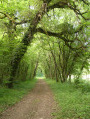
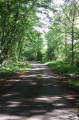
A mainly shaded walk through woodland, though with a large number of tarmac roads.
A ‘nature walk’ organised by the Greater Poitiers Urban Community, the town of Montamisé and the CDRP.

Details

3268532
Creation:
Last update:
Last review:
  • Walking
    Activity: Walking
  • ↔
    Distance: 4.14 mi
  • ◔
    Average duration: 2h 05 
  • ▲
    Difficulty: Easy

  • ⚐
    Back to start: Yes
  • ↗
    Ascent: + 167 ft
  • ↘
    Descent: - 167 ft

  • ▲
    Highest point: 427 ft
  • ▼
    Lowest point: 285 ft
  • ⚐ Country: France
  • ⚐ City: Montamisé (86360)
  • ⚑
    Start/End: N 46.621092° / E 0.422157°
  • ❏
    IGN map(s): Ref. 1826SB, 1827SB
  • Hour-by-hour weather

Photos

Description of the walk

Start at Place de la Mairie (at the end of Rue du Combattant), in front of the hiking information board.

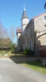
(S/E) Walk up Place de l’Église, skirting the church, and continue straight on along Rue de l’Ancien Porche. Walk past the school and the sports centre car park.

(1) At the junction with the Stop sign, in front of the cross, turn right onto Rue des Trois Barreaux. Stay on this road and head downhill to the roundabout on the D3.
Carry on along the departmental road which enters Tronc (Route de la Forêt) on the left (ignoring Rue des Geais).

(2) Take the first local track on the left. After passing a meadow on your right, turn left onto Chemin “Ribaton”.

(3) Once you’ve left the forest, turn right at the T-junction (Chemin “Les Fousserettes”). At the next T-junction (Chemin “La Jourie”), turn left.

(4) When the track joins a tarmac road, turn left. At the next fork, take the left-hand track.
Carry on straight ahead until you reach the D85, on Rue du Prunella, and turn left.

(5) Take the first left (Allée des Sablons, “Clos de Prunella”), just after No. 20. After the bend to the right, turn left into the street, then left again.

(6) At the end of the cul-de-sac, take the footpath which leads to another cul-de-sac. Continue along Allée des Fousserettes, which curves to the right and then continues straight on.

(7) Take the first right onto Allée Simone-Gault, turn left onto the footpath (Chemin du Bijou) and continue along this path (do not turn into Rue du Bijou immediately on the left).

At the end of the path, turn left onto Rue du Prunella, then take the first left onto Rue du Queroir, or continue straight on to reach the church directly.

(1) Once you reach the crossroads with the cross, turn right onto Rue de l’Ancien Porche and continue straight on to return to the starting point (S/E).

Waypoints

  1. S/E : mi 0 - alt. 361 ft - Town Hall Square
  2. 1 : mi 0.25 - alt. 394 ft - Crossroads at the end of the circular loop
  3. 2 : mi 0.84 - alt. 292 ft - Forest path
  4. 3 : mi 1.49 - alt. 394 ft - Turn right at the fork
  5. 4 : mi 2.23 - alt. 423 ft - Junction with the tarmac road near La Jourie
  6. 5 : mi 2.93 - alt. 404 ft - Clos du Prunella
  7. 6 : mi 3.1 - alt. 410 ft - End of the cul-de-sac
  8. 7 : mi 3.52 - alt. 404 ft - Allée Simone-Gault
  9. S/E : mi 4.14 - alt. 361 ft - Town Hall Square

Notes

An easy walk, but the paths may be muddy in wet weather.
No specific signposting.

Alternative route:
Shortcut to (6): carry on straight ahead to join (1).

Reviews and comments

4.8 / 5
Based on 2 reviews

Reliability of the description
5 / 5
Ease of following the route
5 / 5
Route interest
4.5 / 5
Odeladetout
Odeladetout

Overall rating : 4.7 / 5

Date of your route : Apr 05, 2021
Reliability of the description : ★★★★★ Very good
Ease of following the route : ★★★★★ Very good
Route interest : ★★★★☆ Good
Very busy route : No

There are some beautiful forest scenery along this route.
However, the section through the town before and after entering the forest is a bit long.
You pass through some rather uninteresting residential areas, but the forest is definitely worth it!

Machine-translated

Rico86000
Rico86000

Overall rating : 5 / 5

Date of your route : Aug 16, 2020
Reliability of the description : ★★★★★ Very good
Ease of following the route : Not used / Not applicable
Route interest : ★★★★★ Very good
Very busy route : No

We followed this route, which combines a variety of settings: roads, forest tracks and residential areas.
The description was very detailed. One minor hiccup was between the end of Point 6 and Point 7 – we couldn’t find the junction between Allée Simone GAULT and Chemin du Bijou... So we carried on straight along Allée Simone GAULT and came to the end at the junction leading to the school and the sports complex we’d started at. So no major issues.
Thanks again for sharing this!
Rico

Machine-translated

Other walks in the area

For more walks, use our search engine .

The GPS track and description are the property of this route's author. Please do not copy them without permission.