Country:

 City:


Start at Vernouillet-Verneuil station
(S) On leaving the station, keep to the left along the street running alongside Place du Général Charles de Gaulle. Once on the other side of the square, turn right and then take the first street on the left (Rue Clere). At the first junction, turn left again onto the Grande Rue. Then take the first street on the right (Rue Paul Doumer). Continue straight ahead at the roundabout to stay on Rue Paul Doumer. Stay on this street until you reach Vernouillet Town Hall.
(1) Once you reach the town hall, turn left onto Rue Jean Jaurès and stay on this road until you have passed under the railway line. At the junction with the railway line, carry on straight ahead, ignoring all the side streets branching off to the left and right, until you reach a football stadium. Then turn left onto Chemin du Pépin. At the end of the path, cross Avenue de Triel and walk alongside the Val de Seine Outdoor and Leisure Centre along the street of the same name, which then becomes Route de Verneuil. Once you reach the end of the street, carry on straight ahead, walking along the banks of the Seine heading south. Turn right up the steps leading to the bridge and cross the Seine.
(2) On the other side of the Seine is Triel-sur-Seine. Take the first flight of steps on the left to walk along the banks of the Seine heading north on the Promenade Seligenstadt. At the roundabout, take the first exit onto a narrow street which becomes a pedestrian walkway, then turn left when you reach the D190.
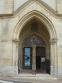
(3) Take the first street on the right and go through the passageway under the arch of the church in Triel-sur-Seine. Then pass under a railway line again, following Rue Galande. At the end of the street, turn left onto Rue des Bois, which runs alongside the Triel-sur-Seine cemetery.
(4) After the cemetery, take the first path on the left, the Grande Sente des Beauregards.
(5) Just after the first left-hand bend, turn right onto a dirt track. This track gradually narrows to become the Chemin des Mareilles and enters the Hautil State Forest. Continue straight on at the first three junctions, then, at the fourth, turn left onto the Première Sente des Haumonts.
(6) Take the first path on the right. From the edge of the path, you can look out over the Côtes des Feuillets with remarkable views of the Seine. But be careful, as these vantage points are not secured. At each junction, stay on the main path and carry on straight ahead. At the fourth junction, begin the descent towards Vaux-sur-Seine down a fairly steep slope. Just before the end of the path, turn left onto a flight of steps and then carry on straight ahead onto Rue du Bel Air.
(7) At the end of the street, by the railway viaduct, turn right and then take the first left onto Boulevard Angibout. Stay on this boulevard until you reach the first flight of steps on the right.
(8) Go up the steps, turn right onto Rue Auguste Dolnet, then climb a second set of steps on the left. This path becomes a track (Chemin des Jeunes Plantes). Take the first track on the left (Chemin des Fortes Terres). From here, carry on straight ahead at every junction until you can go no further, then turn left onto Rue Armand Raulet.
(9) At the junction with Rue du Moulin à Vent, carry on straight ahead along Chemin du Bois de Bouillon. 400 metres further on, ignore Chemin du Val Hebert on the right and continue along the same path until you reach a wash house. At the junction by the wash house, keep to the right and walk behind the Évecquemont school. At the school, turn right onto Rue du Vieux Colombier, then continue straight on along Rue d’Adhemar.
(10) Walk past Évecquemont Church and its castle and stay on this street until it ends. At the end of Rue d’Adhemar, keep right onto Rue de Tessancourt and, at the bend, take the steps, then cross the D922 to start a section on a dirt track. Continue straight on at every junction, passing a cemetery, until you reach a junction with a path. Then continue straight on along the GR®.
(11) You will then reach a fork with three paths at La Maraîche. Take the one on the right and continue straight on at every junction until you reach the Château de Villette.
(12) Take your time to admire the château, then return to the previous junction and turn right. Walk alongside the Château de Villette park and cross the bridge over the Aubette. Immediately afterwards, keep left, then take the first street on the right (Rue des Champs). At the end of the street, turn left onto the D28 for a few metres, then take the first track on the right. This track ends in two paths; take the one on the left. Keep to the right at the next junction and, at the end of the track, turn right towards Condécourt. Follow the same path to Condécourt Church.
(13) At the crossroads by the church, turn left onto Rue de la Libération. Continue straight on at the first junction with Rue des Aulnes, which leads towards Chardronville, then take a fairly long left-hand bend and take the first track on the right at La Butte, just before a high-voltage power line. When you reach the end of the fields, turn left to walk alongside a woodland before entering it and arriving near a tennis court. Go past a gate, ignoring the track leading off to the right.
(14) Shortly afterwards, turn left onto a path that runs alongside the football pitch and stay on this road until you reach a car park. Then continue straight on along theGR® at every junction until you reach the next road (D81). Cross this departmental road and carry on straight ahead before turning left, after 200 m, onto a path running alongside the Aubette. The path leads to a track which you should follow to the left. Cross the Aubette at a wash house and carry on straight ahead at every junction until you reach the church at Longuesse.
(15) Take your time to admire the church, then return to the previous wash house via the same route. Just after the wash house, turn left onto theGR® at a bend. Soon after, leave the path that continues straight on along the Aubette and turn right onto a track. This is a former railway line. At the end of the track, in Vigny, take the path on the right. Walk past Vigny Church, then turn left. A few metres further on is the entrance to Vigny Castle, which is well worth a visit.
(16) Then return to the previous junction and turn left. Keep left again at the next two junctions. At the bend, continue straight on along a lane, which turns into a track. Begin a gentle climb. After a right-hand bend, enjoy a lovely view of Vigny and, when you reach the road, turn left and pass in front of an oil pipeline station. Then turn right again to pass under a four-lane road and arrive at a roundabout.
(17) Take the first exit, then the first track on the left. Carry straight on at the first three junctions.
(18) At the fourth junction, turn left towards Us. Pass under a power line and begin a descent to cross a stream and pass near a pumping station. The track gradually widens and turns into a path. Turn left at the first junction, then right at the next. Follow the road to the church.
(19) At the junction by the church in Us, keep left onto Rue Henri Clément. At each junction, carry straight on until you have left the village, then take the first street on the right at Les Closeaux.
(20) Cross the railway line, then cross the River Viosne. After the river, turn left onto a track leading to some houses before heading into the forest. Take the first track on the left, then turn immediately right. Cross a wood at Les Friches, then begin a descent towards a spring. Carry on straight ahead at a small junction at the end of the descent into the Vallée d’Orémus. TheGR® then branches off westwards and climbs slightly. During this ascent, ignore an inconspicuous path coming from the left. Then stay on theGR® until the next track coming from the right.
(21) Turn left towards Santeuil. Carry on straight ahead at every junction until you reach Santeuil church and its cemetery.
(22) Turn left at the crossroads by the cemetery, then turn right at the next junction. You will then reach the D51. Follow it to the left until you reach Santeuil station (E).

 Visorando Member
 Easy
 Moderate
 Difficult