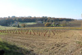
From valleys to hills near Léoville

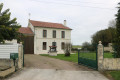
A pleasant walk through valleys and hills, steeped in nature and history. This route also offers the chance to admire the beautiful estates and buildings of the Saintonge region, as well as a working mill where part of the mechanism is on display.

Details

n°787277
Creation:
Last update:
Last review:
  • Walking
    Activity: Walking
  • ↔
    Distance: 5.36 mi
  • ◔
    Average duration: 2h 45 
  • ▲
    Difficulty: Easy

  • ⚐
    Back to start: Yes
  • ↗
    Ascent: + 341 ft
  • ↘
    Descent: - 341 ft

  • ▲
    Highest point: 312 ft
  • ▼
    Lowest point: 138 ft

Photos

Description of the walk

(S/E) Leave the leisure centre car park and turn right to take the track heading east.

(1) At the crossroads, turn right and immediately take a path on the left. At the end of this, take the road on the right and go round the water tower on the right. Take the path on the left immediately after the water tower and head into the woodland.

(2) Cross the small road D253E3 and continue along the road opposite. After the hamlet of Messac, turn right onto a path at the edge of a small wood. At the T-junction, turn left.

(3) About a hundred metres further on, turn right. At the next crossroads, take the path on the left. Carry on straight ahead, ignoring a turn-off on the left.

(4) At the T-junction, turn left towards the hamlet of Chez Chaillou. When you reach the first buildings, you’ll rejoin the tarmac road. Cross the Le Pharaon stream, then come to a T-junction. Turn left here. Continue along the road, passing the road leading to Séguinaud on your right.

(5) Immediately afterwards, take the path on the right through the vineyards. This path takes a right-angle bend to the left, then forms an S-bend (an old mill stands on a small mound; the interior is visible at the walker’s own risk). Continue until you reach a T-junction.

(6) Then turn left and continue to the hamlet of Bapaille. Turn right onto the road and carry on to the junction with the D249 at the hamlet of Chez Bouet.

(7) Turn left and take the D249. Take the first track on the right. At the T-junction, turn left. After about fifty metres (elevation 72), turn right. When you reach a small road before the Moulins de Chez Verdon, turn left and continue to the D142.

(8) Turn left and proceed with caution along the D142 for about five hundred metres. Pass two branches of the Pharaon and follow the Moulin du Geay.

(9) Take the small road on the left towards the hamlet of La Barde. Continue straight on along this road, leaving on your left various paths leading, amongst other places, to the hamlets of Lavaud and Chez Viaud. After about six hundred metres, cross the D253E3 road and continue straight on.

(1) At the next junction, turn right towards Léoville. You’ll find the car park on your left (S/E).

Waypoints

  1. S/E : mi 0 - alt. 157 ft - Car park at the leisure centre
  2. 1 : mi 0.1 - alt. 194 ft - Crossroads of the circular loop
  3. 2 : mi 0.72 - alt. 302 ft - T-junction on the D253E3
  4. 3 : mi 1.08 - alt. 256 ft - Crossroads
  5. 4 : mi 1.66 - alt. 184 ft - Crossroads (path and road)
  6. 5 : mi 2.28 - alt. 171 ft - Road–path junction
  7. 6 : mi 2.67 - alt. 240 ft - T-junction
  8. 7 : mi 3.18 - alt. 187 ft - Chez Bouet
  9. 8 : mi 3.99 - alt. 161 ft - T-junction on the D142
  10. 9 : mi 4.33 - alt. 148 ft - T-junction
  11. S/E : mi 5.36 - alt. 157 ft - Car park at the leisure centre

Notes

The car park is located at the Base de Loisirs.

This walk across varied terrain requires suitable footwear.

This route is loosely based on route no. 24A published by the Haute Saintonge Community, ‘Les Moulins Leoville’. Consequently, some sections are unmarked. It is advisable to follow the directions in the description and on the map, whilst also reading the landscape (which is straightforward in this area). Some sections are marked in white and red for theGR® 360 –GRP® and in yellow (24A and/or 25). In addition, there are sometimes orange markings for horse riding trails.

Hike completed by the author on 12 December 2017.

Worth a visit

Léoville

The Romanesque parish church of Saint-Christophe. It has been listed as a historic monument since 2000. It features some unusual architectural elements and a surprising funerary inscription, unique in the region.
The Lariat lake, at the foot of the village.
Fountain.
Puyrigaud Castle, privately owned.

Jonzac

Jonzac Castle
Jonzac Castle is one of the town’s most iconic landmarks. Perched on a limestone spur overlooking the Seugne Valley, it dates mainly from the 15th century. Significant alterations were made to its structure in the 19th century (conversion into the town hall, the sub-prefecture and the theatre, and the creation of a street which resulted in the disappearance of the grand central staircase). Nevertheless, the creation of an esplanade dotted with trees and green spaces helps to showcase the building and the monumental entrance gatehouse, featuring bracket-supported machicolations with four superimposed blocks and three drawbridge grooves.

City Gate
The city gate is one of the few remaining vestiges of the fortified wall that once protected the castle district.
Church of Saint-Gervais-Saint-Protais
Carmelite Convent
Chapel of La Maladrerie
The town centre is home to many old houses and buildings, nestled amongst winding alleyways inherited from the medieval past. It also features structures dating from the 19th and 20th centuries, such as the theatre (1886), the covered market, with its ‘Eiffel’-style metal framework, built next to the church (1889), the Caisse d’Epargne building, with its monumental façade bearing the town’s coat of arms (1905); and the Coq d’Or building, featuring a monumental balcony designed to welcome distinguished visitors to the town.

Always be cautious and plan ahead when you're outdoors. Visorando and the author of this route cannot be held responsible for any accidents occurring on this route.

The GR® and PR® markings are the intellectual property of the Fédération Française de Randonnée Pédestre.

Reviews and comments

5 / 5
Based on 1 review

Reliability of the description
Not used
Ease of following the route
5 / 5
Route interest
5 / 5
chipie33290
chipie33290

Overall rating : 5 / 5

Date of your route : Dec 04, 2024
Reliability of the description : Not used / Not applicable
Ease of following the route : ★★★★★ Very good
Route interest : ★★★★★ Very good
Very busy route : No

A very varied route with beautiful views and some lovely historic buildings.
A bit of a climb at the start, but otherwise easy.
Thank you for this route

Machine-translated

Other walks in the area

For more walks, use our search engine .

The GPS track and description are the property of this route's author. Please do not copy them without permission.